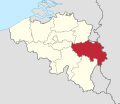
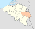
Category:Maps of Liège (province)
Jump to navigation
Jump to search
Wikimedia category | |||||
| Upload media | |||||
| Instance of | |||||
|---|---|---|---|---|---|
| Category combines topics | |||||
| Province of Liege | |||||
province in Wallonia, Belgium | |||||
| Pronunciation audio | |||||
| Instance of | |||||
| Named after | |||||
| Location | Walloon Region, Belgium | ||||
| Capital | |||||
| Official language | |||||
| Head of government |
| ||||
| Population |
| ||||
| Area |
| ||||
| official website | |||||
 | |||||
Provinces of Belgium: Province of Antwerp · Brussels-Capital Region · East Flanders · Flemish Brabant · Province of Liege · Luxembourg · Province of Namur · Walloon Brabant · West Flanders
Subcategories
This category has the following 43 subcategories, out of 43 total.
*
- Maps of Land of Herve (3 F)
A
- Maps of Amay (3 F)
- Maps of Amel (4 F)
- Maps of Ans (3 F)
- Maps of Aubel (3 F)
- Maps of Aywaille (5 F)
B
- Maps of Baelen (3 F)
- Maps of Burg-Reuland (2 F)
C
- Maps of Chaudfontaine (3 F)
D
- Maps of Dalhem (2 F)
E
- Maps of Engis (3 F)
- Maps of Eupen (7 F)
F
- Maps of Flémalle (10 F)
H
- Maps of Herve (3 F)
J
- Maps of Juprelle (3 F)
K
L
- Maps of Lierneux (2 F)
M
N
- Maps of Neupré (2 F)
O
- Maps of Olne (12 F)
P
- Maps of Plombières (6 F)
R
- Maps of Raeren (4 F)
S
- Maps of Seraing (5 F)
- Maps of Spa (6 F)
- Maps of Stavelot (5 F)
T
- Maps of Theux (3 F)
V
- Maps of Visé (6 F)
W
- Maps of Wanze (5 F)
- Maps of Waremme (2 F)
- Maps of Welkenraedt (3 F)
Pages in category "Maps of Liège (province)"
This category contains only the following page.
Media in category "Maps of Liège (province)"
The following 29 files are in this category, out of 29 total.
-
Basse-Meuse Belgium Map.png 290 × 220; 7 KB
-
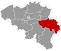
Belgieluik.png 398 × 335; 6 KB
-
Belgium Liège location map.svg 651 × 501; 141 KB
-
BelgiumLiege.png 398 × 335; 7 KB
-
Buurtspoorwegen Luik.png 2,832 × 1,822; 1.57 MB
-
Carte des bonnes villes de la Principauté de Liège.svg 512 × 701; 312 KB
-
Dalhem-comte.jpg 1,677 × 1,537; 478 KB
-
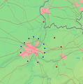
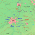
Festungsring Luettich Karte he.png 720 × 726; 89 KB
-
Festungsring Luettich Karte he1.png 720 × 726; 118 KB
-
Festungsring Luettich Karte hu.png 960 × 968; 432 KB
-
Gemeenten Belgische Eifel.png 290 × 220; 7 KB
-
Gemeenten Land van Eupen.png 290 × 220; 7 KB
-
Hesbaye liégeoise.png 290 × 220; 10 KB
-
Landvanherve.PNG 316 × 237; 8 KB
-
Festungsring Luettich Karte.png 720 × 726; 54 KB
-
Liege A605.png 494 × 543; 280 KB
-
Limburg grenswijzigingen 20ste eeuw.svg 512 × 438; 402 KB
-
Luikbevolkingsdichtheid.PNG 578 × 445; 25 KB
-
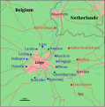
Map of Liege defences hu.svg 721 × 729; 65 KB
-
Map of Liege defences.svg 721 × 729; 55 KB
-
Moresnet.png 413 × 515; 5 KB
-
Ourthe-Amblève.png 290 × 220; 7 KB
-
Platdietsestreek.png 500 × 400; 17 KB
-
Province de Liège in Belgium.svg 1,136 × 988; 371 KB
-
Province di Lidje (eplaeçmint).png 270 × 159; 2 KB
-
Province of Liege (Belgium) location.svg 1,136 × 945; 202 KB
-
Provinz Lüttich 2019.png 1,136 × 990; 330 KB
-
ProvLiègeLocatie2.png 398 × 335; 6 KB
-
Westermarck-lui.png 290 × 220; 7 KB


