Category:Maps of Montgomery County, Maryland
Jump to navigation
Jump to search
Counties of Maryland: Allegany · Anne Arundel · Baltimore · Calvert · Caroline · Carroll · Cecil · Charles · Dorchester · Frederick · Garrett · Harford · Howard · Kent · Montgomery · Prince George's · Queen Anne's · Somerset · St. Mary's · Talbot · Washington · Wicomico · Worcester · Independent city:
map depicting all, or a portion of Montgomery County, Maryland, United States | |||||
| Upload media | |||||
| Instance of | |||||
|---|---|---|---|---|---|
| Location | Montgomery County, Maryland | ||||
| |||||
Subcategories
This category has the following 9 subcategories, out of 9 total.
*
A
Media in category "Maps of Montgomery County, Maryland"
The following 58 files are in this category, out of 58 total.
-

-

-

-

-

-

-
-

-
-

-

-

-

-

-

-
 BethesdaCDPmap.png 500 × 375; 41 KB
-
 Chevy Chase, Section 2, adjacent to Washington D.C. LOC 2011593738.jpg 10,970 × 9,397; 18.93 MB
-
 Chevy Chase, Section 2, adjacent to Washington D.C. LOC 2011593738.tif 10,970 × 9,397; 294.93 MB
-
 ChevyChaseCDPmap.png 500 × 375; 51 KB
-
 Clara Barton Parkway map.svg 991 × 764; 1.69 MB
-
 CorridorCitiesTransitwayACT3.jpg 2,250 × 1,575; 443 KB
-
 Dairy farms, Seneca Creek Watershed, Montgomery County, Maryland LOC 82696025.jpg 3,376 × 2,619; 943 KB
-
 Dairy farms, Seneca Creek Watershed, Montgomery County, Maryland LOC 82696025.tif 3,376 × 2,619; 25.3 MB
-
 Darnestown CDP MD.png 658 × 653; 184 KB
-
 DarnestownAndSeneca.png 607 × 558; 103 KB
-
 Dc22counties.jpg 981 × 766; 211 KB
-
 DuFief Mill-Travilah-C&O.png 749 × 600; 153 KB
-

-
-

-

-

-
 Maryland Route 185 map.png 922 × 579; 38 KB
-
 Montgomery County MD 1862 Darnestown.png 728 × 710; 822 KB
-
 Montgomery County, Maryland LOC 81690009.jpg 6,164 × 5,544; 3.35 MB
-
 Montgomery County, Maryland, Agricultural Reserve.png 3,644 × 2,081; 101 KB
-
 North Potomac MD US Census.png 1,193 × 633; 442 KB
-
 NorthBethesdaMap.gif 500 × 375; 37 KB
-
 Poolesville-Darnestown-Rockville MD 1841.png 586 × 444; 558 KB
-
 Project map, Seneca Creek Watershed, Montgomery County, Maryland LOC 82696024.jpg 3,376 × 2,608; 869 KB
-
 Project map, Seneca Creek Watershed, Montgomery County, Maryland LOC 82696024.tif 3,376 × 2,608; 25.19 MB
-
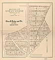
 Properties of the Chevy Chase Land Company.jpg 2,265 × 2,716; 957 KB
-
 Rachel CarsonGW locator.gif 427 × 366; 44 KB
-
 Section no. 2, Chevy Chase, Maryland LOC 2011593737.jpg 6,998 × 7,674; 6.43 MB
-
 Section no. 2, Chevy Chase, Maryland LOC 2011593737.tif 6,998 × 7,674; 153.64 MB
-
 Selden Island Topo.jpg 1,194 × 896; 407 KB
-
 Seneca MD USGS map.png 559 × 504; 651 KB
-
 SilverSpringCDPmap.gif 500 × 375; 49 KB
-
 Travilah CDP and surrounding area.png 1,260 × 867; 644 KB
-
 Travilah CDP Map from US Census.png 744 × 645; 231 KB
-
 Travilah CDP, Maryland 2020.png 1,020 × 696; 510 KB
-
 Travilah NE.png 1,004 × 639; 229 KB
-
 Travilah NW.png 965 × 645; 184 KB
-
 Travilah South.png 1,003 × 646; 199 KB
-
 Vicinity of Washington DC by Griffith Hopkins, 1894 (Jackson City detail crop).jpg 1,693 × 1,938; 867 KB
-
 Vicinity of Washington DC by Griffith Hopkins, 1894.jpg 18,600 × 18,600; 46.48 MB
-
 Whiteoak.jpg 362 × 252; 22 KB
-
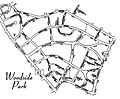 Woodside Park, Maryland, Map.jpg 3,952 × 3,248; 2.03 MB

.jpg)
.jpg)
.jpg)
.jpg)
.jpg)
.jpg)
.jpg)
.jpg)


.jpg)


