Category:Travel maps of Montgomery County (Maryland)
Jump to navigation
Jump to search
Subcategories
This category has the following 3 subcategories, out of 3 total.
T
- Travel maps of Bethesda (1 F)
- Travel maps of Kensington (3 F)
- Travel maps of Silver Spring (1 F)
Media in category "Travel maps of Montgomery County (Maryland)"
The following 6 files are in this category, out of 6 total.
-
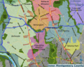 Inner Montgomery County map.png 3,000 × 2,399; 4.48 MB
-
 Inner Montgomery County map.svg 943 × 771; 1.76 MB
-
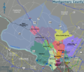 Montgomery County map.png 2,400 × 2,037; 1.37 MB
-
 Montgomery County map.svg 336 × 284; 967 KB
-
 Rachel CarsonGW locator.gif 427 × 366; 44 KB
-
 Wheaton map.png 2,048 × 1,536; 494 KB


