Category:Maps of Talbot County, Maryland
Jump to navigation
Jump to search
Counties of Maryland: Allegany · Anne Arundel · Baltimore · Calvert · Caroline · Carroll · Cecil · Charles · Dorchester · Frederick · Garrett · Harford · Howard · Kent · Montgomery · Prince George's · Queen Anne's · Somerset · St. Mary's · Talbot · Washington · Wicomico · Worcester · Independent city:
Wikimedia category | |||||
| Upload media | |||||
| Instance of | |||||
|---|---|---|---|---|---|
| Category combines topics | |||||
| Talbot County | |||||
county in Maryland, United States of America     | |||||
| Instance of | |||||
| Part of |
| ||||
| Named after |
| ||||
| Location | Maryland | ||||
| School district | |||||
| Capital | |||||
| Inception |
| ||||
| Population |
| ||||
| Area |
| ||||
| Different from | |||||
| official website | |||||
 | |||||
Subcategories
This category has the following 2 subcategories, out of 2 total.
Media in category "Maps of Talbot County, Maryland"
The following 15 files are in this category, out of 15 total.
-
 Talbot County, Maryland LOC 81690094.jpg 10,056 × 8,856; 10.92 MB
-
 Talbot County, Maryland LOC 81690094.tif 10,056 × 8,856; 254.79 MB
-
 Battle of St Michaels troop positions 11 barges.png 913 × 703; 175 KB
-
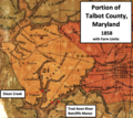
 Detail of District 4, Talbot County, Maryland, 1858.jpg 1,008 × 785; 144 KB
-
 Easton Historic District in Maryland.png 639 × 657; 306 KB
-
 Map of Maryland highlighting Talbot County.svg 1,929 × 1,009; 80 KB
-
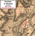 Raid Near St Michaels MD.png 738 × 756; 1.26 MB
-
 Raid Near St Michaels.png 610 × 633; 935 KB
-
 Raid Near St. Michaels Choptank.png 749 × 840; 1.29 MB
-
 Saint Michaels - Maryland - Chesapeake 1832.png 611 × 663; 900 KB
-
 St Michaels 1813 War v2.png 854 × 737; 1.47 MB
-
 St Michaels 1813 War.png 889 × 615; 1.22 MB
-
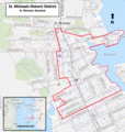 St Michaels Historic District Map 2014.png 734 × 773; 882 KB
-
 St. Michaels area 1858.png 690 × 594; 1 MB
-
 TalbotCountyMD-Hollyday.png 772 × 687; 1.03 MB


