Category:Maps of Lehrte
Jump to navigation
Jump to search

Region Hannover  Barsinghausen · Burgdorf · Hannover · Laatzen · Lehrte · Sehnde · Wedemark · Wennigsen · Wunstorf ·
Wikimedia category | |||||
| Upload media | |||||
| Instance of | |||||
|---|---|---|---|---|---|
| Category combines topics | |||||
| Lehrte | |||||
town in the district of Hanover, in Lower Saxony, Germany .jpg)   | |||||
| Instance of |
| ||||
| Location | Hanover region, Lower Saxony, Germany | ||||
| Population |
| ||||
| Area |
| ||||
| Elevation above sea level |
| ||||
| official website | |||||
 | |||||
Media in category "Maps of Lehrte"
The following 19 files are in this category, out of 19 total.
-
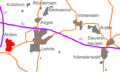 Lage Ahlten in Lehrte.png 626 × 378; 32 KB
-
 Ahlten in Preussische Landesaufnahme vom 1896 Blatt 3625 Lehrte.jpg 4,372 × 3,353; 5.55 MB
-
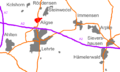 Lage Aligse in Lehrte.png 626 × 378; 32 KB
-
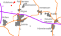
 Lage Arpke in Lehrte.png 626 × 378; 32 KB
-
 DB 1730 railway map.png 1,386 × 995; 1.39 MB
-
 Die Freien vor dem Nordwalde.png 704 × 535; 41 KB
-
 Hämeler Wald 1784.png 1,129 × 786; 205 KB
-
 Lage Hamelerwald in Lehrte.png 626 × 378; 32 KB
-
 Lage Immensen in Lehrte.png 626 × 378; 32 KB
-
 Lehrte Klärteiche Lageplan.PNG 1,138 × 771; 302 KB
-
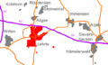
 Lage Kolshorn in Lehrte.png 626 × 378; 32 KB
-
 Lage Lehrte in Lehrte.png 626 × 378; 32 KB
-
 Lehrte in der Region Hannover.png 562 × 482; 39 KB
-
 Lehrte in H.svg 667 × 558; 492 KB
-
 Lehrte in Preussische Landesaufnahme vom 1896 Blatt 3625 Lehrte.jpg 5,326 × 4,326; 4.57 MB
-
 Lage Roddensen in Lehrte.png 626 × 378; 33 KB
-
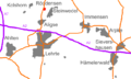
 Lage Sievershausen in Lehrte.png 626 × 378; 32 KB
-
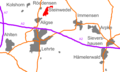 Lage Steinwedel in Lehrte.png 626 × 378; 32 KB
-
 Steinwedel Orientierungstafel.jpg 4,568 × 3,880; 12.83 MB


