Category:Maps of Bremervörde
Jump to navigation
Jump to search
Use the appropriate category for maps showing all or a large part of Bremervörde. See subcategories for smaller areas:
| If the map shows | Category to use |
|---|---|
| Bremervörde on a recently created map | Category:Maps of Bremervörde or its subcategories |
| Bremervörde on a map created more than 70 years ago | Category:Old maps of Bremervörde or its subcategories |
| the history of Bremervörde on a recently created map | Category:Maps of the history of Bremervörde or its subcategories |
| the history of Bremervörde on a map created more than 70 years ago | Category:Old maps of the history of Bremervörde or its subcategories |
Wikimedia category | |||||
| Upload media | |||||
| Instance of | |||||
|---|---|---|---|---|---|
| Category combines topics | |||||
| Bremervörde | |||||
municipality of Germany | |||||
| Instance of |
| ||||
| Location | Rotenburg (Wümme) district, Lower Saxony, Germany | ||||
| Head of government |
| ||||
| Population |
| ||||
| Area |
| ||||
| Elevation above sea level |
| ||||
| official website | |||||
 | |||||
Subcategories
This category has only the following subcategory.
Media in category "Maps of Bremervörde"
The following 10 files are in this category, out of 10 total.
-
Lange diercke sachsen deutsche landschaften wattenkueste.jpg 1,235 × 2,057; 1.14 MB
-
Map elbe mouth 1910.jpg 1,500 × 927; 787 KB
-
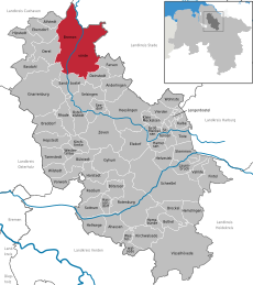
Bremervörde in ROW.svg 2,059 × 2,317; 663 KB
-
Ortschaften Bremervörde Blanko.svg 560 × 850; 12 KB
-
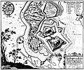
Bremervoerde-1653-Merian.jpg 3,176 × 2,642; 2.31 MB
-
Bremervörde (Merian).jpg 3,381 × 2,754; 2.37 MB
-
Saxoniae Inferioris (Merian) b 032.jpg 3,516 × 2,804; 2.44 MB
-
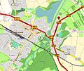
2017 02 02 Gnattenberg-Werft BRV final.JPG 620 × 521; 79 KB
-
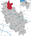
Bremervörde Lagekarte.svg 705 × 490; 44 KB


