Category:Locator maps of municipalities in Landkreis Bad Dürkheim
Jump to navigation
Jump to search
Urban districts (cities):
Media in category "Locator maps of municipalities in Landkreis Bad Dürkheim"
The following 64 files are in this category, out of 64 total.
-
 Altleiningen in DÜW.svg 231 × 231; 191 KB
-
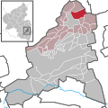
 Bad Dürkheim in DÜW.svg 231 × 231; 229 KB
-
 Battenberg (Pfalz) in DÜW.svg 231 × 231; 191 KB
-
 Bissersheim in DÜW.svg 231 × 231; 191 KB
-
 Bobenheim am Berg in DÜW.svg 231 × 231; 422 KB
-
 Bockenheim an der Weinstraße in DÜW.svg 231 × 231; 191 KB
-
 Carlsberg in DÜW.svg 231 × 231; 191 KB
-
 Dackenheim in DÜW.svg 231 × 231; 422 KB
-
 Deidesheim in DÜW.svg 231 × 231; 422 KB
-
 Deidesheim.png 230 × 228; 11 KB
-
 Dirmstein in DÜW.svg 231 × 231; 191 KB
-
 Ebertsheim in DÜW.svg 231 × 231; 191 KB
-
 Ellerstadt in DÜW.svg 231 × 231; 421 KB
-
 Elmstein in DÜW.svg 231 × 231; 422 KB
-
 Erpolzheim in DÜW.svg 231 × 231; 422 KB
-
 Esthal in DÜW.svg 231 × 231; 422 KB
-
 Forst an der Weinstraße in DÜW.svg 231 × 231; 422 KB
-
 Frankeneck in DÜW.svg 231 × 231; 422 KB
-
 Freinsheim in DÜW.svg 231 × 231; 422 KB
-
 Freinsheim.png 230 × 234; 12 KB
-
 Friedelsheim in DÜW.svg 231 × 231; 421 KB
-
 Gerolsheim in DÜW.svg 231 × 231; 191 KB
-
 Großkarlbach in DÜW.svg 231 × 231; 191 KB
-
 GruenstadtLand.png 234 × 230; 13 KB
-
 Grünstadt in DÜW.svg 231 × 231; 422 KB
-
 Gönnheim in DÜW.svg 231 × 231; 421 KB
-
 Hassloch.png 234 × 226; 10 KB
-
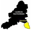
 Haßloch in DÜW.svg 231 × 231; 422 KB
-
 Herxheim am Berg in DÜW.svg 231 × 231; 422 KB
-
 Hettenleidelheim in DÜW.svg 231 × 231; 191 KB
-
 Hetttenleidelheim.png 232 × 224; 12 KB
-
 Kallstadt in DÜW.svg 231 × 231; 422 KB
-
 Kindenheim in DÜW.svg 231 × 231; 191 KB
-
 Kirchheim an der Weinstraße in DÜW.svg 231 × 231; 191 KB
-
 Kleinkarlbach in DÜW.svg 231 × 231; 191 KB
-
 Kreiskarte RP Deidesheim Ned.PNG 403 × 478; 12 KB
-
 Lambrecht (Pfalz) in DÜW.svg 231 × 231; 422 KB
-
 Lambrecht.png 230 × 228; 12 KB
-
 Laumersheim in DÜW.svg 231 × 231; 191 KB
-
 Lindenberg in DÜW.svg 231 × 231; 422 KB
-
 Meckenheim in DÜW.svg 231 × 231; 422 KB
-
 Mertesheim in DÜW.svg 231 × 231; 191 KB
-
 Neidenfels in DÜW.svg 231 × 231; 422 KB
-
 Neuleiningen in DÜW.svg 231 × 231; 191 KB
-
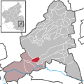
 Niederkirchen bei Deidesheim in DÜW.svg 231 × 231; 422 KB
-
 Obersülzen in DÜW.svg 231 × 231; 191 KB
-
 Obrigheim (Pfalz) in DÜW.svg 231 × 231; 191 KB
-
 Quirnheim in DÜW.svg 231 × 231; 191 KB
-
 Ruppertsberg in DÜW.svg 231 × 231; 422 KB
-
 Tiefenthal in DÜW.svg 231 × 231; 191 KB
-
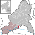
 Verbandsgemeinde Deidesheim in DÜW.svg 231 × 231; 422 KB
-
 Verbandsgemeinde Freinsheim in DÜW.svg 231 × 231; 422 KB
-
 Verbandsgemeinde Grünstadt-Land in DÜW.svg 231 × 231; 422 KB
-
 Verbandsgemeinde Hettenleidelheim in DÜW.svg 231 × 231; 422 KB
-
 Verbandsgemeinde Lambrecht (Pfalz) in DÜW.svg 231 × 231; 422 KB
-
 Verbandsgemeinde Leiningerland in DÜW.svg 231 × 231; 335 KB
-
 Verbandsgemeinde Wachenheim in DÜW.svg 231 × 231; 421 KB
-
 Verbandsgemeinden in DÜW.svg 231 × 231; 130 KB
-
 Wachenheim an der Weinstraße in DÜW.svg 231 × 231; 421 KB
-
 Wachenheim.png 234 × 226; 11 KB
-
 Wattenheim in DÜW.svg 231 × 231; 191 KB
-
 Weidenthal in DÜW.svg 231 × 231; 422 KB
-
 Weisenheim am Berg in DÜW.svg 231 × 231; 422 KB
-
 Weisenheim am Sand in DÜW.svg 231 × 231; 422 KB


_in_D%C3%9CW.svg)


_in_D%C3%9CW.svg)


_in_D%C3%9CW.svg)


_in_D%C3%9CW.svg)


