Category:Maps of Morecambe Bay
Jump to navigation
Jump to search
Media in category "Maps of Morecambe Bay"
The following 19 files are in this category, out of 19 total.
-
196 of '(Our own country. Descriptive, historical, pictorial.)' (11248393725).jpg 1,935 × 1,272; 764 KB
-
Admiralty Chart No 1826 Burrow Head to Liverpool, Published 1953.jpg 11,149 × 16,186; 58.6 MB
-
198 of '(Our own country. Descriptive, historical, pictorial.)' (11175094965).jpg 1,928 × 1,291; 719 KB
-
Admiralty Chart No 1825a The Irish Sea, Published 1925.jpg 16,412 × 15,521; 22.26 MB
-
Admiralty Chart No 1825b Irish Sea Sheet II, Published 1868.jpg 16,397 × 14,764; 73.56 MB
-
Admiralty Chart No 1826 Formby Point to Kirkcudbright, Published 1893.jpg 11,316 × 18,307; 58.34 MB
-
Admiralty Chart No 2010 Morecambe Bay, Published 1873.jpg 12,195 × 8,415; 10.59 MB
-
Geological Map NW England Garwood 1912 01.jpg 5,829 × 9,171; 6.38 MB
-
Geological Map NW England Garwood 1912 02.jpg 6,134 × 5,175; 3.41 MB
-
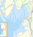
Location map United Kingdom Morecambe Bay.svg 823 × 899; 6.46 MB
-
Morcambe Bay, Lancashire - Ordnance Survey.jpg 1,527 × 1,348; 737 KB
-
Morecambe Bay OS map.png 1,411 × 975; 257 KB
-
Ordnance Survey One-Inch Sheet 88 Barrow in Furness, Published 1947.jpg 8,238 × 9,578; 9.12 MB
-
Ordnance Survey One-Inch Sheet 88 Barrow-in-Furness, Published 1965.jpg 8,246 × 9,898; 10.65 MB
-
Ordnance Survey One-Inch Sheet 89 Lancaster & Kendal, Published 1965.jpg 8,224 × 9,891; 12.73 MB
-
Ordnance Survey One-Inch sheet 89 Lancaster and Kendal, published 1947.jpg 8,174 × 9,601; 10.93 MB
-
Ordnance Survey Quarter-inch Sheet 8 Solway Firth, Published 1966.jpg 9,650 × 8,880; 9.72 MB
-
Wyre Harbour Belcher Nautical Magazine 1837 802.png 5,691 × 5,123; 15.36 MB


