Category:Maps of Karnataka by district
Jump to navigation
Jump to search
States of India: Andhra Pradesh · Jharkhand · Karnataka · Kerala · Madhya Pradesh · Tamil Nadu · Telangana · West Bengal
Union territories: Dadra and Nagar Haveli and Daman and Diu ·
Former states of India:
Former union territories:
Union territories: Dadra and Nagar Haveli and Daman and Diu ·
Former states of India:
Former union territories:
| NO WIKIDATA ID FOUND! Search for Maps of Karnataka by district on Wikidata | |
| Upload media |
Subcategories
This category has the following 32 subcategories, out of 32 total.
B
- Maps of Bagalkot district (25 F)
- Maps of Belagavi district (16 F)
- Maps of Bidar district (25 F)
C
- Maps of Chikmagalur district (10 F)
- Maps of Chitradurga district (6 F)
D
- Maps of Davanagere district (8 F)
- Maps of Dharwad district (17 F)
G
- Maps of Gadag district (11 F)
- Maps of Kalaburagi district (20 F)
H
- Maps of Hassan District (66 F)
- Maps of Haveri district (12 F)
K
- Maps of Kodagu district (18 F)
- Maps of Kolar district (8 F)
- Maps of Koppal district (9 F)
M
- Maps of Mandya district (5 F)
R
- Maps of Raichur district (10 F)
- Maps of Ramanagara district (7 F)
S
- Maps of Shivamogga district (6 F)
T
- Maps of Tumkur district (12 F)
U
V
Y
- Maps of Yadgir district (42 F)
Media in category "Maps of Karnataka by district"
This category contains only the following file.
-
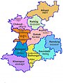 Gakak map.jpg 454 × 600; 43 KB
