Category:Maps of Mysore district
Jump to navigation
Jump to search
Media in category "Maps of Mysore district"
The following 43 files are in this category, out of 43 total.
-
 1801 - 20 - 62(E) Sketch of Gopal Sammy Betta.jpg 6,171 × 4,978; 1.19 MB
-
 Mysore history 450.jpg 2,571 × 1,671; 523 KB
-
 Mysore history 750.jpg 2,604 × 1,680; 918 KB
-
 Mysore history 1050.jpg 2,676 × 1,728; 914 KB
-
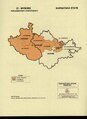
 Mysore kingdoms 1625.jpg 2,447 × 1,650; 1.44 MB
-
 History of Mysore 1897.jpg 2,628 × 3,232; 3.47 MB
-
 Mysore Gazetteer map 1897.jpg 3,920 × 4,112; 8.55 MB
-
 Mysore city Gazetteer map 1897.jpg 3,888 × 4,248; 13.25 MB
-
 Seringapatam plan.jpg 2,792 × 1,800; 3.33 MB
-
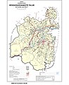
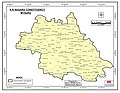
 ASSEMBLY CONSTITUENCY MAP - MYSORE DISTRICT.pdf 2,479 × 1,752; 492 KB
-
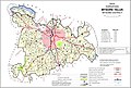
 Chamaraja Vidhana Sabha Constituency.jpg 2,975 × 3,850; 743 KB
-
 Chamarajanagar Lok Sabha Constituency Map (2009 - Present).pdf 1,275 × 1,650; 147 KB
-
 Chamarajanagar Lok Sabha Constituency Map with district boundary (2009 - Present).pdf 1,179 × 1,618; 546 KB
-
 Chamundeshwari Vidhana Sabha Constituency.jpg 3,300 × 2,550; 652 KB
-
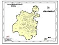
 Heggadadevanakote (Taluk) 2011.jpg 680 × 832; 177 KB
-
 Heggadadevanakote (Taluk) Vidhana Sabha Constituency.jpg 3,300 × 2,550; 726 KB
-
 Hunasuru (Taluk) Vidhana Sabha Constituency.jpg 3,300 × 2,550; 971 KB
-
 Hunsur Map.png 786 × 1,122; 1.76 MB
-
 HUNSUR TALUK 2011.jpg 869 × 588; 183 KB
-
 India Karnataka Mysore district.svg 1,630 × 2,356; 274 KB
-
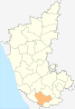
 Karnataka - Mysore.PNG 379 × 451; 51 KB
-
 KarnatakaMysore.png 200 × 306; 5 KB
-
 Krishnaraja Vidhana Sabha Constituency.jpg 3,300 × 2,550; 578 KB
-
 Krishnarajanagara (Taluk) 2011.jpg 872 × 585; 194 KB
-
 Krishnarajanagara (Taluk) Vidhana Sabha Constituency.jpg 3,300 × 2,550; 845 KB
-
 Mandya Lok Sabha Constituency Map (2009 - Present).pdf 1,275 × 1,650; 145 KB
-
 Mandya Lok Sabha Constituency Map with district boundary (2009 - Present).pdf 1,179 × 1,618; 558 KB
-
 Mysore District 2020.png 2,175 × 1,659; 257 KB
-
 MYSORE DISTRICT.jpg 798 × 544; 119 KB
-
 Mysore Lok Sabha Constituency Map with district boundary (2009 - Present).pdf 1,179 × 1,618; 542 KB
-
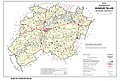
 Mysore Taluk (2011 Census) (cropped).jpg 818 × 554; 167 KB
-
 Mysore Taluk (2011 Census).jpg 870 × 587; 178 KB
-
 Mysoredivision.png 321 × 243; 3 KB
-
 Mysuru Lok Sabha Constituency Map (2009 - Present).pdf 1,275 × 1,650; 125 KB
-
 Nanjangud Taluk 2011.jpg 872 × 600; 189 KB
-
 Nanjangud Vidhana Sabha Constituency.jpg 3,300 × 2,550; 716 KB
-
 Narasimharaja Vidhana Sabha Constituency.jpg 3,300 × 2,550; 631 KB
-
 Periyapatna (Taluk) 2011.jpg 679 × 841; 181 KB
-
 Periyapatna (Taluk) Vidhana Sabha Constituency.jpg 3,300 × 2,550; 718 KB
-
 Srirangapatna map 1792.jpg 2,076 × 1,590; 1.61 MB
-
 T. Narasipura Taluk 2011.jpg 681 × 851; 153 KB
-
 T. Narasipura Vidhana Sabha Constituency.jpg 3,300 × 2,550; 642 KB
-
 Varuna Vidhana Sabha Constituency.jpg 3,300 × 2,550; 684 KB
_Sketch_of_Gopal_Sammy_Betta.jpg)


_2011.jpg)
_Vidhana_Sabha_Constituency.jpg)
_Vidhana_Sabha_Constituency.jpg)


_2011.jpg)
_Vidhana_Sabha_Constituency.jpg)


_(cropped).jpg)
.jpg)


_2011.jpg)
_Vidhana_Sabha_Constituency.jpg)


