<nowiki>Category:Maps of Dharwad district; Category:ダーラヴァーダ県の地図; categoría de Wikimedia; kategori Wikimedia; Wikimedia category; د ويکيمېډيا وېشنيزه; Vikimedya kategorisi; ویکیمیڈیا زمرہ; kategória projektov Wikimedia; категорія проєкту Вікімедіа; 维基媒体分类; Wikimedia-Kategorie; kategorie na projektech Wikimedia; Wikimedia-Kategorie; विकिपीडिया:श्रेणी; page de catégorie de Wikimedia; kategorija na Wikimediji; विकिपीडिया वर्ग; категорија на Викимедији; Wikimedia-Kategorie; Wikimedia-kategori; kategori Wikimédia; تصنيف ويكيميديا; pajenn rummata eus Wikimedia; Wikimedia:ကဏ္ဍခွဲခြင်း; 維基媒體分類; Wikimedia категориясы; categoría de Wikimedia; Wikimedia-Kategorie; Викимедиа категорияһы; tudalen categori Wikimedia; Viciméid catagóir; ردهٔ ویکیپدیا; 维基媒体分类; Wikimedia-kategory; ვიკიპედია:კატეგორიზაცია; ウィキメディアのカテゴリ; categoria Wikimedia; تصنيف بتاع ويكيميديا; විකිමීඩියා ප්රභේද පිටුව; categoria Vicimediorum; Vikipidiya:Shopni; Wikimedia-luokka; Wikimedia category; guruhi Vikimedia; катэгорыя ў праекце Вікімэдыя; Викимедиа проектындагы төркем; catigurìa di nu pruggettu Wikimedia; หน้าหมวดหมู่วิกิมีเดีย; Wikimedia:Kategorija; Wikimedia-Kategorie; Wikimedia:Klassys; категория на Уикимедия; categorie a unui proiect Wikimedia; 維基媒體分類; Wikimedia-kategori; kawan Wikimèdia; 維基媒體分類; 위키미디어 분류; Wikimedia-bólkur; kategorio en Vikimedio; kategori Wikimedia; categoría de Wikimedia; উইকিমিডিয়া বিষয়শ্রেণী; kategori Wikimedia; 维基媒体分类; וויקימעדיע קאַטעגאָריע; kategorija w projektach Wikimedije; thể loại Wikimedia; Wikimedia projekta kategorija; kategoria ti Wikimedia; categoria de um projeto da Wikimedia; Wikimedia category; категорияд Ангилал; Wikimedia-kategori; kategori Wikimedia; پۆلی ویکیمیدیا; Wikimedia category; Vikimédia ñemohenda; Wikimédia-kategória; વિકિપીડિયા શ્રેણી; Wikimediako kategoria; категория в проекте Викимедиа; Wikimedia-Kategorie; катэгорыя ў праекце Вікімедыя; Wikimedia-kategorie; Wîkîmediya:Kategorî; विकिमिडिया श्रेणी; Wikimedia-Kategorie; קטגוריה במיזמי ויקימדיה; Викимедиа проектындагы төркем; Wikimedia-categorie; विकिमिडिया श्रेणी; κατηγορία εγχειρημάτων Wikimedia; Wikimedia-kategoriija; гурӯҳи Викимедиа; categoria de Wikimedia; Wikimedia:Ronnaghys; kategoria w projekcie Wikimedia; categoria di un progetto Wikimedia; Wikimedia-categorie; Wikimedia-Kategorie; categurìa 'e nu pruggette Wikimedia; Wikimedia kategooria; 維基媒體分類; Kategoriya ning Wikimedia; kategorya ng Wikimedia; гурӯҳи Викимедиа; ẹ̀ka Wikimedia; Викимедиина категорија; categoria de um projeto da Wikimedia; kategorija na Wikimediji; Wikimedia-categorie; tumbung Wikimedia; Wikimedia-kategorie; kategorija Wikimedie; Wikimedia proyektındağı törkem; Wikimedia-kategori; 维基媒体分类; kategori Wikimedia; jamii ya Wikimedia; വിക്കിമീഡിയ വർഗ്ഗം; 維基媒體分類; kategori Wikimedia; kategori e Wikimedias; زمرو:وڪيپيڊيا زمرا بندي; Վիքիմեդիայի նախագծի կատեգորիա; categoría de Wikimedia; विकिमीडिया श्रेणी; 维基媒体分类; விக்கிமீடியப் பகுப்பு</nowiki>


 Darwar fort 1781.jpg 6,897 × 5,885; 21.17 MB
 Dharwad Lok Sabha Constituency Map (2009 - Present).pdf 1,275 × 1,650; 165 KB
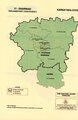 Dharwad Lok Sabha Constituency Map with district boundary (2009 - Present).pdf 1,016 × 1,566; 314 KB
 Dharwad-kn.jpg 3,200 × 2,816; 818 KB
 Dharwad-map.png 400 × 300; 52 KB
 Dharwada-district-en.jpg 3,200 × 2,667; 808 KB
 DharwadDistrictMap-kn.svg 10,134 × 8,499; 1.74 MB
 DharwadDistrictMap-la.svg 10,134 × 8,499; 1.73 MB
 DharwadDistrictMap3000px-kn.png 3,577 × 3,000; 3.36 MB
 Dharwar Kod.png 1,912 × 2,178; 1.64 MB
 India Karnataka Dharwad district.svg 1,630 × 2,356; 274 KB
 Karnataka-districts-Dharwad.png 550 × 870; 19 KB
 KarnatakaDharwar.png 200 × 306; 5 KB
 Map India and Pakistan 1-250,000 Tile ND 43-3 Hubli.jpg 5,000 × 3,801; 4.07 MB
 North Karnataka Tourism map 10.11.2008.JPG 1,857 × 1,353; 469 KB
 North-Karnataka Region Tourism map - 24.09.2008.JPG 1,857 × 1,353; 463 KB
 North-Karnataka Region Tourism map - Manjuanth Doddamani.JPG 1,857 × 1,370; 463 KB


