Category:Maps of India in the 4th century
Jump to navigation
Jump to search
This category is about the subject of the Indian subcontinent 301-400 CE: History maps showing India as it was in the 4th century.
Contemporary old maps belong into: Category:Old maps of India and its subcategories.
Maps of the history of India: (BCE) 6th century · 5th century · 4th century · 3rd century · 2nd century · 1st century · (CE) 1st century · 2nd century · 3rd century · 4th century · 5th century · 6th century · 7th century · 8th century · 9th century · 10th century · 11th century · 12th century · 13th century · 14th century · 15th century · 16th century · 17th century · 18th century · 19th century · 20th century ·
Subcategories
This category has the following 2 subcategories, out of 2 total.
G
- Maps of the Gupta Empire (55 F)
K
- Maps of the Kushan Empire (29 F)
Media in category "Maps of India in the 4th century"
The following 5 files are in this category, out of 5 total.
-
Gupta Empire 320 - 600 ad.PNG 503 × 703; 24 KB
-
India 350 AD.jpg 1,284 × 1,737; 2.6 MB
-
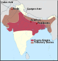
Map for Gupta Empire and tributaries.svg 700 × 734; 1.49 MB
-
South Asia in 400 CE.tif 737 × 655, 2 pages; 2.54 MB
-
Western Satraps map (highlighted).jpg 1,284 × 1,737; 2.25 MB


