
Category:Maps of Palestine in the 4th century
Media in category "Maps of Palestine in the 4th century"
The following 10 files are in this category, out of 10 total.
-
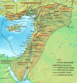
 MACCOUN(1899) p201 323 A.D. - 336 A.D. PALESTINE IN THE TIME OF CONSTANTINE.jpg 2,010 × 3,614; 2.77 MB
-
 MACCOUN(1899) p203 ABOUT 400 A.D. - PALESTINE AT THE BEGINNING OF THE FIFTH CENTURY.jpg 2,014 × 3,606; 2.91 MB
-

-
 Dioecesis Orientis 400 AD-es.svg 661 × 716; 649 KB
-
 Dioecesis Orientis 400 AD-pt.svg 620 × 671; 101 KB
-
 Dioecesis Orientis 400 AD-zh.svg 775 × 839; 316 KB
-
 Dioecesis Orientis 400 AD.png 620 × 671; 373 KB
-
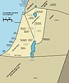 Israel Byzantine 5c.jpg 707 × 839; 154 KB
-
 Palestine according to Eusbius and Jerome - Smith 1915.jpg 2,416 × 3,987; 5.55 MB
-
 Roman era Phonesia.png 402 × 218; 230 KB
_p201_323_A.D._-_336_A.D._PALESTINE_IN_THE_TIME_OF_CONSTANTINE.jpg)
_p203_ABOUT_400_A.D._-_PALESTINE_AT_THE_BEGINNING_OF_THE_FIFTH_CENTURY.jpg)
%27_(11252171523).jpg)


