Category:Maps of India in the 3rd century BC
Appearance
This category is about the subject of the Indian subcontinent 300-201 BCE: History maps showing India as it was in the 3rd century BCE.
Contemporary old maps belong into: Category:Old maps of India and its subcategories.
Maps of the history of India: (BCE) 6th century · 5th century · 4th century · 3rd century · 2nd century · 1st century · (CE) 1st century · 2nd century · 3rd century · 4th century · 5th century · 6th century · 7th century · 8th century · 9th century · 10th century · 11th century · 12th century · 13th century · 14th century · 15th century · 16th century · 17th century · 18th century · 19th century · 20th century ·
Subcategories
This category has only the following subcategory.
M
- Maps of the Mauryan Empire (110 F)
Media in category "Maps of India in the 3rd century BC"
The following 23 files are in this category, out of 23 total.
-
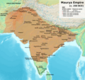
Maurya Empire, c.250 BCE 2.png 1,200 × 1,121; 2.26 MB
-
Mauryan Empire ca. 265 BCE.png 2,225 × 2,185; 4.88 MB
-
Asia 200bc.jpg 2,037 × 1,191; 763 KB
-
India 250 BC.jpg 1,272 × 1,708; 2.04 MB
-
India in 250 B. C.jpg 892 × 1,252; 201 KB
-
India in 250 BCE Joppen.jpg 2,670 × 3,830; 2.57 MB
-
Magadha Expansion 1.gif 680 × 593; 2.19 MB
-
Magadha Expansion 2.gif 680 × 593; 2.21 MB
-
Magadhan Empire expansion.gif 777 × 720; 1.51 MB
-
Map of-Bengal-326-bc-gangaridai.svg 2,200 × 1,491; 4.35 MB
-
Maurja Empire hu ie250.png 2,250 × 2,101; 6.29 MB
-
Maurya Empire boundaries.jpg 1,500 × 1,309; 1.83 MB
-
Maurya Empire with autonomou and free tribes.png 1,200 × 1,121; 3.16 MB
-
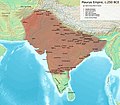
Maurya Empire, c.250 BC.png 1,500 × 1,309; 2.88 MB
-
Mauryan Empire 260 BC (detailed, depicting vassals) 01.png 1,200 × 1,121; 2.07 MB
-
Mauryan Empire 260 BC (detailed, depicting vassals) 02.png 1,200 × 1,121; 2.07 MB
-
Mauryan Empire map (260 BC, Ashoka).png 2,291 × 2,340; 4.67 MB
-
Mauryan Empire map (260 BC, detailed).png 1,200 × 1,121; 1.91 MB
-
North India in 241 BCE.png 8,000 × 4,500; 1.9 MB
-
Samrat Ashoka Samrajya or Emperor Ashoka Empire Map.jpg 991 × 989; 181 KB
-
South India in 300 CE.jpg 804 × 563; 62 KB
-
Standard Mauryan Empire.png 3,054 × 3,666; 1.21 MB
-
मौर्य साम्राज्य अपने चरम पर (Maurya Empire map).png 1,920 × 1,353; 1.26 MB


