Category:Political maps of Columbiana County, Ohio as of the 2000 United States Census
Jump to navigation
Jump to search
Media in category "Political maps of Columbiana County, Ohio as of the 2000 United States Census"
The following 35 files are in this category, out of 35 total.
-
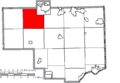 Map of Columbiana County Ohio Highlighting Butler Township.png 712 × 494; 28 KB
-
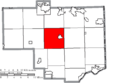 Map of Columbiana County Ohio Highlighting Center Township.png 712 × 494; 28 KB
-
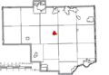
 Map of Columbiana County Ohio Highlighting Columbiana City.png 712 × 494; 28 KB
-
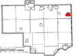
 Map of Columbiana County Ohio Highlighting East Liverpool City.png 712 × 494; 28 KB
-
-
 Map of Columbiana County Ohio Highlighting Elkrun Township.png 712 × 494; 28 KB
-
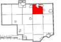 Map of Columbiana County Ohio Highlighting Fairfield Township.png 712 × 494; 28 KB
-
 Map of Columbiana County Ohio Highlighting Franklin Township.png 712 × 494; 28 KB
-
 Map of Columbiana County Ohio Highlighting Hanover Township.png 712 × 494; 28 KB
-
 Map of Columbiana County Ohio Highlighting Hanoverton Village.png 712 × 494; 28 KB
-
 Map of Columbiana County Ohio Highlighting Knox Township.png 712 × 494; 28 KB
-
 Map of Columbiana County Ohio Highlighting Leetonia Village.png 712 × 494; 28 KB
-
 Map of Columbiana County Ohio Highlighting Lisbon Village.png 712 × 494; 28 KB
-
 Map of Columbiana County Ohio Highlighting Liverpool Township.png 712 × 494; 28 KB
-
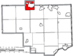
 Map of Columbiana County Ohio Highlighting Madison Township.png 712 × 494; 28 KB
-
 Map of Columbiana County Ohio Highlighting Middleton Township.png 712 × 494; 28 KB
-
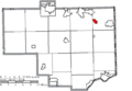
 Map of Columbiana County Ohio Highlighting Minerva Village.png 712 × 494; 28 KB
-
 Map of Columbiana County Ohio Highlighting New Waterford Village.png 712 × 494; 28 KB
-
 Map of Columbiana County Ohio Highlighting Perry Township.png 712 × 494; 28 KB
-
 Map of Columbiana County Ohio Highlighting Rogers Village.png 712 × 494; 28 KB
-
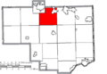
 Map of Columbiana County Ohio Highlighting Saint Clair Township.png 712 × 494; 28 KB
-
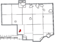
 Map of Columbiana County Ohio Highlighting Salem City.png 712 × 494; 28 KB
-
 Map of Columbiana County Ohio Highlighting Salem Township.png 712 × 494; 28 KB
-
 Map of Columbiana County Ohio Highlighting Salineville Village.png 712 × 494; 28 KB
-
 Map of Columbiana County Ohio Highlighting Summitville Village.png 712 × 494; 28 KB
-
 Map of Columbiana County Ohio Highlighting Unity Township.png 712 × 494; 28 KB
-
 Map of Columbiana County Ohio Highlighting Washington Township.png 712 × 494; 28 KB
-

-
 Map of Columbiana County Ohio Highlighting Wayne Township.png 712 × 494; 28 KB
-
 Map of Columbiana County Ohio Highlighting Wellsville Village.png 712 × 494; 28 KB
-
 Map of Columbiana County Ohio Highlighting West Township.png 712 × 494; 28 KB
-
 Map of Columbiana County Ohio Highlighting Yellow Creek Township.png 712 × 494; 28 KB
-
 Map of Columbiana County Ohio With Municipal and Township Labels.PNG 712 × 494; 58 KB
-
 Map of Columbiana County, Ohio No Text, Municipalities Distinct.png 712 × 494; 28 KB
-
 Map of Columbiana County, Ohio No Text.png 712 × 494; 27 KB


