Category:Maps of 15th-century Europe
Jump to navigation
Jump to search
| Preceded by: Maps of 14th-century Europe |
Maps of 15th-century Europe 1401 AD-1500 AD |
Succeeded by: Maps of 16th-century Europe |
Subcategories
This category has the following 10 subcategories, out of 10 total.
B
E
- Maps of 15th-century England (3 F)
F
G
- Maps of 15th-century Germany (9 F)
I
- Maps of 15th-century Italy (62 F)
M
P
- Maps of 15th-century Poland (1 F)
S
Media in category "Maps of 15th-century Europe"
The following 52 files are in this category, out of 52 total.
-
 Europe en 1400.pdf 1,752 × 1,239; 513 KB
-
 Modern history; Europe (1904) (14579066890).jpg 3,040 × 2,072; 1.88 MB
-
 Deutscher Orden 1410+Farb.png 1,200 × 1,043; 370 KB
-
 Deutscher Orden 1410.png 1,200 × 1,043; 868 KB
-
 Ordensland1410.png 694 × 733; 130 KB
-
 Teutonic Order 1410.png 1,200 × 1,043; 879 KB
-

-

-
 Ordensstaat 1455.PNG 823 × 668; 26 KB
-
 Teutonic state 1455.png 823 × 668; 27 KB
-
 Upper Oka Principalities 1462 ru.png 1,107 × 902; 44 KB
-
 VKL-1462-ru.png 2,328 × 1,845; 208 KB
-
 Deutscher Orden 1466+Farb.png 1,200 × 1,043; 321 KB
-
 Deutscher Orden 1466.png 1,200 × 1,043; 742 KB
-
 IRP 1466.PNG 2,420 × 2,232; 1.24 MB
-
 Teutonic state 1466.png 823 × 666; 28 KB
-
 Teutonic Order 1466.png 1,200 × 1,043; 744 KB
-
 Teutonic Order 1466-es.svg 1,210 × 1,053; 1.79 MB
-
 1Jagiellon countries 1490.PNG 782 × 600; 262 KB
-
 Jagiellon countries 1490.PNG 2,916 × 2,992; 1.68 MB
-
 PJagiellon countries 1490-es.svg 1,683 × 1,714; 1.43 MB
-
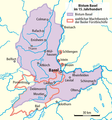 Bistum Basel im 15. Jahrhundert0105a.png 780 × 833; 102 KB
-
 Caminos Santiago Europa siglo XV 1.svg 848 × 844; 2.67 MB
-
 Deutschland im XV. Jahrhundert.jpg 5,644 × 4,640; 5.21 MB
-
 Europa en 1470 (SO) en.svg 306 × 291; 53 KB
-
 Europa en 1470 (SO)-pt.svg 306 × 291; 53 KB
-
 Europa en 1470 (SO).svg 306 × 291; 52 KB
-
 Europe in 1470.PNG 600 × 650; 46 KB
-
 Európa 1470-ben.png 1,800 × 1,950; 1.38 MB
-
 Evropa v 15. století.jpg 706 × 1,136; 498 KB
-
 Grunwald 1410.png 1,200 × 1,424; 845 KB
-
 Henrican navigation routes.gif 294 × 311; 19 KB
-
 HRR 1400.png 3,735 × 3,957; 3.54 MB
-
 Kalmarunionen.png 540 × 238; 70 KB
-
-
 League of Lezhë, 1448-1468.png 3,378 × 6,441; 9.29 MB
-
 Map of Hungary in 1490.png 1,500 × 1,480; 242 KB
-
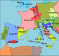
 Map of the Crown of Aragon.svg 2,317 × 977; 557 KB
-

-

-
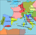
 Mapa de la Corona d'Aragón.svg 2,317 × 977; 556 KB
-
 Mapa de la Corona de Aragón.svg 2,317 × 977; 555 KB
-
 Mapa la Corona d'Aragón.svg 2,317 × 977; 556 KB
-
 Niedersachsen um 1400.jpg 1,948 × 1,644; 487 KB
-
 Niedersachsen um 1400.png 1,948 × 1,644; 3.38 MB
-
 Polska i Litwa w 15. wieku.jpg 2,918 × 2,304; 1.52 MB
-
 Principatele 1450.jpg 359 × 479; 348 KB
-
 TeutonicOrder1422.png 4,213 × 2,932; 16.24 MB
-
 Valentin Finale Version.jpg 578 × 745; 81 KB
-
 Venise et Gênes.jpg 600 × 319; 281 KB
-
 Wustrau Brandenburg-Preußen Museum-Königreiche 4006.jpg 3,389 × 3,587; 7.73 MB
-
 Zsigmond terkep.png 1,214 × 723; 690 KB
_(14579066890).jpg)


_p113_Ausbreitungswege_der_Sinti_und_Roma_in_Europa,_mit_Angabe_der_Ersterw%C3%A4hnung.jpg)
%27_(16403228370).jpg)


_en.svg)
-pt.svg)
.svg)


.jpg)


_and_the_Crown_of_the_Kingdom_of_Poland_(red)_and_its_neighborhood_in_1386_%E2%80%93_1434_(English_version).png)


