Category:Maps of 15th-century France
Jump to navigation
Jump to search
![]() France 1401-1500 CE: Maps showing all or a substantial part of the territory of France as it was in the 15th century.
France 1401-1500 CE: Maps showing all or a substantial part of the territory of France as it was in the 15th century.
| Preceded by: Maps of 14th-century France |
Maps of 15th-century France 1401- 1500 CE |
Succeeded by: Maps of 16th-century France |
Subcategories
This category has the following 2 subcategories, out of 2 total.
*
Media in category "Maps of 15th-century France"
The following 55 files are in this category, out of 55 total.
-
 1400 Northwest.jpg 728 × 593; 74 KB
-
 France (1429)-fr-yug.svg 1,003 × 744; 1.4 MB
-
 França el 1429.png 872 × 639; 221 KB
-
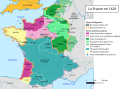
 La France en 1429-es.svg 856 × 894; 1.6 MB
-
 La France en 1429.svg 1,024 × 744; 2 MB
-
-
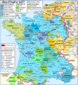
 Carte du royaume de France pendant la mission de Jeanne d'Arc 1429-1430.jpg 6,900 × 6,935; 19.52 MB
-
 Hundred years war france england 1435.PNG 464 × 429; 80 KB
-
 La guerre de 100 ans (de 1415 à 1453)-es.svg 954 × 893; 1.54 MB
-
 La guerre de 100 ans (de 1415 à 1453).svg 1,042 × 744; 2.05 MB
-
 Modern history; Europe (1904) (14763412114).jpg 2,040 × 1,800; 886 KB
-
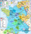
 France XVe siècle.jpg 900 × 970; 372 KB
-
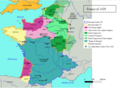
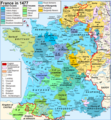
 Map France 1477-en accurate border.svg 900 × 970; 983 KB
-
 Map France 1477-en.svg 900 × 970; 1 MB
-
 Map France 1477-es.svg 900 × 970; 1.53 MB
-
 Map France 1477-fr sovereign Béarn.svg 900 × 970; 1.14 MB
-
 Map France 1477-fr.svg 900 × 970; 1.16 MB
-
 Map France 1477-pt.svg 900 × 970; 1.22 MB
-
 Map France 1477-ru.svg 900 × 970; 1.16 MB
-
 Map France 1477-uk.svg 900 × 970; 1.14 MB
-
 França el 1477.png 602 × 644; 398 KB
-
 C. 1490 France and England.jpg 811 × 1,252; 1.26 MB
-
 C. 1494 France.jpg 1,379 × 1,337; 1.24 MB
-
 Provinces of France 1322-1789.png 2,388 × 2,452; 10.31 MB
-
 Bonen1477.png 237 × 230; 88 KB
-
 Burgundian northern France 1465–1477.png 416 × 399; 92 KB
-
 Carte Campagne 1488.png 1,230 × 942; 202 KB
-
 Carte de massiac en 1429.jpg 1,696 × 1,244; 373 KB
-
-

-
 D339- N° 372. La France à la fin du XVe siècle. - liv3-ch11.png 1,436 × 1,784; 273 KB
-
 France location map-1477-blank.png 2,000 × 1,922; 313 KB
-
 France location map-1477-blank.svg 2,000 × 1,922; 820 KB
-
 Guerre de cent ans (1435) es.svg 466 × 430; 46 KB
-
 Guerre de cent ans (1435)-HE.svg 466 × 430; 33 KB
-
 Guerre de cent ans (1435).svg 466 × 430; 29 KB
-

-
 Le Verdunois XIIIe-XVIe siecle.jpg 1,475 × 1,023; 496 KB
-
 Map France 1477-br.svg 900 × 970; 1,021 KB
-
 Map France 1477-de.svg 900 × 970; 2.74 MB
-
 Map France 1477-en sovereign Béarn.png 900 × 970; 608 KB
-
 Map Southern France 1477-ru.png 888 × 383; 270 KB
-
 Normandie 1449 FR.svg 594 × 439; 226 KB
-
 Normandie 1450 FR.svg 594 × 439; 202 KB
-
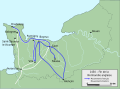
 Normandie Formigny 1450 FR.svg 594 × 439; 954 KB
-
 Pays de Retz.jpg 222 × 171; 10 KB
-
 Pre-1500 map spread.jpg 800 × 764; 258 KB
-
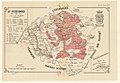
 Traité de Troyes-ar.png 425 × 519; 124 KB
-
 Traité de Troyes-es.svg 425 × 519; 136 KB
-
 Traité de Troyes-nl.svg 425 × 519; 194 KB
-
 Traité de Troyes.svg 425 × 519; 153 KB
-
 Treaty of Troyes-cs.svg 425 × 519; 46 KB
-
 Treaty of Troyes-hu.svg 425 × 519; 37 KB
-
 Treaty of Troyes.svg 425 × 519; 37 KB
-
 Verdrag van Troyes.svg 425 × 519; 136 KB

-fr-yug.svg)


.jpg)


-es.svg)
.svg)
_(14763412114).jpg)


.jpg)
.jpg)

_es.svg)
-HE.svg)
.svg)
.jpg)


