Category:Maps of Ürümqi
Jump to navigation
Jump to search
Subcategories
This category has the following 2 subcategories, out of 2 total.
L
- Locator maps of Ürümqi (9 F)
P
Media in category "Maps of Ürümqi"
The following 15 files are in this category, out of 15 total.
-
 Administrative division Urumqi labelled.svg 2,321 × 3,032; 183 KB
-
 Administrative division Urumqi.png 2,320 × 3,030; 619 KB
-
 Administrative division Urumqi.svg 2,321 × 3,032; 172 KB
-
 China Xinjiang Ürümqi.svg 1,000 × 850; 230 KB
-
 Ethnolinguistic map of Tibet in 1983.png 528 × 790; 444 KB
-
 Subdivisions of Ürümqi-China.png 442 × 369; 5 KB
-
 Urumqi Blank map.png 3,000 × 3,920; 386 KB
-
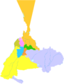
 Urumqi mcp zh.png 310 × 363; 18 KB
-
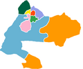
 Urumqi mcp.png 310 × 363; 18 KB
-
 Urumqi-map.svg 1,100 × 1,500; 393 KB
-
 Urumqi.png 1,474 × 1,219; 60 KB
-
 Wulumuqi-map.png 1,500 × 2,067; 506 KB
-
 Wulumuqi-map1.png 3,000 × 2,859; 697 KB
-
 Ürümchi shehiri xeritisi(Uyghur).png 745 × 952; 120 KB
-
 Ürümqi location.png 380 × 300; 19 KB


.png)
