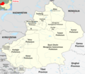
Category:Maps of prefecture-level divisions of Xinjiang
Jump to navigation
Jump to search
- Provinces of the People's Republic of China
- Anhui
- Fujian
- Gansu
- Guangdong
- Guizhou
- Hainan
- Hebei
- Heilongjiang
- Henan
- Hubei
- Hunan
- Jiangsu
- Jiangxi
- Jilin
- Liaoning
- Qinghai
- Shaanxi
- Shandong
- Shanxi
- Sichuan
- Yunnan
- Zhejiang
- Direct-administered municipalities
- Autonomous regions
- Guangxi
- Inner Mongolia
- Ningxia
- Xinjiang
- Special administrative regions
| NO WIKIDATA ID FOUND! Search for Maps of prefecture-level divisions of Xinjiang on Wikidata | |
| Upload media |
Subcategories
This category has the following 18 subcategories, out of 18 total.
A
- Maps of Aksu Prefecture (13 F)
- Maps of Altay Prefecture (9 F)
- Maps of Aral Prefecture (2 F)
B
- Maps of Bayingolin (4 F)
- Maps of Bortala (7 F)
C
- Maps of Changji (4 F)
H
- Maps of Hami (9 F)
- Maps of Hotan (5 F)
I
- Maps of Ili (14 F)
K
- Maps of Karamay (10 F)
- Maps of Kashgar (10 F)
- Maps of Kizilsu (6 F)
S
- Maps of Shihezi (3 F)
T
- Maps of Tacheng (5 F)
- Maps of Tumshuq (2 F)
- Maps of Turpan (5 F)
U
W
- Maps of Wujiaqu (3 F)
Media in category "Maps of prefecture-level divisions of Xinjiang"
The following 7 files are in this category, out of 7 total.
-
Map of Xinjiang in China, with Prefectures and borders.png 2,345 × 2,048; 954 KB
-
Xinjiang prfc map.png 452 × 359; 35 KB
-
Xinjiang prfc map2.png 1,050 × 810; 49 KB
-
Xinjiang prfc map2alt.png 1,280 × 986; 360 KB
-
Xinjiang prfc map Ch.png 500 × 397; 40 KB
-
Xinjiang prfc map vi.png 1,051 × 801; 77 KB
-
Xinjiang prfc map2-lv.png 1,051 × 801; 58 KB


