Category:Maps by Louis Stanislas d'Arcy de La Rochette
Jump to navigation
Jump to search
Subcategories
This category has the following 4 subcategories, out of 4 total.
Media in category "Maps by Louis Stanislas d'Arcy de La Rochette"
The following 18 files are in this category, out of 18 total.
-
 A chart of the Arabian Gulf or Red Sea RMG F0469.tiff 5,538 × 7,372; 116.8 MB
-

-
 Africa - DPLA - 4abcc58a6d8824235e4028a0ddef7e9b.jpg 1,000 × 892; 200 KB
-
 Ambracian Gulf, Louis Stanislas d'Arcy Delarochette,1791.jpg 758 × 473; 128 KB
-
 Map of Greece, Archipelago and part of Anadoli; Louis Stanislas d'Arcy Delarochette 1791.jpg 9,411 × 6,605; 15.99 MB
-

-
 Hind, Hindoostan, or India - by L.S. de la Rochette - btv1b53119576c.jpg 7,114 × 9,895; 11.41 MB
-

-
 IndiaMapDeLaRochette.jpg 3,536 × 4,554; 20.36 MB
-
 Map - Special Collections University of Amsterdam - OTM- HB-KZL 34.27.02.tif 10,008 × 6,491; 185.86 MB
-

-
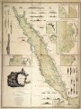
 The Dutch colony of the Cape of Good Hope (20715082746).jpg 1,384 × 2,000; 3.05 MB
-
 The Dutch colony of the Cape of Good Hope - De la Rochette - btv1b53168473v.jpg 5,392 × 7,410; 7.93 MB
-
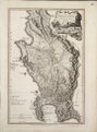
 The Dutch colony of the Cape of Good Hope - De la Rochette - btv1b531684749.jpg 4,313 × 6,408; 4.28 MB
-
 The Dutch colony of the Cape of Good Hope by L.S. De La Rochette RMG F0337.tiff 5,330 × 7,207; 109.9 MB
-
 The Dutch Colony of the Cape of Good Hope by William Faden, 1795.jpg 2,089 × 3,100; 2.84 MB
-

-


.jpg)


