Category:Maps of the Americas by Louis Stanislas d'Arcy de La Rochette
Jump to navigation
Jump to search
Media in category "Maps of the Americas by Louis Stanislas d'Arcy de La Rochette"
The following 18 files are in this category, out of 18 total.
-
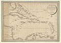
 1796 map of the West Indies.png 2,000 × 1,418; 3.98 MB
-
 A chart of the Antilles - btv1b5970883m.jpg 5,872 × 6,488; 5.8 MB
-

-
 A chart of the Antilles, or, Charibbee, or, Caribs Islands, with the Virgin Isles, LOC 74695636.tif 7,526 × 8,384; 180.53 MB
-
 A general chart of the West India islands - btv1b5970854w.jpg 9,832 × 6,960; 8.27 MB
-
 A map of North America and the west Indies by L. S. de La Rochette - btv1b53088844x.jpg 15,984 × 12,937; 25.96 MB
-
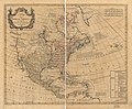 A map of North America, LOC 74694148.jpg 7,434 × 6,167; 6.67 MB
-
 A map of North America, LOC 74694148.tif 7,434 × 6,167; 131.17 MB
-
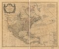
 A map of North America, LOC 74694149.jpg 7,129 × 5,935; 6.51 MB
-

-

-

-

-
 Bowles's new pocket map of North America, LOC 74694150.jpg 8,566 × 6,516; 7.45 MB
-
 Bowles's new pocket map of North America, LOC 74694150.tif 8,566 × 6,516; 159.69 MB
-

-
 The Caribbee islands and Guyana - btv1b5970879q (1 of 2).jpg 7,840 × 9,344; 8.45 MB
-


.jpg)
.jpg)
