Category:Locator maps of the Caribbean Netherlands
Jump to navigation
Jump to search
- This category is for locator maps of the Caribbean Netherlands, consisting of Bonaire, Sint Eustatius, and Saba. For the complete Dutch Caribbean including Aruba, Curaçao, and Sint Maarten, please see Category:Locator maps of the Dutch Caribbean.
Subcategories
This category has the following 4 subcategories, out of 4 total.
B
S
Media in category "Locator maps of the Caribbean Netherlands"
The following 3 files are in this category, out of 3 total.
-
 BES islands location map.svg 1,346 × 1,156; 177 KB
-
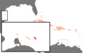
 Caribbean Netherlands.png 251 × 116; 7 KB
-
 Karibik BES Position.png 1,024 × 636; 43 KB


