Category:Locator maps of municipalities in the province of Lleida
Jump to navigation
Jump to search
Provinces of Spain: Álava · Albacete · Alicante · Almería · Asturias‡ · Ávila · Badajoz · Balearic Islands‡ · Barcelona · Biscay · Burgos · Cáceres · Cádiz · Cantabria‡ · Castellón · Córdoba · A Coruña · Cuenca · Gipuzkoa · Girona · Granada · Guadalajara · Huelva · Huesca · Jaén · León · Lleida · Lugo · Madrid‡ · Málaga · Murcia‡ · Navarre‡ · Ourense · Palencia · Las Palmas · Pontevedra · La Rioja‡ · Salamanca · Santa Cruz de Tenerife · Segovia · Seville · Soria · Tarragona · Teruel · Toledo · Valencia · Valladolid · Zamora · Zaragoza · Autonomous cities: Ceuta · Melilla
‡: uniprovincial autonomous communities.
‡: uniprovincial autonomous communities.

Media in category "Locator maps of municipalities in the province of Lleida"
The following 200 files are in this category, out of 232 total.
(previous page) (next page)-
 Karte Gemeinde Abella de la Conca 2022.png 5,000 × 6,301; 2.91 MB
-
 Karte Gemeinde Agramunt 2022.png 5,000 × 6,301; 2.91 MB
-
 Karte Gemeinde Aitona 2022.png 5,000 × 6,301; 2.91 MB
-
 Karte Gemeinde Albatàrrec 2022.png 5,000 × 6,301; 2.91 MB
-
 Karte Gemeinde Albesa 2022.png 5,000 × 6,301; 2.91 MB
-
 Karte Gemeinde Alcanó 2022.png 5,000 × 6,301; 2.91 MB
-
 Karte Gemeinde Alcarràs 2022.png 5,000 × 6,301; 2.91 MB
-
 Karte Gemeinde Alcoletge 2022.png 5,000 × 6,301; 2.91 MB
-
 Karte Gemeinde Alfarràs 2022.png 5,000 × 6,301; 2.91 MB
-
 Karte Gemeinde Alfés 2022.png 5,000 × 6,301; 2.91 MB
-
 Karte Gemeinde Algerri 2022.png 5,000 × 6,301; 2.91 MB
-
 Karte Gemeinde Alguaire 2022.png 5,000 × 6,301; 2.91 MB
-
 Karte Gemeinde Alins 2022.png 5,000 × 6,301; 2.9 MB
-
 Karte Gemeinde Almacelles 2022.png 5,000 × 6,301; 2.91 MB
-
 Karte Gemeinde Almatret 2022.png 5,000 × 6,301; 2.91 MB
-
 Karte Gemeinde Almenar 2022.png 5,000 × 6,301; 2.91 MB
-
 Karte Gemeinde Alpicat 2022.png 5,000 × 6,301; 2.91 MB
-
 Karte Gemeinde Alt Àneu 2022.png 5,000 × 6,301; 2.9 MB
-
 Karte Gemeinde Alàs i Cerc 2022.png 5,000 × 6,301; 2.9 MB
-
 Karte Gemeinde Alòs de Balaguer 2022.png 5,000 × 6,301; 2.91 MB
-
 Karte Gemeinde Anglesola 2022.png 5,000 × 6,301; 2.91 MB
-
 Karte Gemeinde Arbeca 2022.png 5,000 × 6,301; 2.91 MB
-
 Karte Gemeinde Arres 2022.png 5,000 × 6,301; 2.9 MB
-
 Karte Gemeinde Arsèguel 2022.png 5,000 × 6,301; 2.9 MB
-
 Karte Gemeinde Artesa de Lleida 2022.png 5,000 × 6,301; 2.91 MB
-
 Karte Gemeinde Artesa de Segre 2022.png 5,000 × 6,301; 2.91 MB
-
 Karte Gemeinde Aspa 2022.png 5,000 × 6,301; 2.91 MB
-
 Karte Gemeinde Baix Pallars 2022.png 5,000 × 6,301; 2.9 MB
-
 Karte Gemeinde Balaguer 2022.png 5,000 × 6,301; 2.91 MB
-
 Karte Gemeinde Barbens 2022.png 5,000 × 6,301; 2.91 MB
-
 Karte Gemeinde Bassella 2022.png 5,000 × 6,301; 2.9 MB
-
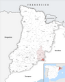
 Localización de Bassella - Lérida.png 264 × 379; 46 KB
-
 Karte Gemeinde Bausen 2022.png 5,000 × 6,301; 2.9 MB
-
 Karte Gemeinde Belianes 2022.png 5,000 × 6,301; 2.91 MB
-
 Karte Gemeinde Bell-lloc d’Urgell 2022.png 5,000 × 6,301; 2.91 MB
-
 Karte Gemeinde Bellaguarda 2022.png 5,000 × 6,301; 2.91 MB
-
 Karte Gemeinde Bellcaire d’Urgell 2022.png 5,000 × 6,301; 2.91 MB
-
 Karte Gemeinde Bellmunt d’Urgell 2022.png 5,000 × 6,301; 2.91 MB
-
 Karte Gemeinde Bellpuig 2022.png 5,000 × 6,301; 2.91 MB
-
 Karte Gemeinde Bellver de Cerdanya 2022.png 5,000 × 6,301; 2.9 MB
-
 Karte Gemeinde Bellvís 2022.png 5,000 × 6,301; 2.91 MB
-
 Karte Gemeinde Benavent de Segrià 2022.png 5,000 × 6,301; 2.91 MB
-
 Karte Gemeinde Biosca 2022.png 5,000 × 6,301; 2.9 MB
-
 Karte Gemeinde Bossòst 2022.png 5,000 × 6,301; 2.9 MB
-
 Karte Gemeinde Bovera 2022.png 5,000 × 6,301; 2.91 MB
-
 Karte Gemeinde Cabanabona 2022.png 5,000 × 6,301; 2.91 MB
-
 Karte Gemeinde Cabó 2022.png 5,000 × 6,301; 2.9 MB
-
 Karte Gemeinde Camarasa 2022.png 5,000 × 6,301; 2.91 MB
-
 Karte Gemeinde Canejan 2022.png 5,000 × 6,301; 2.9 MB
-
 Karte Gemeinde Castell de Mur 2022.png 5,000 × 6,301; 2.91 MB
-
 Karte Gemeinde Castellar de la Ribera 2022.png 5,000 × 6,301; 2.9 MB
-
 Karte Gemeinde Castelldans 2022.png 5,000 × 6,301; 2.91 MB
-
 Karte Gemeinde Castellnou de Seana 2022.png 5,000 × 6,301; 2.91 MB
-
 Karte Gemeinde Castellserà 2022.png 5,000 × 6,301; 2.91 MB
-
 Karte Gemeinde Castelló de Farfanya 2022.png 5,000 × 6,301; 2.91 MB
-
 Karte Gemeinde Cava 2022.png 5,000 × 6,301; 2.9 MB
-
 Karte Gemeinde Cervera 2022.png 5,000 × 6,301; 2.91 MB
-
 Karte Gemeinde Cervià de les Garrigues 2022.png 5,000 × 6,301; 2.91 MB
-
 Karte Gemeinde Ciutadilla 2022.png 5,000 × 6,301; 2.91 MB
-
 Karte Gemeinde Clariana de Cardener 2022.png 5,000 × 6,301; 2.9 MB
-
 Karte Gemeinde Coll de Nargó 2022.png 5,000 × 6,301; 2.9 MB
-
 Karte Gemeinde Conca de Dalt 2022.png 5,000 × 6,301; 2.91 MB
-
 Karte Gemeinde Corbins 2022.png 5,000 × 6,301; 2.91 MB
-
 Karte Gemeinde Cubells 2022.png 5,000 × 6,301; 2.91 MB
-
 Karte Gemeinde El Cogul 2022.png 5,000 × 6,301; 2.91 MB
-
 Karte Gemeinde El Palau d’Anglesola 2022.png 5,000 × 6,301; 2.91 MB
-
 Karte Gemeinde El Poal 2022.png 5,000 × 6,301; 2.91 MB
-
 Karte Gemeinde El Pont de Bar 2022.png 5,000 × 6,301; 2.9 MB
-
 Karte Gemeinde El Pont de Suert 2022.png 5,000 × 6,301; 2.9 MB
-
 Karte Gemeinde El Soleràs 2022.png 5,000 × 6,301; 2.91 MB
-
 Karte Gemeinde El Vilosell 2022.png 5,000 × 6,301; 2.91 MB
-
 Karte Gemeinde Els Alamús 2022.png 5,000 × 6,301; 2.91 MB
-
 Karte Gemeinde Els Omellons 2022.png 5,000 × 6,301; 2.91 MB
-
 Karte Gemeinde Els Omells de na Gaia 2022.png 5,000 × 6,301; 2.91 MB
-
 Karte Gemeinde Els Plans de Sió 2022.png 5,000 × 6,301; 2.91 MB
-
 Karte Gemeinde Els Torms 2022.png 5,000 × 6,301; 2.91 MB
-
 Karte Gemeinde Es Bòrdes 2022.png 5,000 × 6,301; 2.9 MB
-
 Karte Gemeinde Espot 2022.png 5,000 × 6,301; 2.9 MB
-
 Karte Gemeinde Estamariu 2022.png 5,000 × 6,301; 2.9 MB
-
 Karte Gemeinde Estaràs 2022.png 5,000 × 6,301; 2.91 MB
-
 Karte Gemeinde Esterri de Cardós 2022.png 5,000 × 6,301; 2.9 MB
-
 Karte Gemeinde Esterri d’Àneu 2022.png 5,000 × 6,301; 2.9 MB
-
 Karte Gemeinde Farrera 2022.png 5,000 × 6,301; 2.9 MB
-
 Karte Gemeinde Fondarella 2022.png 5,000 × 6,301; 2.91 MB
-
 Karte Gemeinde Foradada 2022.png 5,000 × 6,301; 2.91 MB
-
 Karte Gemeinde Fulleda 2022.png 5,000 × 6,301; 2.91 MB
-
 Karte Gemeinde Fígols i Alinyà 2022.png 5,000 × 6,301; 2.9 MB
-
 Karte Gemeinde Gavet de la Conca 2022.png 5,000 × 6,301; 2.91 MB
-
 Karte Gemeinde Gimenells i el Pla de la Font 2022.png 5,000 × 6,301; 2.91 MB
-
 Karte Gemeinde Golmés 2022.png 5,000 × 6,301; 2.91 MB
-
 Karte Gemeinde Granyanella 2022.png 5,000 × 6,301; 2.91 MB
-
 Karte Gemeinde Granyena de les Garrigues 2022.png 5,000 × 6,301; 2.91 MB
-
 Karte Gemeinde Granyena de Segarra 2022.png 5,000 × 6,301; 2.91 MB
-
 Karte Gemeinde Guimerà 2022.png 5,000 × 6,301; 2.91 MB
-
 Karte Gemeinde Guissona 2022.png 5,000 × 6,301; 2.91 MB
-
 Karte Gemeinde Guixers 2022.png 5,000 × 6,301; 2.9 MB
-
 Karte Gemeinde Gósol 2022.png 5,000 × 6,301; 2.9 MB
-
 Karte Gemeinde Isona i Conca Dellà 2022.png 5,000 × 6,301; 2.91 MB
-
 Karte Gemeinde Ivars de Noguera 2022.png 5,000 × 6,301; 2.91 MB
-
 Karte Gemeinde Ivars d’Urgell 2022.png 5,000 × 6,301; 2.91 MB
-
 Karte Gemeinde Ivorra 2022.png 5,000 × 6,301; 2.91 MB
-
 Karte Gemeinde Josa i Tuixén 2022.png 5,000 × 6,301; 2.9 MB
-
 Karte Gemeinde Juncosa 2022.png 5,000 × 6,301; 2.91 MB
-
 Karte Gemeinde Juneda 2022.png 5,000 × 6,301; 2.91 MB
-
 Karte Gemeinde La Baronia de Rialb 2022.png 5,000 × 6,301; 2.91 MB
-
 Karte Gemeinde La Coma i la Pedra 2022.png 5,000 × 6,301; 2.9 MB
-
 Karte Gemeinde La Floresta 2022.png 5,000 × 6,301; 2.91 MB
-
 Karte Gemeinde La Fuliola 2022.png 5,000 × 6,301; 2.91 MB
-
 Karte Gemeinde La Granadella 2022.png 5,000 × 6,301; 2.91 MB
-
 Karte Gemeinde La Granja d’Escarp 2022.png 5,000 × 6,301; 2.91 MB
-
 Karte Gemeinde La Guingueta d’Àneu 2022.png 5,000 × 6,301; 2.9 MB
-
 Karte Gemeinde La Molsosa 2022.png 5,000 × 6,301; 2.9 MB
-
 Karte Gemeinde La Pobla de Cérvoles 2022.png 5,000 × 6,301; 2.91 MB
-
 Karte Gemeinde La Pobla de Segur 2022.png 5,000 × 6,301; 2.91 MB
-
 Karte Gemeinde La Portella 2022.png 5,000 × 6,301; 2.91 MB
-
 Karte Gemeinde La Sentiu de Sió 2022.png 5,000 × 6,301; 2.91 MB
-
 Karte Gemeinde La Seu d’Urgell 2022.png 5,000 × 6,301; 2.9 MB
-
 Karte Gemeinde La Torre de Cabdella 2022.png 5,000 × 6,301; 2.91 MB
-
 Karte Gemeinde La Vansa i Fórnols 2022.png 5,000 × 6,301; 2.9 MB
-
 Karte Gemeinde Les 2022.png 5,000 × 6,301; 2.9 MB
-
 Karte Gemeinde Les Avellanes i Santa Linya 2022.png 5,000 × 6,301; 2.91 MB
-
 Karte Gemeinde Les Borges Blanques 2022.png 5,000 × 6,301; 2.91 MB
-
 Karte Gemeinde Les Oluges 2022.png 5,000 × 6,301; 2.91 MB
-
 Karte Gemeinde Les Valls de Valira 2022.png 5,000 × 6,301; 2.9 MB
-
 Karte Gemeinde Les Valls d’Aguilar 2022.png 5,000 × 6,301; 2.9 MB
-
 Karte Gemeinde Linyola 2022.png 5,000 × 6,301; 2.91 MB
-
 Karte Gemeinde Lladorre 2022.png 5,000 × 6,301; 2.9 MB
-
 Karte Gemeinde Lladurs 2022.png 5,000 × 6,301; 2.9 MB
-
 Karte Gemeinde Llardecans 2022.png 5,000 × 6,301; 2.91 MB
-
 Karte Gemeinde Llavorsí 2022.png 5,000 × 6,301; 2.9 MB
-
 Karte Gemeinde Lleida 2022.png 5,000 × 6,301; 2.91 MB
-
 Karte Gemeinde Lles de Cerdanya 2022.png 5,000 × 6,301; 2.9 MB
-
 Karte Gemeinde Llimiana 2022.png 5,000 × 6,301; 2.91 MB
-
 Karte Gemeinde Llobera 2022.png 5,000 × 6,301; 2.9 MB
-
 Karte Gemeinde L’Albagés 2022.png 5,000 × 6,301; 2.91 MB
-
 Karte Gemeinde L’Albi 2022.png 5,000 × 6,301; 2.91 MB
-
 Karte Gemeinde L’Espluga Calba 2022.png 5,000 × 6,301; 2.91 MB
-
 Karte Gemeinde Maials 2022.png 5,000 × 6,301; 2.91 MB
-
 Karte Gemeinde Maldà 2022.png 5,000 × 6,301; 2.91 MB
-
 Karte Gemeinde Massalcoreig 2022.png 5,000 × 6,301; 2.91 MB
-
 Karte Gemeinde Massoteres 2022.png 5,000 × 6,301; 2.91 MB
-
 Karte Gemeinde Menàrguens 2022.png 5,000 × 6,301; 2.91 MB
-
 Karte Gemeinde Miralcamp 2022.png 5,000 × 6,301; 2.91 MB
-
 Karte Gemeinde Mollerussa 2022.png 5,000 × 6,301; 2.91 MB
-
 Karte Gemeinde Montellà i Martinet 2022.png 5,000 × 6,301; 2.9 MB
-
 Karte Gemeinde Montferrer i Castellbò 2022.png 5,000 × 6,301; 2.9 MB
-
 Karte Gemeinde Montgai 2022.png 5,000 × 6,301; 2.91 MB
-
 Karte Gemeinde Montoliu de Lleida 2022.png 5,000 × 6,301; 2.91 MB
-
 Karte Gemeinde Montoliu de Segarra 2022.png 5,000 × 6,301; 2.91 MB
-
 Karte Gemeinde Montornès de Segarra 2022.png 5,000 × 6,301; 2.91 MB
-
 Karte Gemeinde Nalec 2022.png 5,000 × 6,301; 2.91 MB
-
 Karte Gemeinde Naut Aran 2022.png 5,000 × 6,301; 2.9 MB
-
 Karte Gemeinde Navès 2022.png 5,000 × 6,301; 2.9 MB
-
 Karte Gemeinde Odèn 2022.png 5,000 × 6,301; 2.9 MB
-
 Karte Gemeinde Oliana 2022.png 5,000 × 6,301; 2.9 MB
-
 Karte Gemeinde Oliola 2022.png 5,000 × 6,301; 2.91 MB
-
 Karte Gemeinde Olius 2022.png 5,000 × 6,301; 2.9 MB
-
 Karte Gemeinde Organyà 2022.png 5,000 × 6,301; 2.9 MB
-
 Karte Gemeinde Os de Balaguer 2022.png 5,000 × 6,301; 2.91 MB
-
 Karte Gemeinde Ossó de Sió 2022.png 5,000 × 6,301; 2.91 MB
-
 Karte Gemeinde Penelles 2022.png 5,000 × 6,301; 2.91 MB
-
 Karte Gemeinde Peramola 2022.png 5,000 × 6,301; 2.9 MB
-
 Karte Gemeinde Pinell de Solsonès 2022.png 5,000 × 6,301; 2.9 MB
-
 Karte Gemeinde Pinós 2022.png 5,000 × 6,301; 2.9 MB
-
 Karte Gemeinde Ponts 2022.png 5,000 × 6,301; 2.91 MB
-
 Karte Gemeinde Prats i Sansor 2022.png 5,000 × 6,301; 2.9 MB
-
 Karte Gemeinde Preixana 2022.png 5,000 × 6,301; 2.91 MB
-
 Karte Gemeinde Preixens 2022.png 5,000 × 6,301; 2.91 MB
-
 Karte Gemeinde Prullans 2022.png 5,000 × 6,301; 2.9 MB
-
 Karte Gemeinde Puiggròs 2022.png 5,000 × 6,301; 2.91 MB
-
 Karte Gemeinde Puigverd de Lleida 2022.png 5,000 × 6,301; 2.91 MB
-
 Karte Gemeinde Puigverd d’Agramunt 2022.png 5,000 × 6,301; 2.91 MB
-
 Karte Gemeinde Rialp 2022.png 5,000 × 6,301; 2.9 MB
-
 Karte Gemeinde Ribera d’Ondara 2022.png 5,000 × 6,301; 2.91 MB
-
 Karte Gemeinde Ribera d’Urgellet 2022.png 5,000 × 6,301; 2.9 MB
-
 Karte Gemeinde Riner 2022.png 5,000 × 6,301; 2.9 MB
-
 Karte Gemeinde Riu de Cerdanya 2022.png 5,000 × 6,301; 2.9 MB
-
 Karte Gemeinde Rosselló 2022.png 5,000 × 6,301; 2.91 MB
-
 Karte Gemeinde Salàs de Pallars 2022.png 5,000 × 6,301; 2.91 MB
-
 Karte Gemeinde Sanaüja 2022.png 5,000 × 6,301; 2.91 MB
-
 Karte Gemeinde Sant Esteve de la Sarga 2022.png 5,000 × 6,301; 2.91 MB
-
 Karte Gemeinde Sant Guim de Freixenet 2022.png 5,000 × 6,301; 2.91 MB
-
 Karte Gemeinde Sant Guim de la Plana 2022.png 5,000 × 6,301; 2.91 MB
-
 Karte Gemeinde Sant Llorenç de Morunys 2022.png 5,000 × 6,301; 2.9 MB
-
 Karte Gemeinde Sant Martí de Riucorb 2022.png 5,000 × 6,301; 2.91 MB
-
 Karte Gemeinde San Ramón (Lleida) 2022.png 5,000 × 6,301; 2.91 MB
-
 Karte Gemeinde Sarroca de Bellera 2022.png 5,000 × 6,301; 2.91 MB
-
 Karte Gemeinde Sarroca de Lleida 2022.png 5,000 × 6,301; 2.91 MB
-
 Karte Gemeinde Senterada 2022.png 5,000 × 6,301; 2.91 MB
-
 Karte Gemeinde Seròs 2022.png 5,000 × 6,301; 2.91 MB
-
 Karte Gemeinde Sidamon 2022.png 5,000 × 6,301; 2.91 MB
-
 Karte Gemeinde Solsona 2022.png 5,000 × 6,301; 2.9 MB
-
 Karte Gemeinde Soriguera 2022.png 5,000 × 6,301; 2.9 MB
-
 Karte Gemeinde Sort 2022.png 5,000 × 6,301; 2.9 MB
-
 Karte Gemeinde Soses 2022.png 5,000 × 6,301; 2.91 MB
-
 Karte Gemeinde Sudanell 2022.png 5,000 × 6,301; 2.91 MB
-
 Karte Gemeinde Sunyer 2022.png 5,000 × 6,301; 2.91 MB
-
 Karte Gemeinde Talarn 2022.png 5,000 × 6,301; 2.91 MB
-
 Karte Gemeinde Talavera 2022.png 5,000 × 6,301; 2.91 MB
-
 Karte Gemeinde Tarroja de Segarra 2022.png 5,000 × 6,301; 2.91 MB


_2022.png)


