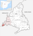
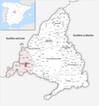
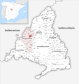
Category:Locator maps of municipalities in the Community of Madrid
Jump to navigation
Jump to search
Provinces of Spain: Álava · Albacete · Alicante · Almería · Asturias‡ · Ávila · Badajoz · Balearic Islands‡ · Barcelona · Biscay · Burgos · Cáceres · Cádiz · Cantabria‡ · Castellón · Córdoba · A Coruña · Cuenca · Gipuzkoa · Girona · Granada · Guadalajara · Huelva · Huesca · Jaén · León · Lleida · Lugo · Madrid‡ · Málaga · Murcia‡ · Navarre‡ · Ourense · Palencia · Las Palmas · Pontevedra · La Rioja‡ · Salamanca · Santa Cruz de Tenerife · Segovia · Seville · Soria · Tarragona · Teruel · Toledo · Valencia · Valladolid · Zamora · Zaragoza · Autonomous cities: Ceuta · Melilla
‡: uniprovincial autonomous communities.
‡: uniprovincial autonomous communities.
Autonomous communities of Spain: Andalusia · Aragon · Asturias · Balearic Islands · Basque Autonomous Community · Canary Islands · Cantabria · Castile and León · Castilla–La Mancha · Catalonia · Extremadura · Galicia · Community of Madrid · Region of Murcia · Navarre · La Rioja · Valencian Community · Autonomous cities: Ceuta · Melilla
Media in category "Locator maps of municipalities in the Community of Madrid"
The following 200 files are in this category, out of 351 total.
(previous page) (next page)-
 0-Municipios de Madrid.svg 400 × 400; 230 KB
-
 Karte Gemeinde Ajalvir 2022.png 5,000 × 5,367; 2.76 MB
-
 Ajalvir (Madrid) mapa.svg 400 × 400; 230 KB
-
 Karte Gemeinde Alameda del Valle 2022.png 5,000 × 5,367; 2.76 MB
-
 Alameda del Valle (Madrid) mapa.svg 400 × 400; 230 KB
-
 Alcalá de Henares (Madrid) mapa.svg 400 × 400; 230 KB
-
 Alcobendas (Madrid) mapa.svg 400 × 400; 230 KB
-
 Alcorcón (Madrid) mapa.svg 400 × 400; 230 KB
-
 Karte Gemeinde Aldea del Fresno 2022.png 5,000 × 5,367; 2.77 MB
-
 Aldea del Fresno (Madrid) mapa.svg 400 × 400; 230 KB
-
 Karte Gemeinde Algete 2022.png 5,000 × 5,367; 2.76 MB
-
 Algete (Madrid) mapa.svg 400 × 400; 230 KB
-
 Karte Gemeinde Alpedrete 2022.png 5,000 × 5,367; 2.76 MB
-
 Alpedrete (Madrid) mapa.svg 400 × 400; 230 KB
-
 Karte Gemeinde Ambite 2022.png 5,000 × 5,367; 2.76 MB
-
 Ambite (Madrid) mapa.svg 400 × 400; 230 KB
-
 Karte Gemeinde Anchuelo 2022.png 5,000 × 5,367; 2.76 MB
-
 Anchuelo (Madrid) mapa.svg 400 × 400; 230 KB
-
 Karte Gemeinde Aranjuez 2022.png 5,000 × 5,367; 2.76 MB
-
 Aranjuez (Madrid) mapa.svg 400 × 400; 230 KB
-
 Arganda del Rey (Madrid) mapa.svg 400 × 400; 230 KB
-
 Karte Gemeinde Arroyomolinos (Madrid) 2022.png 5,000 × 5,367; 2.76 MB
-
 Arroyomolinos (Madrid) mapa.svg 400 × 400; 230 KB
-
 Karte Gemeinde Batres 2022.png 5,000 × 5,367; 2.76 MB
-
 Batres (Madrid) mapa.svg 400 × 400; 230 KB
-
 Karte Gemeinde Becerril de la Sierra 2022.png 5,000 × 5,367; 2.76 MB
-
 Becerril de la Sierra (Madrid) mapa.svg 400 × 400; 230 KB
-
 Karte Gemeinde Belmonte de Tajo 2022.png 5,000 × 5,367; 2.76 MB
-
 Belmonte de Tajo (Madrid) mapa.svg 400 × 400; 230 KB
-
 Karte Gemeinde Berzosa del Lozoya 2022.png 5,000 × 5,367; 2.76 MB
-
 Berzosa del Lozoya (Madrid) mapa.svg 400 × 400; 230 KB
-
 Boadilla del Monte (Madrid) mapa.svg 400 × 400; 230 KB
-
 Karte Gemeinde Braojos 2022.png 5,000 × 5,367; 2.76 MB
-
 Braojos (Madrid) mapa.png 400 × 400; 79 KB
-
 Braojos (Madrid) mapa.svg 400 × 400; 230 KB
-
 Karte Gemeinde Brea de Tajo 2022.png 5,000 × 5,367; 2.76 MB
-
 Brea de Tajo (Madrid) mapa.svg 400 × 400; 230 KB
-
 Karte Gemeinde Brunete 2022.png 5,000 × 5,367; 2.76 MB
-
 Brunete (Madrid) mapa.svg 400 × 400; 230 KB
-
 Buitrago del Lozoya (Madrid) mapa.svg 400 × 400; 230 KB
-
 Karte Gemeinde Buitrago del Lozoya 2022.png 5,000 × 5,367; 2.76 MB
-
 Karte Gemeinde Bustarviejo 2022.png 5,000 × 5,367; 2.76 MB
-
 Bustarviejo (Madrid) mapa.svg 400 × 400; 230 KB
-
 Karte Gemeinde Cabanillas de la Sierra 2022.png 5,000 × 5,367; 2.76 MB
-
 Cabanillas de la Sierra (Madrid) mapa.svg 400 × 400; 230 KB
-
 Karte Gemeinde Cadalso de los Vidrios 2022.png 5,000 × 5,367; 2.77 MB
-
 Cadalso de los Vidrios (Madrid) mapa.svg 400 × 400; 230 KB
-
 Karte Gemeinde Camarma de Esteruelas 2022.png 5,000 × 5,367; 2.76 MB
-
 Camarma de Esteruelas (Madrid) mapa.svg 400 × 400; 230 KB
-
 Karte Gemeinde Campo Real 2022.png 5,000 × 5,367; 2.76 MB
-
 Campo Real (Madrid) mapa.svg 400 × 400; 230 KB
-
 Karte Gemeinde Canencia 2022.png 5,000 × 5,367; 2.76 MB
-
 Canencia (Madrid) mapa.svg 400 × 400; 230 KB
-
 Karte Gemeinde Carabaña 2022.png 5,000 × 5,367; 2.76 MB
-
 Carabaña (Madrid) mapa.svg 400 × 400; 230 KB
-
 Karte Gemeinde Casarrubuelos 2022.png 5,000 × 5,367; 2.76 MB
-
 Casarrubuelos (Madrid) mapa.svg 400 × 400; 230 KB
-
 Karte Gemeinde Cenicientos 2022.png 5,000 × 5,367; 2.77 MB
-
 Cenicientos (Madrid) mapa.svg 400 × 400; 230 KB
-
 Karte Gemeinde Cercedilla 2022.png 5,000 × 5,367; 2.76 MB
-
 Cercedilla (Madrid) mapa.svg 400 × 400; 230 KB
-
 Karte Gemeinde Cervera de Buitrago 2022.png 5,000 × 5,367; 2.76 MB
-
 Cervera de Buitrago (Madrid) mapa.svg 400 × 400; 230 KB
-
 Karte Gemeinde Chapinería 2022.png 5,000 × 5,367; 2.77 MB
-
 Chapinería (Madrid) mapa.svg 400 × 400; 230 KB
-
 Karte Gemeinde Chinchón 2022.png 5,000 × 5,367; 2.76 MB
-
 Chinchón (Madrid) mapa.svg 400 × 400; 230 KB
-
 Karte Gemeinde Ciempozuelos 2022.png 5,000 × 5,367; 2.76 MB
-
 Ciempozuelos (Madrid) mapa.svg 400 × 400; 230 KB
-
 Karte Gemeinde Cobeña 2022.png 5,000 × 5,367; 2.76 MB
-
 Cobeña (Madrid) mapa.svg 400 × 400; 230 KB
-
 Karte Gemeinde Collado Mediano 2022.png 5,000 × 5,367; 2.76 MB
-
 Collado Mediano (Comunidad de Madrid) mapa.svg 870 × 757; 522 KB
-
 Collado Mediano (Madrid) mapa.svg 400 × 400; 230 KB
-
 Karte Gemeinde Collado Villalba 2022.png 5,000 × 5,367; 2.76 MB
-
 Collado Villalba (Madrid) mapa.svg 400 × 400; 230 KB
-
 Karte Gemeinde Colmenar de Oreja 2022.png 5,000 × 5,367; 2.76 MB
-
 Colmenar de Oreja (Madrid) mapa.svg 400 × 400; 230 KB
-
 Karte Gemeinde Colmenar del Arroyo 2022.png 5,000 × 5,367; 2.77 MB
-
 Colmenar del Arroyo (Madrid) mapa.svg 400 × 400; 230 KB
-
 Karte Gemeinde Colmenar Viejo 2022.png 5,000 × 5,367; 2.76 MB
-
 Colmenar Viejo (Madrid) mapa.svg 400 × 400; 230 KB
-
 Karte Gemeinde Colmenarejo 2022.png 5,000 × 5,367; 2.76 MB
-
 Colmenarejo (Madrid) mapa.svg 400 × 400; 230 KB
-
 Karte Gemeinde Corpa 2022.png 5,000 × 5,367; 2.76 MB
-
 Corpa (Madrid) mapa.svg 400 × 400; 230 KB
-
 Karte Gemeinde Coslada 2022.png 5,000 × 5,367; 2.77 MB
-
 Coslada (Madrid) mapa.svg 400 × 400; 230 KB
-
 Karte Gemeinde Cubas de la Sagra 2022.png 5,000 × 5,367; 2.76 MB
-
 Cubas de la Sagra (Madrid) mapa.svg 400 × 400; 230 KB
-
 Karte Gemeinde Daganzo de Arriba 2022.png 5,000 × 5,367; 2.76 MB
-
 Daganzo de Arriba (Madrid) mapa.svg 400 × 400; 230 KB
-
 Karte Gemeinde El Atazar 2022.png 5,000 × 5,367; 2.76 MB
-
 El Atazar (Madrid) mapa.svg 400 × 400; 230 KB
-
 Karte Gemeinde El Berrueco 2022.png 5,000 × 5,367; 2.76 MB
-
 El Berrueco (Madrid) mapa.svg 400 × 400; 230 KB
-
 Karte Gemeinde El Boalo 2022.png 5,000 × 5,367; 2.76 MB
-
 El Boalo (Madrid) mapa.svg 400 × 400; 230 KB
-
 Karte Gemeinde El Escorial 2022.png 5,000 × 5,367; 2.76 MB
-
 El Escorial (Madrid) mapa.svg 400 × 400; 230 KB
-
 Karte Gemeinde El Molar (Madrid) 2022.png 5,000 × 5,367; 2.76 MB
-
 El Molar (Madrid) mapa.svg 400 × 400; 230 KB
-
 Karte Gemeinde El Vellón 2022.png 5,000 × 5,367; 2.76 MB
-
 El Vellón (Madrid) mapa.svg 400 × 400; 230 KB
-
 Karte Gemeinde El Álamo 2022.png 5,000 × 5,367; 2.76 MB
-
 El Álamo (Madrid) mapa.svg 400 × 400; 230 KB
-
 Karte Gemeinde Estremera 2022.png 5,000 × 5,367; 2.76 MB
-
 Estremera (Madrid) mapa.svg 400 × 400; 230 KB
-
 Karte Gemeinde Fresnedillas de la Oliva 2022.png 5,000 × 5,367; 2.77 MB
-
 Fresnedillas de la Oliva (Madrid) mapa.svg 400 × 400; 230 KB
-
 Karte Gemeinde Fresno de Torote 2022.png 5,000 × 5,367; 2.76 MB
-
 Fresno de Torote (Madrid) mapa.svg 400 × 400; 230 KB
-
 Fuenlabrada (Madrid) mapa.svg 400 × 400; 230 KB
-
 Karte Gemeinde Fuente el Saz de Jarama 2022.png 5,000 × 5,367; 2.76 MB
-
 Fuente el Saz de Jarama (Madrid) mapa.svg 400 × 400; 230 KB
-
 Karte Gemeinde Fuentidueña de Tajo 2022.png 5,000 × 5,367; 2.76 MB
-
 Fuentidueña de Tajo (Madrid) mapa.svg 400 × 400; 230 KB
-
 Karte Gemeinde Galapagar 2022.png 5,000 × 5,367; 2.76 MB
-
 Galapagar (Madrid) mapa.svg 400 × 400; 230 KB
-
 Karte Gemeinde Garganta de los Montes 2022.png 5,000 × 5,367; 2.76 MB
-
 Garganta de los Montes (Madrid) mapa.svg 400 × 400; 230 KB
-
 Karte Gemeinde Gargantilla del Lozoya y Pinilla de Buitrago 2022.png 5,000 × 5,367; 2.76 MB
-
 Gargantilla del Lozoya y Pinilla de Buitrago (Madrid) mapa.svg 400 × 400; 231 KB
-
 Karte Gemeinde Gascones 2022.png 5,000 × 5,367; 2.76 MB
-
 Gascones (Madrid) mapa.svg 400 × 400; 230 KB
-
 Getafe (Madrid) mapa.svg 400 × 400; 230 KB
-
 Karte Gemeinde Griñón 2022.png 5,000 × 5,367; 2.76 MB
-
 Griñón (Madrid) mapa.svg 400 × 400; 230 KB
-
 Karte Gemeinde Guadalix de la Sierra 2022.png 5,000 × 5,367; 2.76 MB
-
 Guadalix de la Sierra (Madrid) mapa.svg 400 × 400; 230 KB
-
 Karte Gemeinde Guadarrama 2022.png 5,000 × 5,367; 2.76 MB
-
 Guadarrama (Madrid) mapa.svg 400 × 400; 230 KB
-
 Horcajo de la Sierra (Madrid) mapa.svg 400 × 400; 230 KB
-
 Karte Gemeinde Horcajo de la Sierra-Aoslos 2022.png 5,000 × 5,367; 2.76 MB
-
 Karte Gemeinde Horcajuelo de la Sierra 2022.png 5,000 × 5,367; 2.76 MB
-
 Horcajuelo de la Sierra (Madrid) mapa.svg 400 × 400; 230 KB
-
 Karte Gemeinde Hoyo de Manzanares 2022.png 5,000 × 5,367; 2.76 MB
-
 Hoyo de Manzanares (Madrid) mapa.svg 400 × 400; 230 KB
-
 Karte Gemeinde Humanes de Madrid 2022.png 5,000 × 5,367; 2.76 MB
-
 Humanes de Madrid (Madrid) mapa.svg 400 × 400; 230 KB
-
 Karte Gemeinde La Acebeda 2022.png 5,000 × 5,367; 2.76 MB
-
 La Acebeda (Madrid) mapa.svg 400 × 400; 230 KB
-
 Karte Gemeinde La Cabrera 2022.png 5,000 × 5,367; 2.76 MB
-
 La Cabrera (Madrid) mapa.svg 400 × 400; 230 KB
-
 Karte Gemeinde La Hiruela 2022.png 5,000 × 5,367; 2.76 MB
-
 La Hiruela (Madrid) mapa.svg 400 × 400; 230 KB
-
 Karte Gemeinde La Serna del Monte 2022.png 5,000 × 5,367; 2.76 MB
-
 La Serna del Monte (Madrid) mapa.svg 400 × 400; 230 KB
-
 Karte Gemeinde Las Rozas de Madrid 2022.png 5,000 × 5,367; 2.77 MB
-
 Las Rozas de Madrid (Madrid) mapa.svg 400 × 400; 230 KB
-
 Leganés (Madrid) mapa.svg 400 × 400; 230 KB
-
 Karte Gemeinde Loeches 2022.png 5,000 × 5,367; 2.76 MB
-
 Loeches (Madrid) mapa.svg 400 × 400; 230 KB
-
 Karte Gemeinde Los Molinos 2022.png 5,000 × 5,367; 2.76 MB
-
 Los Molinos (Madrid) mapa.svg 400 × 400; 230 KB
-
 Karte Gemeinde Los Santos de la Humosa 2022.png 5,000 × 5,367; 2.76 MB
-
 Los Santos de la Humosa (Madrid) mapa.svg 400 × 400; 230 KB
-
 Karte Gemeinde Lozoya 2022.png 5,000 × 5,367; 2.76 MB
-
 Lozoya (Madrid) mapa.svg 400 × 400; 230 KB
-
 Karte Gemeinde Lozoyuela-Navas-Sieteiglesias 2022.png 5,000 × 5,367; 2.76 MB
-
 Lozoyuela-Navas-Sieteiglesias (Madrid) mapa.svg 400 × 400; 230 KB
-
 Karte Gemeinde Madarcos 2022.png 5,000 × 5,367; 2.76 MB
-
 Madarcos (Madrid) mapa.svg 400 × 400; 230 KB
-
 Karte Gemeinde Majadahonda 2022.png 5,000 × 5,367; 2.77 MB
-
 Majadahonda (Madrid) mapa.svg 400 × 400; 230 KB
-
 Karte Gemeinde Manzanares el Real 2022.png 5,000 × 5,367; 2.76 MB
-
 Manzanares el Real (Madrid) mapa.svg 400 × 400; 230 KB
-
 Meco (Madrid) mapa.svg 400 × 400; 230 KB
-
 Karte Gemeinde Mejorada del Campo 2022.png 5,000 × 5,367; 2.76 MB
-
 Mejorada del Campo (Madrid) mapa.svg 400 × 400; 230 KB
-
 Karte Gemeinde Miraflores de la Sierra 2022.png 5,000 × 5,367; 2.76 MB
-
 Miraflores de la Sierra (Madrid) mapa.svg 400 × 400; 230 KB
-
 Karte Gemeinde Montejo de la Sierra 2022.png 5,000 × 5,367; 2.76 MB
-
 Montejo de la Sierra (Madrid) mapa.svg 400 × 400; 230 KB
-
 Karte Gemeinde Moraleja de Enmedio 2022.png 5,000 × 5,367; 2.76 MB
-
 Moraleja de Enmedio (Madrid) mapa.svg 400 × 400; 230 KB
-
 Karte Gemeinde Moralzarzal 2022.png 5,000 × 5,367; 2.76 MB
-
 Moralzarzal (Madrid) mapa.svg 400 × 400; 230 KB
-
 Karte Gemeinde Morata de Tajuña 2022.png 5,000 × 5,367; 2.76 MB
-
 Morata de Tajuña (Madrid) mapa.svg 400 × 400; 230 KB
-
 Móstoles (Madrid) mapa.svg 400 × 400; 230 KB
-
 Karte Gemeinde Navacerrada 2022.png 5,000 × 5,367; 2.76 MB
-
 Navacerrada (Madrid) mapa.svg 400 × 400; 230 KB
-
 Karte Gemeinde Navalafuente 2022.png 5,000 × 5,367; 2.76 MB
-
 Navalafuente (Comunidad de Madrid) mapa.svg 870 × 757; 522 KB
-
 Navalafuente (Madrid) mapa.svg 400 × 400; 230 KB
-
 Karte Gemeinde Navalagamella 2022.png 5,000 × 5,367; 2.77 MB
-
 Navalagamella (Madrid) mapa.svg 400 × 400; 230 KB
-
 Karte Gemeinde Navalcarnero 2022.png 5,000 × 5,367; 2.76 MB
-
 Navalcarnero (Madrid) mapa.svg 400 × 400; 230 KB
-
 Karte Gemeinde Navarredonda y San Mamés 2022.png 5,000 × 5,367; 2.76 MB
-
 Navarredonda y San Mamés (Madrid) mapa.svg 400 × 400; 230 KB
-
 Karte Gemeinde Navas del Rey 2022.png 5,000 × 5,367; 2.77 MB
-
 Navas del Rey (Madrid) mapa.svg 400 × 400; 230 KB
-
 Nuevo Baztán (Madrid) mapa.svg 400 × 400; 230 KB
-
 Karte Gemeinde Olmeda de las Fuentes 2022.png 5,000 × 5,367; 2.76 MB
-
 Olmeda de las Fuentes (Madrid) mapa.svg 400 × 400; 230 KB
-
 Karte Gemeinde Orusco de Tajuña 2022.png 5,000 × 5,367; 2.76 MB
-
 Orusco de Tajuña (Madrid) mapa.svg 400 × 400; 230 KB
-
 Karte Gemeinde Paracuellos de Jarama 2022.png 5,000 × 5,367; 2.76 MB


_mapa.svg)

_mapa.svg)
_mapa.svg)
_mapa.svg)
_mapa.svg)

_mapa.svg)

_mapa.svg)

_mapa.svg)

_mapa.svg)

_mapa.svg)

_mapa.svg)
_mapa.svg)
_2022.png)
_mapa.svg)

_mapa.svg)

_mapa.svg)

_mapa.svg)

_mapa.svg)
_mapa.svg)

_mapa.png)
_mapa.svg)

_mapa.svg)

_mapa.svg)
_mapa.svg)


_mapa.svg)

_mapa.svg)

_mapa.svg)

_mapa.svg)

_mapa.svg)

_mapa.svg)

_mapa.svg)

_mapa.svg)

_mapa.svg)

_mapa.svg)

_mapa.svg)

_mapa.svg)

_mapa.svg)

_mapa.svg)

_mapa.svg)

_mapa.svg)
_mapa.svg)

_mapa.svg)

_mapa.svg)

_mapa.svg)

_mapa.svg)

_mapa.svg)

_mapa.svg)

_mapa.svg)

_mapa.svg)

_mapa.svg)

_mapa.svg)

_mapa.svg)

_mapa.svg)

_mapa.svg)
_2022.png)
_mapa.svg)

_mapa.svg)

_mapa.svg)

_mapa.svg)

_mapa.svg)

_mapa.svg)
_mapa.svg)

_mapa.svg)

_mapa.svg)

_mapa.svg)

_mapa.svg)

_mapa.svg)

_mapa.svg)
_mapa.svg)

_mapa.svg)

_mapa.svg)

_mapa.svg)
_mapa.svg)


_mapa.svg)

_mapa.svg)

_mapa.svg)

_mapa.svg)

_mapa.svg)

_mapa.svg)

_mapa.svg)

_mapa.svg)
_mapa.svg)

_mapa.svg)

_mapa.svg)

_mapa.svg)

_mapa.svg)

_mapa.svg)

_mapa.svg)

_mapa.svg)

_mapa.svg)
_mapa.svg)

_mapa.svg)

_mapa.svg)

_mapa.svg)

_mapa.svg)

_mapa.svg)

_mapa.svg)
_mapa.svg)

_mapa.svg)

_mapa.svg)
_mapa.svg)

_mapa.svg)

_mapa.svg)

_mapa.svg)

_mapa.svg)
_mapa.svg)

_mapa.svg)

_mapa.svg)
