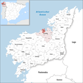
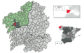
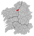
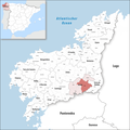
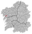
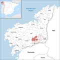
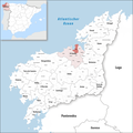
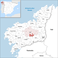
Category:Locator maps of municipalities in the province of A Coruña
Jump to navigation
Jump to search
Provinces of Spain: Álava · Albacete · Alicante · Almería · Asturias‡ · Ávila · Badajoz · Balearic Islands‡ · Barcelona · Biscay · Burgos · Cáceres · Cádiz · Cantabria‡ · Castellón · Córdoba · A Coruña · Cuenca · Gipuzkoa · Girona · Granada · Guadalajara · Huelva · Huesca · Jaén · León · Lleida · Lugo · Madrid‡ · Málaga · Murcia‡ · Navarre‡ · Ourense · Palencia · Las Palmas · Pontevedra · La Rioja‡ · Salamanca · Santa Cruz de Tenerife · Segovia · Seville · Soria · Tarragona · Teruel · Toledo · Valencia · Valladolid · Zamora · Zaragoza · Autonomous cities: Ceuta · Melilla
‡: uniprovincial autonomous communities.
‡: uniprovincial autonomous communities.

Media in category "Locator maps of municipalities in the province of A Coruña"
The following 200 files are in this category, out of 291 total.
(previous page) (next page)-
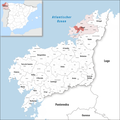
 255px-La Coruna, Spain location3.png 255 × 311; 105 KB
-
 Karte Gemeinde A Baña 2022.png 3,000 × 3,000; 1.13 MB
-
 Karte Gemeinde A Capela 2022.png 3,000 × 3,000; 1.13 MB
-
 Karte Gemeinde A Coruña 2022.png 3,000 × 3,000; 1.13 MB
-
 Karte Gemeinde A Laracha 2022.png 3,000 × 3,000; 1.13 MB
-
 Karte Gemeinde A Pobra do Caramiñal 2022.png 3,000 × 3,000; 1.12 MB
-
 Karte Gemeinde Abegondo 2022.png 3,000 × 3,000; 1.13 MB
-
 Location of Abegondo.png 794 × 500; 38 KB
-
 Situacion Abegondo.PNG 956 × 1,008; 84 KB
-
 Karte Gemeinde Ames 2022.png 3,000 × 3,000; 1.13 MB
-
 Location of Ames.png 794 × 500; 38 KB
-
 Situacion Ames.PNG 956 × 1,008; 84 KB
-
 Karte Gemeinde Aranga 2022.png 3,000 × 3,000; 1.13 MB
-
 Location of Aranga.png 794 × 500; 38 KB
-
 Situacion Aranga.PNG 956 × 1,008; 84 KB
-
 Karte Gemeinde Ares 2022.png 3,000 × 3,000; 1.13 MB
-
 Location of Ares.png 794 × 500; 38 KB
-
 Situacion Ares.PNG 956 × 1,008; 84 KB
-
 Karte Gemeinde Arteixo 2022.png 3,000 × 3,000; 1.13 MB
-
 Location of Arteijo.png 794 × 500; 38 KB
-
 Situacion Arteixo.PNG 956 × 1,008; 84 KB
-
 Karte Gemeinde Arzúa 2022.png 3,000 × 3,000; 1.13 MB
-
 Location of Arzúa.png 794 × 500; 38 KB
-
 Situacion Arzúa.PNG 956 × 1,008; 84 KB
-
 Karte Gemeinde As Pontes de García Rodríguez 2022.png 3,000 × 3,000; 1.12 MB
-
 Karte Gemeinde As Somozas 2022.png 3,000 × 3,000; 1.13 MB
-
 Location of La Baña.png 794 × 500; 38 KB
-
 Situacion A Baña.PNG 956 × 1,008; 84 KB
-
 Karte Gemeinde Bergondo 2022.png 3,000 × 3,000; 1.13 MB
-
 Location of Bergondo.png 794 × 500; 38 KB
-
 Situacion Bergondo.PNG 956 × 1,008; 84 KB
-
 Karte Gemeinde Betanzos 2022.png 3,000 × 3,000; 1.13 MB
-
 Location of Betanzos.png 794 × 500; 38 KB
-
 Situacion Betanzos.PNG 956 × 1,008; 84 KB
-
 Karte Gemeinde Boimorto 2022.png 3,000 × 3,000; 1.13 MB
-
 Location of Boimorto.png 794 × 500; 38 KB
-
 Situacion Boimorto.PNG 956 × 1,008; 84 KB
-
 Karte Gemeinde Boiro 2022.png 3,000 × 3,000; 1.12 MB
-
 Location of Boiro.png 794 × 500; 38 KB
-
 Situacion Boiro.PNG 956 × 1,008; 84 KB
-
 Karte Gemeinde Boqueixón 2022.png 3,000 × 3,000; 1.13 MB
-
 Location of Boqueijón.png 794 × 500; 38 KB
-
 Situacion Boqueixón.PNG 956 × 1,008; 84 KB
-
 Karte Gemeinde Brión 2022.png 3,000 × 3,000; 1.13 MB
-
 Location of Brión.png 794 × 500; 38 KB
-
 Situacion Brión.PNG 956 × 1,008; 84 KB
-
 Karte Gemeinde Cabana de Bergantiños 2022.png 3,000 × 3,000; 1.13 MB
-
 Location of Cabana de Bergantiños.png 794 × 500; 38 KB
-
 Situacion Cabana de Bergantiños.PNG 956 × 1,008; 84 KB
-
 Karte Gemeinde Cabañas 2022.png 3,000 × 3,000; 1.13 MB
-
 Location of Cabañas.png 794 × 500; 38 KB
-
 Situacion Cabanas.PNG 956 × 1,008; 84 KB
-
 Karte Gemeinde Camariñas 2022.png 3,000 × 3,000; 1.13 MB
-
 Location of Camariñas.png 794 × 500; 38 KB
-
 Situacion Camariñas.PNG 956 × 1,008; 84 KB
-
 Karte Gemeinde Cambre 2022.png 3,000 × 3,000; 1.13 MB
-
 Location of Cambre.png 794 × 500; 38 KB
-
 Situacion Cambre.PNG 956 × 1,008; 84 KB
-
 Location of La Capela.png 794 × 500; 38 KB
-
 Situacion A Capela.PNG 956 × 1,008; 84 KB
-
 Karte Gemeinde Carballo 2022.png 3,000 × 3,000; 1.13 MB
-
 Location of Carballo.png 794 × 500; 38 KB
-
 Situacion Carballo.PNG 956 × 1,008; 84 KB
-
 Karte Gemeinde Cariño 2022.png 3,000 × 3,000; 1.12 MB
-
 Location of Cariño.png 794 × 500; 38 KB
-
 Situacion Cariño.PNG 956 × 1,008; 84 KB
-
 Karte Gemeinde Carnota 2022.png 3,000 × 3,000; 1.13 MB
-
 Location of Carnota.png 794 × 500; 38 KB
-
 Situacion Carnota.PNG 956 × 1,008; 84 KB
-
 Karte Gemeinde Carral 2022.png 3,000 × 3,000; 1.13 MB
-
 Location of Carral.png 794 × 500; 38 KB
-
 Situacion Carral.PNG 956 × 1,008; 84 KB
-
 Karte Gemeinde Cedeira 2022.png 3,000 × 3,000; 1.13 MB
-
 Location of Cedeira.png 794 × 500; 38 KB
-
 Situacion Cedeira.PNG 956 × 1,008; 84 KB
-
 Karte Gemeinde Cee 2022.png 3,000 × 3,000; 1.13 MB
-
 Location of Cee.png 794 × 500; 38 KB
-
 Situacion Cee.PNG 956 × 1,008; 84 KB
-
 Karte Gemeinde Cerceda 2022.png 3,000 × 3,000; 1.13 MB
-
 Location of Cerceda.png 794 × 500; 38 KB
-
 Situacion Cerceda.PNG 956 × 1,008; 84 KB
-
 Karte Gemeinde Cerdido 2022.png 3,000 × 3,000; 1.13 MB
-
 Location of Cerdido.png 794 × 500; 38 KB
-
 Situacion Cerdido.PNG 956 × 1,008; 84 KB
-
 Karte Gemeinde Coirós 2022.png 3,000 × 3,000; 1.13 MB
-
 Location of Coirós.png 794 × 500; 38 KB
-
 Situacion Coirós.PNG 956 × 1,008; 84 KB
-
 Karte Gemeinde Corcubión 2022.png 3,000 × 3,000; 1.13 MB
-
 Location of Corcubión.png 794 × 500; 38 KB
-
 Situacion Corcubión.PNG 956 × 1,008; 84 KB
-
 Karte Gemeinde Coristanco 2022.png 3,000 × 3,000; 1.13 MB
-
 Location of Coristanco.png 794 × 500; 38 KB
-
 Situacion Coristanco.PNG 956 × 1,008; 84 KB
-
 Situacion A Coruña.PNG 956 × 1,008; 84 KB
-
 Karte Gemeinde Culleredo 2022.png 3,000 × 3,000; 1.13 MB
-
 Location of Culledero.png 794 × 500; 38 KB
-
 Situacion Culleredo.PNG 956 × 1,008; 84 KB
-
 Karte Gemeinde Curtis 2022.png 3,000 × 3,000; 1.13 MB
-
 Situacion Curtis.PNG 956 × 1,008; 84 KB
-
 Karte Gemeinde Dodro 2022.png 3,000 × 3,000; 1.12 MB
-
 Location of Dodro.png 794 × 500; 38 KB
-
 Situacion Dodro.PNG 956 × 1,008; 84 KB
-
 Karte Gemeinde Dumbría 2022.png 3,000 × 3,000; 1.13 MB
-
 Location of Dumbría.png 794 × 500; 38 KB
-
 Situacion Dumbría.PNG 956 × 1,008; 84 KB
-
 Karte Gemeinde Fene 2022.png 3,000 × 3,000; 1.13 MB
-
 Location of Fene.png 794 × 500; 38 KB
-
 Situacion Fene.PNG 956 × 1,008; 84 KB
-
 Karte Gemeinde Ferrol 2022.png 3,000 × 3,000; 1.13 MB
-
 Location of El Ferrol.png 794 × 500; 38 KB
-
 Situacion Ferrol.PNG 956 × 1,008; 84 KB
-
 Karte Gemeinde Fisterra 2022.png 3,000 × 3,000; 1.13 MB
-
 Location of Finisterre.png 794 × 500; 38 KB
-
 Situacion Fisterra.PNG 956 × 1,008; 84 KB
-
 Karte Gemeinde Frades 2022.png 3,000 × 3,000; 1.13 MB
-
 Location of Frades.png 794 × 500; 38 KB
-
 Situacion Frades.PNG 956 × 1,008; 84 KB
-
 Karte Gemeinde Irixoa 2022.png 3,000 × 3,000; 1.13 MB
-
 Situacion Irixoa.PNG 956 × 1,008; 84 KB
-
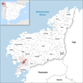
 La Coruna, Spain location.png 256 × 233; 77 KB
-
 Location of Laracha.png 794 × 500; 38 KB
-
 Situacion A Laracha.PNG 956 × 1,008; 84 KB
-
 Localización de A Laracha.png 296 × 318; 11 KB
-
 Karte Gemeinde Laxe 2022.png 3,000 × 3,000; 1.13 MB
-
 Location of Laje.png 794 × 500; 38 KB
-
 Situacion Laxe.PNG 956 × 1,008; 84 KB
-
 Localizacion de Noia.svg 512 × 553; 564 KB
-
 Location map Santiago de Compostela (cathedral area).svg 1,220 × 1,261; 1.8 MB
-
 Location map Santiago de Compostela (historic center).svg 1,979 × 2,184; 5.98 MB
-
 Location of Cesuras.png 794 × 500; 38 KB
-
 Location of Curtis.png 794 × 500; 38 KB
-
 Location of El Pino.png 794 × 500; 38 KB
-
 Location of La Coruña.png 794 × 500; 38 KB
-
 Location of Noya.png 794 × 500; 38 KB
-
 Location of Oleiros.png 794 × 500; 38 KB
-
 Location of Ortigueira.png 794 × 500; 38 KB
-
 Location of Oza-Cesuras.png 794 × 500; 63 KB
-
 Location of Puentedeume.png 794 × 500; 38 KB
-
 Location of Rianjo.png 794 × 500; 38 KB
-
 Location of Santiago de Compostela.png 794 × 500; 38 KB
-
 Location of Sobrado.png 794 × 500; 38 KB
-
 Location of Somozas.png 794 × 500; 38 KB
-
 Location of Trazo.png 794 × 500; 38 KB
-
 Location of Vedra.png 794 × 500; 38 KB
-
 Location of Vilasantar.png 794 × 500; 38 KB
-
 Location Santiago de Compostela.svg 512 × 553; 556 KB
-
 Karte Gemeinde Lousame 2022.png 3,000 × 3,000; 1.13 MB
-
 Location of Lousame.png 794 × 500; 38 KB
-
 Situacion Lousame.PNG 956 × 1,008; 84 KB
-
 Location of Malpica de Bergantiños.png 794 × 500; 38 KB
-
 Situacion Malpica de Bergantiños.PNG 956 × 1,008; 84 KB
-
 Karte Gemeinde Malpica de Bergantiños 2022.png 3,000 × 3,000; 1.13 MB
-
 Karte Gemeinde Mazaricos 2022.png 3,000 × 3,000; 1.13 MB
-
 Location of Mazaricos.png 794 × 500; 38 KB
-
 Situacion Mazaricos.PNG 956 × 1,008; 84 KB
-
 Karte Gemeinde Mañón 2022.png 3,000 × 3,000; 1.12 MB
-
 Location of Mañón.png 794 × 500; 38 KB
-
 Situacion Mañón.PNG 956 × 1,008; 84 KB
-
 Karte Gemeinde Melide (Galicien) 2022.png 3,000 × 3,000; 1.13 MB
-
 Location of Melide.png 794 × 500; 38 KB
-
 Situacion Melide.PNG 956 × 1,008; 84 KB
-
 Karte Gemeinde Mesía 2022.png 3,000 × 3,000; 1.13 MB
-
 Location of Mesia.png 794 × 500; 38 KB
-
 Situacion Mesía.PNG 956 × 1,008; 84 KB
-
 Karte Gemeinde Miño 2022.png 3,000 × 3,000; 1.13 MB
-
 Location of Miño.png 794 × 500; 38 KB
-
 Situacion Miño.png 956 × 1,008; 84 KB
-
 Karte Gemeinde Moeche 2022.png 3,000 × 3,000; 1.13 MB
-
 Location of Moeche.png 794 × 500; 38 KB
-
 Situacion Moeche.PNG 956 × 1,008; 84 KB
-
 Karte Gemeinde Monfero 2022.png 3,000 × 3,000; 1.12 MB
-
 Location of Monfero.png 794 × 500; 38 KB
-
 Situacion Monfero.PNG 956 × 1,008; 84 KB
-
 Karte Gemeinde Mugardos 2022.png 3,000 × 3,000; 1.13 MB
-
 Location of Mugardos.png 794 × 500; 38 KB
-
 Situacion Mugardos.PNG 956 × 1,008; 84 KB
-
 Karte Gemeinde Muros 2022.png 3,000 × 3,000; 1.13 MB
-
 Location of Muros.png 794 × 500; 38 KB
-
 Situacion Muros.PNG 956 × 1,008; 84 KB
-
 Karte Gemeinde Muxía 2022.png 3,000 × 3,000; 1.13 MB
-
 Location of Mugía.png 794 × 500; 38 KB
-
 Situacion Muxía.PNG 956 × 1,008; 84 KB
-
 Karte Gemeinde Narón 2022.png 3,000 × 3,000; 1.13 MB
-
 Location of Narón.png 794 × 500; 38 KB
-
 Situacion Narón.PNG 956 × 1,008; 84 KB
-
 Karte Gemeinde Neda 2022.png 3,000 × 3,000; 1.13 MB
-
 Location of Neda.png 794 × 500; 38 KB
-
 Situacion Neda.PNG 956 × 1,008; 84 KB
-
 Karte Gemeinde Negreira 2022.png 3,000 × 3,000; 1.13 MB
-
 Location of Negreira.png 794 × 500; 38 KB
-
 Situacion Negreira.PNG 956 × 1,008; 84 KB
-
 Karte Gemeinde Noia 2022.png 3,000 × 3,000; 1.13 MB
-
 Situacion Noia.PNG 956 × 1,008; 84 KB
-
 Karte Gemeinde O Pino 2022.png 3,000 × 3,000; 1.13 MB
-
 Karte Gemeinde Oleiros 2022.png 3,000 × 3,000; 1.13 MB
-
 Situacion Oleiros.PNG 956 × 1,008; 84 KB
-
 Karte Gemeinde Ordes 2022.png 3,000 × 3,000; 1.13 MB
-
 Location of Ordes.png 794 × 500; 38 KB
-
 Situacion Ordes.PNG 956 × 1,008; 84 KB
-
 Karte Gemeinde Oroso 2022.png 3,000 × 3,000; 1.13 MB


.svg)
.svg)


_2022.png)


