Category:Locator maps of São Tomé and Príncipe
Jump to navigation
Jump to search
Countries of Africa: Algeria · Angola · Benin · Botswana · Burkina Faso · Burundi · Cameroon · Cape Verde · Central African Republic · Chad · Comoros · Democratic Republic of the Congo · Republic of the Congo · Djibouti · Egypt‡ · Equatorial Guinea · Eritrea · Eswatini · Ethiopia · Gabon · The Gambia · Ghana · Guinea · Guinea-Bissau · Ivory Coast · Kenya · Lesotho · Liberia · Libya · Madagascar · Malawi · Mali · Mauritania · Mauritius · Morocco · Mozambique · Namibia · Niger · Nigeria · Rwanda · São Tomé and Príncipe · Senegal · Seychelles · Sierra Leone · Somalia · South Africa · South Sudan · Sudan · Tanzania · Togo · Tunisia · Uganda · Zambia · Zimbabwe
Limited recognition: Ambazonia · Sahrawi Arab Democratic Republic · Somaliland – Other areas: Canary Islands · Ceuta · Madeira · Mayotte · Melilla · Réunion · Saint Helena, Ascension and Tristan da Cunha · Western Sahara
‡: partly located in Africa
Limited recognition: Ambazonia · Sahrawi Arab Democratic Republic · Somaliland – Other areas: Canary Islands · Ceuta · Madeira · Mayotte · Melilla · Réunion · Saint Helena, Ascension and Tristan da Cunha · Western Sahara
‡: partly located in Africa
Subcategories
This category has the following 2 subcategories, out of 2 total.
!
B
Media in category "Locator maps of São Tomé and Príncipe"
The following 21 files are in this category, out of 21 total.
-
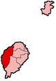
 Cantagalo District.svg 620 × 850; 31 KB
-
 Caué District.svg 620 × 850; 31 KB
-
 Lembá District.svg 620 × 850; 31 KB
-
 Lobata District.svg 620 × 850; 31 KB
-
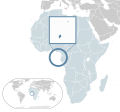 Location São Tomé and Príncipe AU Africa.svg 1,400 × 1,300; 2.17 MB
-
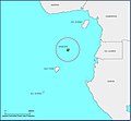
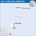
 LocationSaoTomeAndPrincipe.png 250 × 115; 7 KB
-
 Locator map of Príncipe in São Tomé & Príncipe.jpg 2,265 × 2,092; 232 KB
-
 Locator map of São Tomé in São Tomé & Príncipe.jpg 2,265 × 2,092; 226 KB
-
 Mé-Zóchi District.svg 620 × 850; 31 KB
-
 Pagué District.svg 620 × 850; 31 KB
-
 SaoTome AguaGrande.png 236 × 343; 3 KB
-
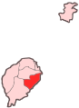
 SaoTome Cantagalo.png 236 × 343; 3 KB
-
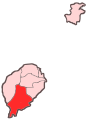
 SaoTome Caue.png 236 × 343; 3 KB
-
 SaoTome Districts.png 236 × 343; 4 KB
-
 SaoTome Lemba.png 236 × 343; 3 KB
-
 SaoTome Lobata.png 236 × 343; 3 KB
-
 SaoTome MeZochi.png 236 × 343; 3 KB
-
 SaoTome Pague.png 236 × 343; 3 KB
-
 São Tomé and Príncipe - Location Map (2013) - STP - UNOCHA.svg 250 × 250; 348 KB
-
 World Factbook (1982) Sao Tome and Principe.jpg 588 × 588; 86 KB
-
 Água Grande District.svg 620 × 850; 31 KB


_-_STP_-_UNOCHA.svg)
_Sao_Tome_and_Principe.jpg)
