Category:Locator maps of Ivory Coast
Jump to navigation
Jump to search
Subcategories
This category has the following 6 subcategories, out of 6 total.
Media in category "Locator maps of Ivory Coast"
The following 27 files are in this category, out of 27 total.
-
 Abidjanlagune.JPG 412 × 276; 44 KB
-
 Communes locator map of Côte d'Ivoire.jpg 4,137 × 4,257; 1.4 MB
-
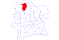 Côte d'Ivoire departments Boundiali.png 1,281 × 878; 26 KB
-
 Côte d'Ivoire ZDC.png 934 × 928; 28 KB
-
 District of Comoé.png 2,000 × 2,197; 382 KB
-
 District of Gôh-Djiboua.png 932 × 1,024; 182 KB
-
 District of Lacs.png 932 × 1,024; 178 KB
-
 District of Montagnes.png 2,000 × 2,020; 521 KB
-
 District of Sassandra-Marahoué.png 932 × 1,024; 182 KB
-
 District of Woroba.png 2,000 × 2,020; 459 KB
-
 Districts of Côte d'Ivoire (Numbered).png 2,000 × 2,197; 396 KB
-
 Ivory Coast - Location Map (2013) - CIV - UNOCHA.svg 254 × 254; 332 KB
-
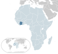
 Locator map of Côte d'Ivoire in Africa.svg 1,000 × 1,000; 188 KB
-
 Location Côte d'Ivoire AU Africa.svg 1,400 × 1,300; 2.17 MB
-
 LocationCotedIvoire.png 250 × 115; 6 KB
-
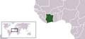
 LocationCotedIvoire.svg 1,000 × 500; 2.76 MB
-
 Comoé national park location.PNG 326 × 350; 17 KB
-
 Région des Lagunes locator map.svg 1,400 × 1,414; 1.37 MB
-
 Région des Savanes locator map.svg 1,400 × 1,414; 1.39 MB
-
 Régions of Côte d'Ivoire (Numbered).png 357 × 348; 38 KB
-
 Sub-prefectures map Côte d'Ivoire.jpg 4,110 × 4,250; 2.54 MB
-
 Tai national park Ivory Coast.PNG 326 × 350; 13 KB
-
 World Factbook (1982) Ivory Coast.jpg 588 × 588; 81 KB
-
 000 Bregu i Fildishtë harta.PNG 330 × 352; 12 KB
-
 Côte d'Ivoire Dep Bondoukou.png 1,281 × 878; 52 KB
-
 Laguneébrié.png 394 × 184; 27 KB
-
 Localisationjacqueville et villesvoisines.png 494 × 546; 20 KB


.png)
_-_CIV_-_UNOCHA.svg)


.png)


_Ivory_Coast.jpg)


