Category:Locator maps of Morocco
Jump to navigation
Jump to search
Subcategories
This category has the following 8 subcategories, out of 8 total.
Media in category "Locator maps of Morocco"
The following 137 files are in this category, out of 137 total.
-
 .Morocco.png 585 × 487; 18 KB
-
 Africa morocco.png 635 × 600; 128 KB
-
 Agadir-circo.jpg 416 × 363; 59 KB
-
 Ait Atta Territory.png 787 × 787; 32 KB
-
 Algeria Morocco Locator 1975-1979.png 1,147 × 865; 43 KB
-
 Aousserd-circo.jpg 771 × 576; 75 KB
-
 Assazag-circo.jpg 404 × 392; 33 KB
-
 Atlantic Coast, Morocco.png 450 × 333; 10 KB
-
 Beni-mellal-circo.jpg 491 × 609; 90 KB
-
 Bennour-circo.jpg 878 × 573; 99 KB
-
 Benslimane-circo.jpg 878 × 573; 98 KB
-
 Berkane-circo.jpg 445 × 613; 103 KB
-
 Berrechid-circo.jpg 878 × 573; 103 KB
-
 Bni makada locator map.png 1,374 × 870; 94 KB
-
 Boujdour-circo.jpg 948 × 646; 100 KB
-
 Boulemane-circo.jpg 641 × 598; 117 KB
-
 Chaouia, Doukkala, Tadla.png 439 × 334; 12 KB
-
 Chaouia2.png 612 × 599; 8 KB
-
 Charf-Mghogha locator map.png 1,374 × 870; 87 KB
-
 Charf-Souani locator map.png 1,374 × 870; 89 KB
-
 Chichaoua-circo.jpg 787 × 624; 137 KB
-
 Chtouka-circo.jpg 416 × 363; 59 KB
-
 Circo gueliz.jpg 440 × 645; 51 KB
-
 Circo medina sidi youssef.jpg 440 × 645; 53 KB
-
 Circo menara.jpg 440 × 645; 53 KB
-
 Circo rabat chellah.jpg 424 × 537; 59 KB
-
 Circo rabat ocean.jpg 424 × 536; 59 KB
-
 Circo sale jadida.jpg 586 × 603; 56 KB
-
 Circo sale medina.jpg 586 × 603; 59 KB
-
 Dahba-circo.jpg 771 × 576; 81 KB
-

-
 Driouch-circo.jpg 445 × 613; 103 KB
-
 El Kelaa des Sraghna.jpg 2,858 × 2,858; 374 KB
-
 Errachidia-circo.jpg 457 × 422; 64 KB
-
 Essaouira-circo.jpg 787 × 624; 138 KB
-
 Essemara-circo.jpg 948 × 646; 102 KB
-
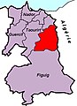
 Figuig-circo.jpg 445 × 613; 105 KB
-
 Fquih-circo.jpg 491 × 609; 87 KB
-
 Guelmim-circo.jpg 404 × 392; 32 KB
-
 Guelmim-Oued Noun in Morocco.png 800 × 837; 62 KB
-
 Guercif-circo.jpg 445 × 613; 104 KB
-
 Hajeb-circo.jpg 641 × 598; 113 KB
-
 Haouz-circo.jpg 787 × 624; 140 KB
-
 Ifrane-circo.jpg 641 × 598; 113 KB
-
 Inezgane-circo.jpg 416 × 363; 60 KB
-
 Jadida-circo.jpg 878 × 573; 102 KB
-
 Jerada-circo.jpg 445 × 613; 103 KB
-
 Kelaa-circo.jpg 787 × 624; 134 KB
-
 Khenifra-circo.jpg 491 × 609; 92 KB
-
 Khouribga-circo.jpg 491 × 609; 89 KB
-
 Laayoune-circo.jpg 948 × 646; 100 KB
-
 Laâyoune-Sakia El Hamra in Morocco.png 800 × 837; 62 KB
-
 Laâyoune-Sakia El Hamra.png 623 × 610; 46 KB
-
 Le Rif au nord du Maroc (ancien Rif espagnol).png 1,024 × 902; 168 KB
-
 Le territoire des Beni Amer.jpg 2,048 × 1,620; 306 KB
-
 Location Maroc.png 1,000 × 500; 98 KB
-
 Location Morocco AU Africa.png 2,000 × 1,857; 502 KB
-
 Location Morocco AW (WS excluded).png 385 × 238; 10 KB
-
 Location Morocco AW (WS included).png 385 × 238; 10 KB
-
 Location Morocco AW.png 385 × 238; 10 KB
-
 Location Morocco.png 640 × 320; 57 KB
-
 LocationMorocco striped2.png 250 × 115; 5 KB
-
 LocationMorocco2.png 1,920 × 960; 237 KB
-
 Locator EH-MA-MR-DZ.png 300 × 300; 6 KB
-
 Locator maps of Morocco and Western Sahara.png 640 × 640; 134 KB
-
 LocationMorocco defacto.png 250 × 115; 2 KB
-
 LocationMorocco striped.png 250 × 115; 5 KB
-
 LocationMorocco.png 250 × 115; 5 KB
-
 LocationMoroccoWesternSahara.png 250 × 115; 5 KB
-
 LocationmoroccowithSO.png 250 × 115; 5 KB
-
 LocationMorocco.svg 1,000 × 500; 2.76 MB
-
 LocationMorocco2.svg 1,000 × 500; 2.76 MB
-
 LocationMorocco3.svg 1,000 × 500; 2.75 MB
-
 LocationMoroccoWesternSahara.svg 1,000 × 500; 2.76 MB
-
 Maroc-geo.png 2,000 × 2,000; 638 KB
-
 Marokkó Afrikában.png 120 × 111; 9 KB
-
 Marruecos mapa.png 1,200 × 1,200; 541 KB
-
 Masmouda.jpg 500 × 537; 75 KB
-
 Masmoudi.jpg 1,958 × 2,048; 338 KB
-
 Meknassas.jpg 1,125 × 844; 89 KB
-
 Meknes-circo.jpg 641 × 598; 112 KB
-
 Mesfioua.jpg 828 × 704; 86 KB
-
 Midelt-circo.jpg 457 × 422; 64 KB
-
 Morocco (orthographic projection, WS claimed).png 500 × 500; 116 KB
-
 Morocco location maps.png 737 × 600; 63 KB
-
 Morocco location-001.jpg 1,280 × 1,041; 176 KB
-
 Morocco Locator.png 1,160 × 1,056; 64 KB
-
 Morocco(orthographic projection - Africa centered).png 553 × 553; 126 KB
-
 Morocco.med.png 250 × 115; 7 KB
-
 Morocco.png 2,000 × 2,000; 784 KB
-
 Moroccointheworld.png 550 × 550; 79 KB
-
 Morroco location map - North Atlantic Coast.png 736 × 598; 74 KB
-
 Morroco ortography proyection WS clamed area.png 1,100 × 1,100; 392 KB
-
 Nador-circo.jpg 445 × 613; 105 KB
-
 Norway Morocco Locator.png 1,432 × 742; 45 KB
-
 Nos usines.png 261 × 306; 18 KB
-
 Ouarzazate-circo.jpg 457 × 422; 64 KB
-
 Oujda-circo.jpg 445 × 613; 105 KB
-
 PLUS WAY.png 600 × 600; 146 KB
-
 PROVINCIA DRIOUCH.jpg 1,080 × 1,123; 63 KB
-
 Rehamna-circo.jpg 787 × 624; 139 KB
-
 Région de l'Oriental Marocain - Maroc.jpg 573 × 600; 83 KB
-
 Safi-circo.jpg 787 × 624; 141 KB
-
 Sefrou-circo.jpg 641 × 598; 113 KB
-
 Settat-circo.jpg 878 × 573; 106 KB
-
 Sidi-ifni-circo.jpg 404 × 392; 33 KB
-
 Sidi-kacem-circo.jpg 403 × 479; 50 KB
-
 Sidi-slimane-circo.jpg 403 × 482; 42 KB
-
 Skhirate-circo.jpg 295 × 259; 25 KB
-
 Tanger-Médina locator map.png 1,374 × 870; 86 KB
-
 Tantan-circo.jpg 404 × 392; 31 KB
-
 Taounate-circo.jpg 641 × 598; 114 KB
-
 Taourirt-circo.jpg 445 × 613; 103 KB
-
 Tarfaya-circo.jpg 948 × 646; 100 KB
-
 Taroudant-circo.jpg 416 × 363; 56 KB
-
 Tata-circo.jpg 416 × 363; 56 KB
-
 Taza-circo.jpg 641 × 598; 116 KB
-
 Territoire des Beni Amer.jpg 2,048 × 1,722; 294 KB
-
 Tinghir-circo.jpg 457 × 422; 65 KB
-
 Tiznit-circo.jpg 416 × 363; 57 KB
-
 Ville Ahfir, située sur la carte du Maroc.jpg 800 × 837; 159 KB
-
 World Factbook (1982) Morocco.jpg 588 × 587; 75 KB
-
 Xexuão,subdivisões,1,circulo-Bab Taza.png 460 × 354; 11 KB
-
 Xexuão,subdivisões,1,circulo-Bni Ahmed.png 460 × 354; 11 KB
-
 Xexuão,subdivisões,1,circulo-Bou Ahmed.png 460 × 354; 11 KB
-
 Xexuão,subdivisões,1,circulo-Jebha.png 460 × 354; 11 KB
-
 Xexuão,subdivisões,1,círculo-Bab Berred.png 460 × 354; 11 KB
-
 Xexuão,subdivisões,1,círculo-Jebha,comuna-M'tioua.png 460 × 354; 11 KB
-
 Xexuão,subdivisões,1,município-Xexuão.png 460 × 354; 11 KB
-
 Xexuão,subdivisões,1.png 460 × 354; 11 KB
-
 Yaacoub-circo.jpg 641 × 598; 110 KB
-
 Youssoufia-circo.jpg 787 × 624; 136 KB
-
 Zagora-circo.jpg 457 × 422; 64 KB
-
 موقع جماعة سميمو بإقليم الصويرة.png 464 × 738; 158 KB
-
 موقع مدينة تطوان.png 427 × 382; 77 KB
-
 موقع مدينة ويسلان بعمالة مكناس.png 554 × 498; 82 KB
-
 يبيبي.jpg 550 × 550; 55 KB


.png)


.png)
.png)


.png)


.png)


_Morocco.jpg)


