Category:Locator maps of Chandigarh
Jump to navigation
Jump to search
States of India: Andhra Pradesh · Arunachal Pradesh · Assam · Bihar · Chhattisgarh · Goa · Gujarat · Haryana · Himachal Pradesh · Jharkhand · Karnataka · Kerala · Madhya Pradesh · Maharashtra · Manipur · Meghalaya · Mizoram · Nagaland · Odisha · Punjab · Rajasthan · Sikkim · Tamil Nadu · Telangana · Tripura · Uttar Pradesh · Uttarakhand · West Bengal
Union territories: Andaman and Nicobar Islands · Chandigarh · Dadra and Nagar Haveli and Daman and Diu · Delhi · Jammu and Kashmir · Ladakh · Lakshadweep · Puducherry
Former states of India: Jammu and Kashmir ·
Former union territories: Dadra and Nagar Haveli district · Daman and Diu ·
Union territories: Andaman and Nicobar Islands · Chandigarh · Dadra and Nagar Haveli and Daman and Diu · Delhi · Jammu and Kashmir · Ladakh · Lakshadweep · Puducherry
Former states of India: Jammu and Kashmir ·
Former union territories: Dadra and Nagar Haveli district · Daman and Diu ·
Media in category "Locator maps of Chandigarh"
The following 11 files are in this category, out of 11 total.
-
 Chandigarh in India (claimed and disputed hatched).svg 1,500 × 1,615; 1.44 MB
-
 Chandigarh in India (claims hatched).svg 1,500 × 1,615; 2.4 MB
-
 Chandigarh in India (disputed hatched).svg 1,500 × 1,615; 2.4 MB
-
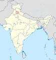
 Chandigarh in India.png 350 × 425; 81 KB
-
 Chandigarh in India.svg 1,500 × 1,615; 2.4 MB
-
 Chandigarh New.png 1,594 × 1,870; 205 KB
-
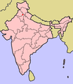
 In-ch kaart.jpg 460 × 482; 29 KB
-
 IN-CH.svg 512 × 583; 155 KB
-
 India Chandigarh locator map.svg 1,574 × 1,738; 837 KB
-
 IndiaCndgh.png 300 × 347; 30 KB
-
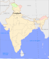 Overzichtskaart Chandigarh.PNG 1,165 × 1,415; 318 KB
.svg)
.svg)
.svg)


