Category:Location maps of Ukraine
Appearance
| This category should only contain blank "Location maps" created for geo-location purposes which follow a same uniform standard, and have been created with a Geographic information system (GIS) software program using a compatible equirectangular or conical projection and for which the geographic coordinate system is known. For more information or questions see the wikiproject: German Wikipedia:Kartenwerkstatt/Positionskarten and this discussion page. |
Subcategories
This category has the following 25 subcategories, out of 25 total.
Media in category "Location maps of Ukraine"
The following 27 files are in this category, out of 27 total.
-
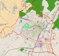
Bila Tserkva location map.png 968 × 717; 654 KB
-
Buczacz location map.png 2,293 × 1,704; 880 KB
-
Drohobych location map.png 1,028 × 1,034; 1.39 MB
-
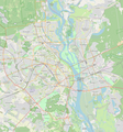
Location Map Kyiv cropped.png 1,238 × 1,326; 1.44 MB
-
Location Map Kyiv.png 1,987 × 2,007; 3.32 MB
-
Lutsk location map.png 1,376 × 1,427; 1.9 MB
-
Map of Ukraine under russian occupation, grey (2014–2022).svg 3,780 × 2,540; 1.8 MB
-
Mukachevo location map.png 960 × 883; 679 KB
-
Reliefkarte Ukraine West.png 1,569 × 1,624; 4.31 MB
-
Reliefkarte Ukraine.png 2,876 × 1,954; 8 MB
-
Rivne location map.png 1,880 × 1,292; 1.35 MB
-
Rivne location map.svg 2,384 × 1,746; 10.37 MB
-
South-East Ukraine adm location map.png 2,000 × 1,343; 489 KB
-
Ternopil location map.png 1,970 × 1,398; 2.96 MB
-
Ukraine (1991-2014) location map.svg 1,546 × 1,038; 477 KB
-
Ukraine according to Russian claims (2022) location map (1917 highlighted).svg 1,367 × 931; 1.4 MB
-
Ukraine adm location map improved.svg 3,780 × 2,540; 1.77 MB
-
Ukraine adm location map.svg 1,546 × 1,038; 499 KB
-
Ukraine Eurovision 2017 map.svg 1,546 × 1,038; 173 KB
-
Ukraine location map.svg 1,546 × 1,038; 429 KB
-
Ukraine Lviv location map.svg 1,493 × 1,085; 143 KB
-
Ukraine relief location map.jpg 1,720 × 1,157; 1.14 MB
-
Ukraine under russian occupation.svg 3,780 × 2,540; 1.85 MB
-
Uzhhorod location map.png 1,289 × 1,238; 868 KB
-
Vinnytsia location map.png 2,045 × 1,490; 3.43 MB
-
Zhovkva location map.png 1,984 × 1,642; 1.3 MB
-
Zhytomyr location map.png 1,619 × 1,340; 1.51 MB


