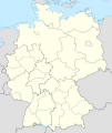
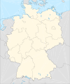
Category:Location maps of Germany
Jump to navigation
Jump to search
| This category should only contain blank "Location maps" created for geo-location purposes which follow a same uniform standard, and have been created with a Geographic information system (GIS) software program using a compatible equirectangular or conical projection and for which the geographic coordinate system is known. For more information or questions see the wikiproject: German Wikipedia:Kartenwerkstatt/Positionskarten and this discussion page. |
Subcategories
This category has the following 3 subcategories, out of 3 total.
!
S
Media in category "Location maps of Germany"
The following 31 files are in this category, out of 31 total.
-
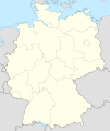
Germany location map.svg 1,073 × 1,272; 452 KB
-
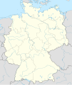
Germany2 location map.svg 1,073 × 1,272; 638 KB
-
Regionalliga Nord 2008-2012 location map.png 1,486 × 1,296; 435 KB
-
Regionalliga Süd 2008-2012 location map.png 1,140 × 1,166; 252 KB
-
Regionalliga West 2008-2012 location map.png 640 × 1,062; 148 KB
-
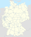
Deutschland Autobahnen.svg 1,073 × 1,272; 467 KB
-
Deutschland.svg 1,343 × 1,591; 735 KB
-
Federal Republic of Germany (since 1990).png 1,728 × 2,048; 404 KB
-
Germany (+districts +municipalities) location map 2013.svg 1,779 × 2,095; 25.26 MB
-
Germany (+districts +municipalities) location map current.svg 1,779 × 2,095; 25.26 MB
-
Germany (+districts +municipalities) location map.png 5,000 × 5,888; 1.15 MB
-
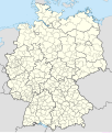
Germany (+districts) location map.svg 1,073 × 1,272; 2.21 MB
-
Germany adm location map.svg 1,073 × 1,272; 643 KB
-
Germany adm location mapHOFER LAND.svg 512 × 607; 937 KB
-
Germany Coast adm location map.svg 891 × 401; 259 KB
-
Germany localisation map 2008 (colors).jpg 1,707 × 2,048; 340 KB
-
Germany localisation map 2008 quizz.svg 700 × 840; 733 KB
-
Germany localisation map 2008.svg 525 × 630; 439 KB
-
Germany location map German color system.svg 1,001 × 1,198; 365 KB
-
Germany Southwest location map.svg 789 × 1,063; 212 KB
-
Lippstadt Wappen und Landkarte.jpg 2,565 × 1,500; 263 KB
-
Lower Lusatia location map.png 2,549 × 1,646; 552 KB
-
Lusatia location map.png 2,619 × 2,932; 1.15 MB
-
Middle Germany location map.svg 512 × 412; 378 KB
-
NeueLaender.png 774 × 983; 90 KB
-
Northwest Germany location map.svg 601 × 636; 871 KB
-
States and City-States of Germany.png 1,728 × 2,048; 605 KB
-
Upper Lusatia location map rivers.png 2,271 × 1,552; 831 KB
-
Upper Lusatia location map.png 2,271 × 1,552; 616 KB
-
YOGTZE case location map.png 857 × 1,013; 1.49 MB
-
Позиционная карта Германии и земли Саксония-Анхальт.png 1,513 × 2,047; 543 KB

