Category:Location maps of Latvia
Jump to navigation
Jump to search
| This category should only contain blank "Location maps" created for geo-location purposes which follow a same uniform standard, and have been created with a Geographic information system (GIS) software program using a compatible equirectangular or conical projection and for which the geographic coordinate system is known. For more information or questions see the wikiproject: German Wikipedia:Kartenwerkstatt/Positionskarten and this discussion page. |
Media in category "Location maps of Latvia"
The following 23 files are in this category, out of 23 total.
-
Aglona municipality (location map).svg 965 × 876; 952 KB
-
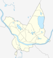
Daugavpils (location map).png 798 × 872; 151 KB
-
Daugavpils (location map).svg 491 × 488; 707 KB
-
EST + LAT 55.5–59.8, 20.5–28.4 blank.png 2,837 × 2,982; 721 KB
-
EST + LAT 55.5–59.8, 20.5–28.4 relief.png 2,837 × 2,982; 10.84 MB
-
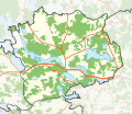
Kastuļina parish (location map).svg 676 × 584; 982 KB
-
Kraslavas novads (location map).svg 1,935 × 1,298; 2.55 MB
-
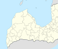
Latvia adm location map.svg 1,304 × 821; 216 KB
-
Latvia Daugavpils municipality location map.svg 302 × 386; 45 KB
-
Latvia location map (2009).svg 1,305 × 822; 316 KB
-
Latvia location map.svg 1,304 × 821; 139 KB
-
Latvia relief location map.jpg 1,739 × 1,095; 191 KB
-
Latvia relief location map.svg 1,305 × 821; 613 KB
-
Latvija coasts crop.svg 658 × 574; 104 KB
-
Latvija coasts relief.png 1,581 × 1,822; 3.12 MB
-
Latvija coasts.svg 658 × 770; 103 KB
-
Latvijas rajonu karte.svg 1,305 × 822; 251 KB
-
Latvijas upes relief location map.svg 1,305 × 821; 578 KB
-
Location map Latvia Riga metropolitan.svg 341 × 372; 1.14 MB
-
Location of Iecava Parish.png 1,662 × 1,341; 611 KB
-
LV Coast location map.svg 702 × 592; 145 KB
-
Relief Map of Latvia.jpg 1,200 × 756; 309 KB
-
Reliefkarte Lettland.png 2,697 × 1,822; 6.32 MB


