Category:Landforms of Washington (state)
Jump to navigation
Jump to search
States of the United States: Alabama · Alaska · Arizona · Arkansas · California · Colorado · Connecticut · Delaware · Florida · Georgia · Hawaii · Idaho · Illinois · Indiana · Iowa · Kansas · Kentucky · Louisiana · Maine · Maryland · Massachusetts · Michigan · Minnesota · Mississippi · Missouri · Montana · Nebraska · Nevada · New Hampshire · New Jersey · New Mexico · New York · North Carolina · North Dakota · Ohio · Oklahoma · Oregon · Pennsylvania · Rhode Island · South Carolina · South Dakota · Tennessee · Texas · Utah · Vermont · Virginia · Washington · West Virginia · Wisconsin · Wyoming – Washington, D.C.
American Samoa · Guam · Northern Mariana Islands · Puerto Rico · United States Virgin Islands – Baker Island · Howland Island · Midway Atoll · Wake Island
American Samoa · Guam · Northern Mariana Islands · Puerto Rico · United States Virgin Islands – Baker Island · Howland Island · Midway Atoll · Wake Island
Wikimedia category | |||||
| Upload media | |||||
| Instance of | |||||
|---|---|---|---|---|---|
| Category combines topics | |||||
| Washington | |||||
state of the United States of America someja satełitar in setenbre    | |||||
| Pronunciation audio | |||||
| Instance of | |||||
| Part of | |||||
| Named after | |||||
| Location |
| ||||
| Located in or next to body of water | |||||
| Capital | |||||
| Legislative body | |||||
| Executive body | |||||
| Highest judicial authority | |||||
| Head of government |
| ||||
| Inception |
| ||||
| Highest point | |||||
| Population |
| ||||
| Area |
| ||||
| Elevation above sea level |
| ||||
| Replaces | |||||
| Different from | |||||
| Maximum temperature record |
| ||||
| Minimum temperature record |
| ||||
| official website | |||||
 | |||||
Subcategories
This category has the following 40 subcategories, out of 40 total.
Media in category "Landforms of Washington (state)"
The following 16 files are in this category, out of 16 total.
-
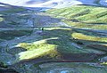 02-31-00, fields - panoramio.jpg 2,059 × 1,400; 1.91 MB
-
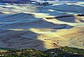 03-49-02 fields - panoramio.jpg 2,048 × 1,398; 1.86 MB
-
 20150613MargaretLake1.JPG 1,452 × 1,944; 675 KB
-
 Above Dry Falls 01.jpg 4,056 × 3,040; 6.44 MB
-
 Debry dune at Frenchman Cataract.jpg 4,056 × 3,040; 6.03 MB
-
 Fifes Peaks in Yakima County.jpg 2,272 × 1,704; 830 KB
-
 Fifes Peaks unnamed pinnacle.jpg 2,195 × 1,537; 2.19 MB
-
 Governors Ridge from the highway 123.jpg 1,974 × 1,136; 1.59 MB
-
 Gray Wolf Ridge from Buckhorn.jpg 1,128 × 802; 738 KB
-
 Jabberwocky Tower.jpg 1,200 × 1,600; 730 KB
-
 Jackita Ridge and Devils Park.jpg 3,226 × 1,931; 1.27 MB
-
 Mount Deception from Marmot Pass.jpg 1,328 × 473; 490 KB
-
 Point Glover 01.jpg 6,000 × 4,000; 14.45 MB
-
 Pothole - 1.jpg 4,056 × 3,040; 8.95 MB
-
 Russian Butte seen from Middle Fork Snoqualmie River Road.jpg 2,216 × 1,531; 930 KB
-
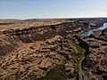
 Sentinel Gap, Washington.jpg 4,056 × 3,040; 5.14 MB


