Category:Coasts of Washington (state)
Jump to navigation
Jump to search
States of the United States: Alabama · Alaska · California · Connecticut · Delaware · Florida · Georgia · Hawaii · Illinois · Indiana · Louisiana · Maine · Maryland · Massachusetts · Michigan · Minnesota · Mississippi · New Hampshire · New Jersey · New York · North Carolina · Ohio · Oregon · Pennsylvania · Rhode Island · South Carolina · Texas · Virginia · Washington · Wisconsin
Guam · Puerto Rico
Guam · Puerto Rico
| Upload media | |||||
| |||||
Subcategories
This category has the following 26 subcategories, out of 26 total.
Media in category "Coasts of Washington (state)"
The following 69 files are in this category, out of 69 total.
-
 "The sphinx of the Washington Coast," 1910 - DPLA - ea6a004647060582a5716d048ed34b5e.jpg 5,746 × 4,560; 3.63 MB
-
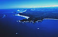 Aerial view of Teahwhit Head and James Island.jpg 1,780 × 1,160; 259 KB
-

-

-
 As North And West As We Could Get (222770105).jpeg 2,000 × 1,429; 739 KB
-
 Beach at Westport, WA 01.jpg 4,288 × 2,848; 5.62 MB
-
 Beach at Westport, WA 02.jpg 3,270 × 2,409; 4.15 MB
-
 Beach at Westport, WA pano 01.jpg 25,445 × 2,648; 21.75 MB
-
 Bellingham Washington July (69417853).jpeg 2,048 × 1,536; 1.06 MB
-
 Bellingham Washington July (69417855).jpeg 2,048 × 1,536; 1.06 MB
-
 Big soap bubble on the Edmonds, WA shore.jpg 6,000 × 4,000; 9.78 MB
-
 Boat entering harbor at Westport, WA.jpg 4,288 × 2,848; 4.18 MB
-
 Breakthrough - Flickr - brewbooks.jpg 3,264 × 2,448; 5.42 MB
-
 Cape Flattery Pacific View.jpg 2,048 × 1,536; 2.4 MB
-

-
Cinematic FPV Flight on Washington Coast - 4K.webm 1 min 43 s, 3,840 × 2,160; 157.97 MB
-
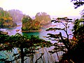
 COSTA RECORTADA EN LA PUSH - panoramio.jpg 4,288 × 2,848; 2.96 MB
-
 Deadman's Hollow, North Beach, Wash., ca. 1910 - DPLA - 28d3ff0d9d77c3c3783f1a40c3c0b784.jpg 5,264 × 3,970; 1.43 MB
-
 Driftwood Expanse, Northern Washington Coast.png 800 × 600; 1.75 MB
-
 Fishing Rocks, North Beach, Wash., ca. 1910 - DPLA - dcc26b8259dbeddd62d8131645efb56a.jpg 5,302 × 3,991; 1.84 MB
-
 Foggy Coastline.JPG 4,352 × 2,448; 3.93 MB
-
 La Push River mouth.jpg 2,560 × 1,920; 1.74 MB
-
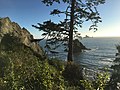
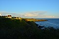
 Larrabee State Park coastline.jpg 3,072 × 2,304; 2.91 MB
-
 Line4067 - Flickr - NOAA Photo Library.jpg 3,880 × 2,684; 4.11 MB
-
 Line6040 (14318774008).jpg 7,635 × 1,025; 3.55 MB
-
 Line6986 (27906850166).jpg 2,560 × 1,920; 3.12 MB
-

-
 Moclips deer.jpg 4,320 × 2,432; 1.67 MB
-
 Mouth of the Columbia River Marker - panoramio.jpg 480 × 360; 21 KB
-
 North Head Lighthouse, Pacific Ocean.jpg 7,360 × 4,912; 15.98 MB
-
Ocean Shores Washington with Autel Evo I Drone.webm 3 min 57 s, 3,840 × 1,920; 388.09 MB
-
Ocean Shores, WA drone footage, 2024.webm 4 min 5 s, 3,840 × 2,160; 392.52 MB
-
 Ocean sunset.JPG 2,592 × 1,936; 1.42 MB
-
 Ohh, somewhere.jpg 4,032 × 3,024; 4 MB
-
 OlympicCoastNationalMarineSanctuary.jpg 188 × 243; 15 KB
-
 Point Defiance Park - 180 Pano.jpg 18,324 × 4,005; 13.76 MB
-
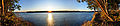
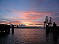 Port of Seattle at Sundown.jpg 1,024 × 768; 471 KB
-
 Pt Defiance Park 02.jpg 2,592 × 1,944; 647 KB
-
 Pt Defiance Park 03.jpg 2,592 × 1,944; 666 KB
-
 Rocks west of Carroll Island, June 1907 (WASTATE 1369).jpeg 768 × 662; 76 KB
-

-
 San Juan Island - Eagle Cove 01.jpg 6,000 × 4,000; 9.4 MB
-
 San Juan Island - Eagle Cove 02.jpg 6,000 × 4,000; 8.92 MB
-
 Seattle - Low tide at Discovery Park south beach, circa 1980.jpg 1,200 × 759; 309 KB
-
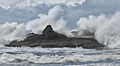 Splash (5436334487).jpg 1,644 × 900; 1.01 MB
-
 Splash! (7815308444).jpg 6,320 × 4,208; 17.48 MB
-

-
 Tacoma Narrows Bridge from Point Defiance Park.jpg 1,200 × 800; 574 KB
-
 Tacoma Narrows view 03.jpg 2,592 × 1,944; 786 KB
-
 View from Lummi Island.jpg 1,024 × 680; 308 KB
-
 ViewFromPointDefiancePark1916.JPG 1,508 × 1,001; 271 KB
-
 Washington Coast (5652090829) (2).jpg 4,752 × 3,168; 5.29 MB
-
 Washington Coast (5652100327) (2).jpg 2,677 × 1,785; 1.62 MB
-
 Washington Coast (5652102729) (2).jpg 4,752 × 3,168; 4.37 MB
-
 Washington Coast (5652105519) (2).jpg 4,752 × 3,168; 5.19 MB
-
 Washington Coast (5652633822) (2).jpg 2,751 × 1,965; 1.84 MB
-
 Washington Coast (5652636970) (2).jpg 4,752 × 3,168; 6.07 MB
-
 Washington Coast (5652640300) (2).jpg 4,752 × 3,168; 6.61 MB
-
 Washington Coast (5652646278) (2).jpg 4,752 × 3,168; 6.55 MB
-
 Washington Coast (5652649976) (2).jpg 3,168 × 4,752; 7.07 MB
-
 Washington Coast (5652653382) (2).jpg 4,752 × 3,168; 6.44 MB
-
 Washington Coast (5652656236) (2).jpg 4,752 × 3,168; 5.4 MB
-
 Washington Coast.png 3,456 × 2,234; 8.93 MB
-
 Washington Coastline (5768925827) (2).jpg 3,168 × 4,752; 7.19 MB
-
 Washington Coastline (5769461216) (2).jpg 4,752 × 3,168; 5.93 MB
-
 Wea04562 (14502611471).jpg 4,288 × 2,848; 4.34 MB
-
 Westport, WA - weather station.jpg 4,288 × 2,848; 4.09 MB
-
 Westport, WA looking south on shore.jpg 4,288 × 2,848; 4.76 MB
-
 Whaler's Village Des Moines, Washington August 2009 - panoramio.jpg 3,888 × 2,592; 5.32 MB


.jpeg)


.jpeg)
.jpeg)


.jpg)


.jpeg)


.jpg)
.jpg)
.jpg)


_(2).jpg)
_(2).jpg)
_(2).jpg)
_(2).jpg)
_(2).jpg)
_(2).jpg)
_(2).jpg)
_(2).jpg)
_(2).jpg)
_(2).jpg)
_(2).jpg)

_(2).jpg)
_(2).jpg)
.jpg)


.jpeg)
.jpg)
.jpeg)
.jpg)