Category:Rock formations in Washington (state)
Jump to navigation
Jump to search
States of the United States: Alabama · Alaska · Arizona · Arkansas · California · Colorado · Connecticut · Delaware · Florida · Georgia · Hawaii · Idaho · Illinois · Indiana · Iowa · Kansas · Kentucky · Louisiana · Maine · Maryland · Massachusetts · Michigan · Minnesota · Mississippi · Missouri · Montana · Nebraska · Nevada · New Hampshire · New Jersey · New Mexico · New York · North Carolina · North Dakota · Ohio · Oklahoma · Oregon · Pennsylvania · Rhode Island · South Carolina · South Dakota · Tennessee · Texas · Utah · Vermont · Virginia · Washington · West Virginia · Wisconsin · Wyoming – Washington, D.C.
American Samoa · Northern Mariana Islands
American Samoa · Northern Mariana Islands
Subcategories
This category has the following 26 subcategories, out of 26 total.
B
C
F
- Fifes Peaks (11 F)
- Frenchman Coulee (1 P, 41 F)
G
- Giants Graveyard (6 F)
- Governors Needle (3 F)
L
- Liberty Bell Mountain (17 F)
- Lincoln Rock (3 F)
M
- Moses Coulee (24 F)
N
O
R
T
- Touchet Formation (10 F)
U
- Umatilla Rock (14 F)
Media in category "Rock formations in Washington (state)"
The following 52 files are in this category, out of 52 total.
-

-
 Agatha Tower at Frenchman Coulee.jpg 1,500 × 1,000; 1.79 MB
-

-
 Basalt columns 22897.JPG 2,560 × 1,920; 2.34 MB
-
 Basalt columns 23125.JPG 2,560 × 1,920; 2.34 MB
-

-
 Bridal Veil Falls (Snohomish County, Washington) (9155861094).jpg 1,632 × 918; 302 KB
-
 Camp Schurman on the Emmons Glacier at Mt. Rainier, WA.jpg 2,816 × 1,880; 3.67 MB
-
 CapeFlatteryWashington.jpg 1,772 × 1,180; 890 KB
-
 Coarse sand dike Starbuck.JPG 2,304 × 3,072; 6.6 MB
-
 Columbia River Basalt Group 1675.JPG 4,272 × 2,848; 7.58 MB
-
 Columbia River Basalt Group 1736.JPG 4,272 × 2,848; 6.53 MB
-
 Columbia River Basalt Group 1805.JPG 4,272 × 2,848; 5.44 MB
-
 Columbia River Basalt Group 1806.JPG 4,272 × 2,848; 6.16 MB
-
 Columbia River Basalt Group 1808.JPG 4,272 × 2,848; 6.35 MB
-
 Columbia River Basalt Group 1935.JPG 4,272 × 2,848; 5.76 MB
-
 Columbia River Basalt Group 1943-4 panorama.jpg 7,113 × 2,655; 6.35 MB
-
 Columbia River Basalt Group 1943.JPG 4,272 × 2,848; 6.32 MB
-
 Columbia River Basalt Group 1944.JPG 4,272 × 2,848; 6.52 MB
-
 Columbia River Basalt Group 1946.JPG 4,272 × 2,848; 5.05 MB
-
 Columbia River Basalt Group 1948.JPG 4,272 × 2,848; 7.28 MB
-
 Columbia River Basalt Group 7942.JPG 4,272 × 2,848; 6.42 MB
-
 Columbia River Basalt Group 7949.JPG 4,272 × 2,848; 5.28 MB
-
 Cupalo Rock 6593 ft.jpg 2,272 × 1,704; 823 KB
-
 Deadman's Hollow, North Beach, Wash., ca. 1910 - DPLA - 28d3ff0d9d77c3c3783f1a40c3c0b784.jpg 5,264 × 3,970; 1.43 MB
-
 Fishing Rocks, North Beach, Wash., ca. 1910 - DPLA - dcc26b8259dbeddd62d8131645efb56a.jpg 5,302 × 3,991; 1.84 MB
-
 Flickr - brewbooks - Interesting Geology near Welch Peak (1 of 3).jpg 3,072 × 2,304; 1.24 MB
-
 Flickr - brewbooks - Interesting Geology near Welch Peak (2 of 3).jpg 3,072 × 2,304; 1.32 MB
-
 Flickr - brewbooks - Interesting Geology, near Mount St Helens.jpg 3,072 × 2,304; 1.56 MB
-
 Frenchman Coulee banner.JPG 4,272 × 614; 1.38 MB
-
 Frenchmans coulee.jpg 450 × 337; 97 KB
-
 Hill near Republic WA.jpg 1,854 × 1,324; 1.69 MB
-
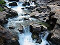 Icicle Creek Rapids.jpg 1,280 × 960; 1.05 MB
-
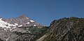
 Little Tahoma - panoramio.jpg 2,615 × 2,058; 1.11 MB
-
 Little Tahoma 8168s.JPG 7,887 × 3,831; 10.73 MB
-
 North Cowlitz Chimney seen from State Route 123, Mount Rainier National Park.jpg 2,272 × 1,457; 1.79 MB
-
 North Cowlitz Chimney seen from State Route 123.jpg 1,946 × 1,396; 1.61 MB
-
 Observation Rock on Ptarmigan Ridge, Mount Rainier (502307088).jpg 765 × 554; 130 KB
-
 Outcrop near Riverside WA.jpg 2,216 × 1,583; 2.35 MB
-

-
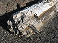 PetrifiedWoodGPFSP.jpg 2,592 × 1,944; 2.35 MB
-
 Rattlesnake-Mt-Lower-Ledge-hikers-3980.jpg 2,048 × 1,536; 1.17 MB
-

-
 Rocks west of Carroll Island, June 1907 (WASTATE 1369).jpeg 768 × 662; 76 KB
-
 The place to see it all - panoramio.jpg 2,576 × 1,932; 1.32 MB
-
 Three skiers near El Dorado spur (509708661).jpg 765 × 590; 111 KB
-
 Tilted Rock (7985474125).jpg 4,912 × 7,360; 21.24 MB
-
 Touchet-formation-alng-tcht-rvr.JPG 1,138 × 948; 428 KB
-
 Umtanum Creek Recreation Area 1653.JPG 4,272 × 2,848; 7.02 MB
-
 Unusual rocks (4f611b01a308411eb4a0cce461b101ba).JPG 2,112 × 2,816; 2.62 MB
-
 WA-DryFalls-DryValleyPanorama v1.jpg 10,623 × 2,935; 22.48 MB
-
 Wallula-Gap-the-sisters.JPG 1,339 × 1,786; 716 KB


.jpg)


.jpg)
_(9155861094).jpg)


.jpg)
.jpg)


.jpg)

.jpeg)


.jpg)
.jpeg)

.jpg)
.jpg)


.JPG)
