
Category:Kirkhill (civil parish)
Scottish parish in Highland, Scotland, UK | |||||
| Upload media | |||||
| Instance of | |||||
|---|---|---|---|---|---|
| Named after | |||||
| Location |
| ||||
| Population |
| ||||
| Area |
| ||||
 | |||||
Subcategories
This category has the following 8 subcategories, out of 8 total.
A
- Achnagairn House (15 F)
B
I
- Inchmore, Kirkhill (9 F)
K
L
- Lentran (22 F)
M
- Moniack Burn (14 F)
- Moniack Castle (7 F)
R
- Reelig Glen (24 F)
Media in category "Kirkhill (civil parish)"
The following 200 files are in this category, out of 498 total.
(previous page) (next page)-
 44871 with Great Britain IX, passing Groam Farm - geograph.org.uk - 4930005.jpg 3,014 × 2,400; 2.16 MB
-
 60163 Tornado passing Wester Lovat - geograph.org.uk - 4609599.jpg 2,900 × 1,886; 1.81 MB
-
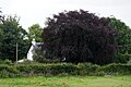 A copper beech at Wester Lovat - geograph.org.uk - 5482881.jpg 1,024 × 682; 205 KB
-
 A Crop of Cones - geograph.org.uk - 7096396.jpg 1,024 × 768; 210 KB
-
 A farmhouse on Englishton Muir - geograph.org.uk - 1545089.jpg 640 × 480; 56 KB
-
 A Flock of Brambling - geograph.org.uk - 7096427.jpg 1,024 × 768; 138 KB
-
 A mound in marshland - geograph.org.uk - 1541271.jpg 640 × 480; 78 KB
-
 A terminal pylon at Beauly - geograph.org.uk - 6846913.jpg 1,600 × 836; 193 KB
-
 A862 about to enter Inchmore - geograph.org.uk - 4749850.jpg 2,049 × 1,341; 1.2 MB
-
 A862 approaching Bunchrew - geograph.org.uk - 4750165.jpg 1,912 × 1,203; 743 KB
-
 A862 approaching Drumreach - geograph.org.uk - 4749846.jpg 2,270 × 1,374; 1.08 MB
-
 A862 approaching the Easter Moniack turning - geograph.org.uk - 4749842.jpg 2,024 × 1,274; 720 KB
-
 A862 approaching the Kirkhill turning - geograph.org.uk - 4749829.jpg 2,796 × 1,701; 1.64 MB
-
 A862 Beauly Road - geograph.org.uk - 3703108.jpg 640 × 428; 105 KB
-
 A862 by the Kirkton Muir turning - geograph.org.uk - 4750168.jpg 2,235 × 1,302; 1.2 MB
-
 A862 east of Rhinduie House - geograph.org.uk - 4749860.jpg 2,184 × 1,332; 1.08 MB
-
 A862 near Bunchrew - geograph.org.uk - 2225211.jpg 800 × 531; 181 KB
-
 A862 near Bunchrew - geograph.org.uk - 3697086.jpg 1,600 × 1,200; 437 KB
-
 A862 near Phopachy House - geograph.org.uk - 4332625.jpg 800 × 600; 84 KB
-
 A862 running alongside the Beauly Firth - geograph.org.uk - 4749891.jpg 2,303 × 1,407; 1.11 MB
-
 A862 running alongside the railway line - geograph.org.uk - 4749881.jpg 2,295 × 1,431; 1.33 MB
-
 A862 towards Bunchrew - geograph.org.uk - 7279075.jpg 4,032 × 3,024; 3.03 MB
-
 A862 towards Lentran - geograph.org.uk - 7279079.jpg 4,032 × 3,024; 2.56 MB
-
 Abandoned house, Easter Aultfearn - geograph.org.uk - 3163781.jpg 3,200 × 1,775; 1.48 MB
-
 Abandoned house, Letter - geograph.org.uk - 3163882.jpg 3,200 × 1,950; 1.81 MB
-
 Access road to Ardfearn Nursery - geograph.org.uk - 3697076.jpg 1,600 × 1,200; 487 KB
-
 Access to Eileantulloch House - geograph.org.uk - 1531453.jpg 640 × 417; 73 KB
-
 Achnagairn abandoned houses - geograph.org.uk - 2707096.jpg 2,419 × 1,359; 742 KB
-
 Achnagairn Lodges - geograph.org.uk - 4444735.jpg 2,968 × 2,000; 2.02 MB
-
 Allt Mòr - geograph.org.uk - 4853065.jpg 4,360 × 3,270; 6.25 MB
-
 Allt Mòr - geograph.org.uk - 4853082.jpg 4,608 × 3,456; 6.98 MB
-

-
 Approaching Auldfearn Nursery - geograph.org.uk - 1543593.jpg 640 × 480; 74 KB
-
 Approaching Inchmore on the A862 - geograph.org.uk - 7435715.jpg 3,927 × 2,945; 1.76 MB
-
 Ardfearn Nursery and Gift Shop, Bunchrew - geograph.org.uk - 5838927.jpg 1,600 × 1,068; 244 KB
-
 Auldfearn Nursery and Giftshop - geograph.org.uk - 1543531.jpg 640 × 480; 65 KB
-
 B9164 - geograph.org.uk - 6144621.jpg 1,280 × 857; 1.17 MB
-
 B9164 by the Wester Lovat turning - geograph.org.uk - 4751784.jpg 2,946 × 2,064; 2.79 MB
-
 B9164 crossing Newton Burn - geograph.org.uk - 4751767.jpg 3,028 × 2,037; 2.38 MB
-
 B9164 passing through Kirkhill - geograph.org.uk - 4751777.jpg 3,010 × 1,962; 2.11 MB
-
 B9164 road, by Dunballoch - geograph.org.uk - 6453882.jpg 3,000 × 2,309; 3.04 MB
-
 B9164 towards Kirkhill - geograph.org.uk - 7279089.jpg 4,032 × 3,024; 3.25 MB
-
 Balblair House - geograph.org.uk - 3664119.jpg 3,000 × 2,325; 1.78 MB
-
 Balcarse Farm - geograph.org.uk - 2716799.jpg 2,523 × 1,853; 1.21 MB
-
 Barley fields by Wester Lovat - geograph.org.uk - 7255770.jpg 3,202 × 2,340; 3.14 MB
-
 Barn at the end of a muddy track - geograph.org.uk - 2707246.jpg 2,446 × 1,835; 1.03 MB
-
 Beauly Firth - geograph.org.uk - 4403383.jpg 640 × 360; 66 KB
-
 Beauly Firth at Lentran - geograph.org.uk - 5838929.jpg 1,600 × 1,068; 292 KB
-
 Beauly Firth from Parkhouse, near Bunchrew - geograph.org.uk - 6930545.jpg 1,600 × 720; 284 KB
-
 Beauly Firth Mudflats - geograph.org.uk - 4613261.jpg 640 × 480; 51 KB
-
 Beauly Firth near high tide - geograph.org.uk - 4573420.jpg 1,400 × 1,055; 310 KB
-
 Beauly Firth Saltings - geograph.org.uk - 4403402.jpg 640 × 379; 69 KB
-
 Beauly Firth Saltings - geograph.org.uk - 4814685.jpg 640 × 422; 49 KB
-
 Beech Tree - geograph.org.uk - 5214882.jpg 640 × 480; 153 KB
-

-
 Bend in road in Kinlea Wood - geograph.org.uk - 1544203.jpg 640 × 497; 84 KB
-
 Bend in the River Beauly - geograph.org.uk - 5437112.jpg 640 × 480; 61 KB
-
 Beside the Beauly Firth - geograph.org.uk - 5842621.jpg 2,592 × 1,944; 1.18 MB
-
 Between Hills - geograph.org.uk - 7096382.jpg 1,024 × 768; 249 KB
-
 Black sheep, Ladystone Steading - geograph.org.uk - 7435440.jpg 4,000 × 3,000; 2.66 MB
-
 Blackpark Farm - geograph.org.uk - 3173935.jpg 640 × 480; 81 KB
-
 Bleak road over moorland - geograph.org.uk - 3844269.jpg 1,439 × 957; 395 KB
-
 Boots n Paddles, Cabrich - geograph.org.uk - 3060524.jpg 3,000 × 1,567; 1.15 MB
-
 Bracken and birch, Cnoc a' Chinn - geograph.org.uk - 5951605.jpg 3,000 × 2,223; 2.92 MB
-

-
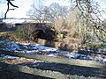
 Bridge over the Moniack Burn - geograph.org.uk - 4788059.jpg 1,024 × 768; 282 KB
-
 Bridge over the railway at Wester Lovat - geograph.org.uk - 1755000.jpg 3,072 × 2,304; 3.34 MB
-
 Bunchrew Caravan Park - geograph.org.uk - 7435458.jpg 4,000 × 3,000; 3.01 MB
-
 Bunchrew House - geograph.org.uk - 7435334.jpg 4,000 × 3,000; 2.32 MB
-
 Bunchrew View - geograph.org.uk - 3602691.jpg 640 × 404; 60 KB
-

-
 By The Beauly Firth - geograph.org.uk - 4403392.jpg 640 × 371; 65 KB
-
 By the Moniack Burn, Reelig Glen - geograph.org.uk - 6086686.jpg 1,600 × 1,200; 1.19 MB
-
 By the path through Reelig Community Woodland - geograph.org.uk - 5822659.jpg 1,600 × 1,187; 861 KB
-
 Camping by the Beauly Firth - geograph.org.uk - 7435452.jpg 4,032 × 3,024; 4.51 MB
-
 Carse land near Kirkhill - geograph.org.uk - 7344266.jpg 1,024 × 768; 232 KB
-
 Cats to the left - geograph.org.uk - 2707720.jpg 2,476 × 1,794; 1.61 MB
-

-
 Cattle in field at West Croft - geograph.org.uk - 6929510.jpg 1,024 × 768; 222 KB
-
 Cattle, at Kirkton Muir - geograph.org.uk - 3227644.jpg 2,800 × 2,019; 1.79 MB
-
 Cattle, by Englishton Muir - geograph.org.uk - 4704477.jpg 2,846 × 2,000; 2.26 MB
-
 Chalets in Milifiack - geograph.org.uk - 1541364.jpg 640 × 480; 73 KB
-
 Cleared forest, by Altnacardich - geograph.org.uk - 5823400.jpg 3,000 × 2,265; 3.16 MB
-
 Cleared forest, by Altnacardich - geograph.org.uk - 6470618.jpg 3,000 × 2,308; 3.31 MB
-
 Cleared forest, by Lentranhill - geograph.org.uk - 3173464.jpg 3,000 × 1,839; 1.06 MB
-
 Cleared forest, by Reelig - geograph.org.uk - 3086309.jpg 3,000 × 1,834; 1.67 MB
-
 Cleared woodland near Kirkton Muir - geograph.org.uk - 6213813.jpg 1,024 × 768; 177 KB
-
 Cnoc A Chinn Trig Point Flush Bracket S7728 - geograph.org.uk - 6830264.jpg 1,195 × 1,514; 1.47 MB
-
 Coastal crop field, Bunchrew - geograph.org.uk - 4814714.jpg 640 × 406; 49 KB
-
 Coastline at Bunchrew - geograph.org.uk - 4425830.jpg 1,600 × 1,065; 254 KB
-
 Corgrain Point and a snow capped Ben Wyvis - geograph.org.uk - 5954495.jpg 1,024 × 640; 190 KB
-
 Cottage in Dunain Forest - geograph.org.uk - 7435437.jpg 3,769 × 2,827; 2.36 MB
-
 Coulmore Bay viewed from Phopachy - geograph.org.uk - 6010211.jpg 640 × 400; 63 KB
-
 Craft Workshop - geograph.org.uk - 1543508.jpg 640 × 425; 76 KB
-
-
 Crop field near Easter Lovat - geograph.org.uk - 4814679.jpg 640 × 464; 53 KB
-

-
 Crop field, Gallows Hill - geograph.org.uk - 4812538.jpg 640 × 448; 54 KB
-
 Crossing Moniack Bridge - geograph.org.uk - 1531431.jpg 640 × 480; 127 KB
-
 Deltic on the Royal Scotsman, passing Ferrybrae - geograph.org.uk - 4441480.jpg 2,500 × 2,055; 2.19 MB
-
 Distant Strathfarrar hills seen from the Aird - geograph.org.uk - 6086262.jpg 1,600 × 1,063; 361 KB
-
 Disused road near Easter Moniack - geograph.org.uk - 3697098.jpg 1,600 × 1,200; 672 KB
-
 Douglas Fir by the Moniack Burn - geograph.org.uk - 6086680.jpg 1,600 × 1,200; 1 MB
-
 Driveway, Achnagairn Castle - geograph.org.uk - 6453926.jpg 2,300 × 2,844; 3.58 MB
-
 Dunballoch Plantation - geograph.org.uk - 5563283.jpg 640 × 327; 101 KB
-
 East Lodge, Achnagairn - geograph.org.uk - 4446602.jpg 2,400 × 2,274; 1.95 MB
-
 Easter Lovat Farmhouse - geograph.org.uk - 6298164.jpg 640 × 480; 103 KB
-
 Easter Lovat from Wester Lovat - geograph.org.uk - 5482894.jpg 1,024 × 682; 125 KB
-
 Easter Lovat trig point - geograph.org.uk - 2669638.jpg 1,024 × 768; 180 KB
-
 Easter Lovat Trig Point Flush Bracket S7416 - geograph.org.uk - 6770945.jpg 1,663 × 1,236; 875 KB
-
 Edge of woodland near Englishton Muir - geograph.org.uk - 2225187.jpg 800 × 531; 294 KB
-
 Electricity pylon by A982 - geograph.org.uk - 1531473.jpg 640 × 480; 50 KB
-
 Electricity Pylons and Logging Vehicle by Long Wood - geograph.org.uk - 5779173.jpg 5,184 × 3,456; 5.89 MB
-
 End of the road - geograph.org.uk - 7276443.jpg 1,024 × 768; 227 KB
-
 Entering Kirkhill - geograph.org.uk - 5482874.jpg 1,024 × 682; 235 KB
-

-
 Entrance to Màm Mòr Forest - geograph.org.uk - 5282832.jpg 640 × 480; 122 KB
-
 Farm building near Drumchardine - geograph.org.uk - 4988457.jpg 800 × 600; 101 KB
-
 Farm road at Faschapple - geograph.org.uk - 1741213.jpg 800 × 531; 263 KB
-
 Farm road junction at Faschapple - geograph.org.uk - 1741168.jpg 800 × 531; 287 KB
-
 Farm road near Faschapple - geograph.org.uk - 1741239.jpg 800 × 531; 287 KB
-
 Farm track on Englishton Muir - geograph.org.uk - 6213820.jpg 1,024 × 755; 124 KB
-
 Farmland above the Beauly Firth - geograph.org.uk - 6213823.jpg 1,024 × 768; 123 KB
-
 Farmland and railway by the firth - geograph.org.uk - 2715073.jpg 2,522 × 1,852; 1.19 MB
-
 Farmland at Inchberry - geograph.org.uk - 2225221.jpg 800 × 531; 173 KB
-
 Farmland at Mains of Bunchrew - geograph.org.uk - 5614545.jpg 640 × 480; 72 KB
-
 Farmland by the A862 below Cononbank Farm - geograph.org.uk - 6929521.jpg 1,024 × 764; 139 KB
-
 Fence post driver, by Altourie - geograph.org.uk - 6502461.jpg 3,200 × 2,223; 2.94 MB
-
 Festooned trees by the Moniack Burn - geograph.org.uk - 6086582.jpg 1,600 × 1,200; 1.15 MB
-
 Field - Easter Moniak - geograph.org.uk - 5507112.jpg 640 × 400; 100 KB
-
 Field at Mains of Kingask - geograph.org.uk - 6870039.jpg 1,024 × 768; 206 KB
-
 Field beside the Beauly Firth - geograph.org.uk - 2743091.jpg 800 × 253; 48 KB
-
 Field by the Beauly Firth - geograph.org.uk - 4821373.jpg 640 × 480; 63 KB
-
 Field near Bunchrew - geograph.org.uk - 5778820.jpg 640 × 480; 48 KB
-
 Field of stubble at Wester Lovat - geograph.org.uk - 1755046.jpg 3,072 × 2,304; 2.97 MB
-
 Field overlooking the Beauly Firth - geograph.org.uk - 1870014.jpg 640 × 480; 71 KB
-
 Fields and power lines, by Englishton Muir - geograph.org.uk - 4704501.jpg 2,862 × 2,000; 2.22 MB
-
 Fields and woodland, by Reelig - geograph.org.uk - 5824503.jpg 3,000 × 2,299; 2.85 MB
-
 Fields at Cononbank Farm, near Kirkhill - geograph.org.uk - 5837816.jpg 1,600 × 1,065; 284 KB
-
 Fields beside the Beauly Firth at Bunchrew - geograph.org.uk - 5838926.jpg 1,600 × 1,068; 335 KB
-
 Fields by Inchberry Farm - geograph.org.uk - 3035592.jpg 3,000 × 1,995; 1.08 MB
-
 Fields near Balchraggan - geograph.org.uk - 7436250.jpg 4,032 × 3,024; 1.96 MB
-
 Fields, by Inchmore - geograph.org.uk - 7218244.jpg 3,232 × 2,066; 3.36 MB
-
 Fields, by Kirkton - geograph.org.uk - 5951511.jpg 3,111 × 2,200; 2.85 MB
-
 Fields, near Groam Farm - geograph.org.uk - 3475023.jpg 2,700 × 1,994; 1.47 MB
-
 Finger post near Moniack Castle - geograph.org.uk - 1541337.jpg 640 × 480; 53 KB
-
 Fire break beneath the electricity lines on Dunain Hill - geograph.org.uk - 7435435.jpg 4,000 × 3,000; 2.52 MB
-
 Folly above the Moniack Burn - geograph.org.uk - 5520985.jpg 640 × 480; 184 KB
-
 Footbridge on terrace path in Reelig Glen - geograph.org.uk - 6086669.jpg 1,600 × 1,200; 1.22 MB
-
 Footbridge over Moniack Burn, Reelig Glen - geograph.org.uk - 5822635.jpg 1,600 × 1,202; 940 KB
-

-
 Forest Path - geograph.org.uk - 4802569.jpg 4,608 × 3,456; 7.11 MB
-
 Forest path on the Aird - geograph.org.uk - 7272494.jpg 1,024 × 768; 321 KB
-
 Forest road to Mam Mor on the Aird - geograph.org.uk - 7276453.jpg 1,024 × 768; 242 KB
-
 Forest track down Dunain Hill - geograph.org.uk - 7435442.jpg 3,024 × 4,032; 2.98 MB
-
 Forest track fording the Allt na Ceardaich - geograph.org.uk - 3205813.jpg 2,500 × 2,500; 1.61 MB
-
 Forest track into Long Wood - geograph.org.uk - 6947045.jpg 1,024 × 768; 219 KB
-
 Forest track near Easter Craggach - geograph.org.uk - 7276482.jpg 1,024 × 768; 310 KB
-
 Forest track on Màm Mòr - geograph.org.uk - 3134802.jpg 2,189 × 2,700; 1.75 MB
-
 Forest track, by Blackfold - geograph.org.uk - 3204958.jpg 2,172 × 2,700; 1.54 MB
-
 Forest track, by Màm Mòr - geograph.org.uk - 3596390.jpg 2,500 × 2,213; 1.62 MB
-
 Forest track, on Inchberry Hill - geograph.org.uk - 3596187.jpg 2,800 × 2,016; 1.55 MB
-
 Forestry gate at Newtonhill - geograph.org.uk - 4976388.jpg 1,024 × 768; 310 KB
-
 Forestry road - geograph.org.uk - 584493.jpg 640 × 480; 134 KB
-
 Forestry road - geograph.org.uk - 584508.jpg 640 × 480; 120 KB
-
 Frozen unnamed Loch - geograph.org.uk - 4798481.jpg 7,296 × 5,472; 7.83 MB
-
 Gate on forest track, by Altnacardich - geograph.org.uk - 3227563.jpg 2,292 × 2,800; 1.61 MB
-
 Gated farm road to Wester Faschapple - geograph.org.uk - 1741228.jpg 800 × 531; 303 KB
-
 Gatelodge and Piers to Reelig House - geograph.org.uk - 5507123.jpg 1,024 × 640; 368 KB
-
 Giant's Grave - geograph.org.uk - 5507118.jpg 1,024 × 640; 447 KB
-
 Gravel pit in coastal slopes at Groam - geograph.org.uk - 6846881.jpg 1,600 × 909; 232 KB
-
 Grazing land above the Allt Mor - geograph.org.uk - 888889.jpg 640 × 480; 156 KB
-
 Grazing, Rhinduie - geograph.org.uk - 4814694.jpg 640 × 544; 121 KB
-
 Great Glen Way above Easter Altourie - geograph.org.uk - 5115655.jpg 1,024 × 678; 143 KB
-
 Great Glen Way and minor road, by Altourie - geograph.org.uk - 3134042.jpg 3,300 × 1,696; 1.31 MB
-
 Great Glen Way crossing misty moorland - geograph.org.uk - 5115647.jpg 1,024 × 678; 210 KB
-
 Great Glen Way crossing moorland, near Blackfold - geograph.org.uk - 3133750.jpg 3,000 × 1,772; 1.42 MB
-
 Groam farmhouse and buildings - geograph.org.uk - 6846897.jpg 1,600 × 896; 204 KB
-
 Groynes at Bunchrew - geograph.org.uk - 867886.jpg 640 × 480; 51 KB
-
 Harvest underway at Wester Moniack - geograph.org.uk - 5698746.jpg 640 × 480; 100 KB
-
 Harvested fields, by Wester Craggach - geograph.org.uk - 3173230.jpg 3,000 × 1,843; 1.5 MB
-
 Harvesting at Wester Moniack - geograph.org.uk - 5698751.jpg 640 × 480; 94 KB
-
 Headstone at Kirkton - geograph.org.uk - 7096459.jpg 1,024 × 768; 298 KB
-
 Heather moorland on Meall na Caiplich Bige - geograph.org.uk - 2027739.jpg 3,264 × 2,448; 2.87 MB
-
 Highland cattle near Moniack - geograph.org.uk - 7324309.jpg 1,024 × 768; 161 KB
-
 Honey Fungus, Armillaria mellea, in Reelig Glen - geograph.org.uk - 7299632.jpg 1,600 × 1,067; 1.89 MB
-
 House and horse at Wester Lovat - geograph.org.uk - 5482888.jpg 1,024 × 682; 133 KB
-
 House at Cabrich - geograph.org.uk - 970903.jpg 640 × 480; 253 KB
-
 Houses on the A862 at Bunchrew - geograph.org.uk - 7435449.jpg 4,032 × 3,024; 2.23 MB
-
 Hunters platform - geograph.org.uk - 2226917.jpg 480 × 640; 74 KB
-
 In Reelig Community Woodland - geograph.org.uk - 5822650.jpg 1,600 × 1,202; 905 KB
-
 In Reelig Community Woodland - geograph.org.uk - 6086672.jpg 1,600 × 1,200; 1.08 MB
-
 In Reelig Glen - geograph.org.uk - 4732516.jpg 1,600 × 1,200; 1.19 MB
-
 In Reelig Glen - geograph.org.uk - 4732720.jpg 1,125 × 1,500; 1.3 MB
-
 In Reelig Glen - geograph.org.uk - 4732730.jpg 1,600 × 1,200; 1.17 MB
-
 Inchmore Gallery - geograph.org.uk - 7435711.jpg 3,941 × 2,955; 2.28 MB
-
 Inside the old burial ground, Kirkton - geograph.org.uk - 4581766.jpg 2,848 × 2,000; 3.2 MB
-
 Inverness to Beauly railway - geograph.org.uk - 1543522.jpg 640 × 497; 63 KB
-
 Junction for Knockbain - geograph.org.uk - 1541376.jpg 640 × 506; 66 KB
-
 Kirkhill - geograph.org.uk - 7344265.jpg 1,024 × 768; 344 KB


&filefrom=Kirkhill+village+-+geograph.org.uk+-+6142388.jpg#mw-category-media)