Category:Kirkhill, Highland
Jump to navigation
Jump to search
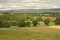
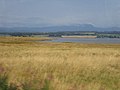
English: Kirkhill is a village, located 2 miles east of Beauly, close to the south opening of the Beauly Firth, and 10 miles west of Inverness, in Ross-shire, Scottish Highlands and is in the Scottish council area of Highland.
Nederlands: Kirkhill ( Schots-Gaelisch: Cnoc Mhoire) is een dorp in de Schotse Lieutenancy Ross and Cromarty in de council Highland ongeveer 3 kilometer ten oosten van Beauly en ongeveer 16 kilometer ten westen van Inverness .
village in Highland, Scotland, UK  | |||||
| Upload media | |||||
| Instance of | |||||
|---|---|---|---|---|---|
| Location |
| ||||
 | |||||
Media in category "Kirkhill, Highland"
The following 39 files are in this category, out of 39 total.
-
 Cemetery by Wardlaw Mausoleum, Kirkhill - geograph.org.uk - 1754789.jpg 4,761 × 2,196; 590 KB
-
 Clunes station site geograph-3112513-by-Ben-Brooksbank.jpg 2,395 × 1,450; 3.78 MB
-
 Cononbank Farm - geograph.org.uk - 247869.jpg 640 × 480; 103 KB
-
 Demolition at Groam Farm - geograph.org.uk - 277078.jpg 640 × 480; 103 KB
-
 Kirkhill Higland.jpg 640 × 480; 89 KB
-
 Kirkhill war memorial (geograph 2691502).jpg 1,944 × 2,592; 1.3 MB
-
 Telephone box in a hedge, Kirkhill - geograph.org.uk - 3664155.jpg 2,400 × 2,400; 1.54 MB
-
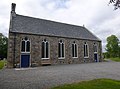 Wardlaw Church, Kirkhill - geograph.org.uk - 3630087.jpg 2,800 × 2,085; 1.49 MB
-
 Wardlaw Church, Kirkhill - geograph.org.uk - 3858760.jpg 800 × 600; 120 KB
-
 Abandoned Project^ - geograph.org.uk - 277061.jpg 640 × 480; 168 KB
-
 Ardmachdunie Farm - geograph.org.uk - 277031.jpg 640 × 480; 109 KB
-
-
 Craggach Farm - geograph.org.uk - 502792.jpg 640 × 426; 100 KB
-
 Croft house and building, Altnacardoch - geograph.org.uk - 58176.jpg 640 × 436; 77 KB
-
 Dilapidated Croft Building - geograph.org.uk - 277057.jpg 640 × 480; 152 KB
-
 Farm building at Holme - geograph.org.uk - 502788.jpg 640 × 426; 60 KB
-
-
 Fields and hillock - geograph.org.uk - 502827.jpg 640 × 426; 113 KB
-
 Fields by Milifiach - geograph.org.uk - 502798.jpg 640 × 426; 113 KB
-
 Forest access track - geograph.org.uk - 502796.jpg 640 × 426; 121 KB
-
 Forestry road - geograph.org.uk - 584493.jpg 640 × 480; 134 KB
-
 Forestry road - geograph.org.uk - 584508.jpg 640 × 480; 120 KB
-
 Forestry road - geograph.org.uk - 584542.jpg 640 × 480; 137 KB
-
 Gate across forest road - geograph.org.uk - 584538.jpg 640 × 480; 144 KB
-
 Geese on Mudflats - geograph.org.uk - 674109.jpg 640 × 480; 40 KB
-
-
 Moniack bridge - geograph.org.uk - 172823.jpg 640 × 427; 146 KB
-
 Northern Lights - geograph.org.uk - 247894.jpg 640 × 480; 115 KB
-
 Old road - geograph.org.uk - 584531.jpg 640 × 480; 145 KB
-
 Old road - geograph.org.uk - 584534.jpg 640 × 480; 121 KB
-
 Pasture Land at Rebeg - geograph.org.uk - 277042.jpg 640 × 480; 111 KB
-
 Public road looking toward Moniack Winery - geograph.org.uk - 502820.jpg 640 × 426; 100 KB
-
 Road junction - geograph.org.uk - 584527.jpg 640 × 480; 124 KB
-
 Road to Newton House and Balcarse Farm - geograph.org.uk - 277069.jpg 640 × 480; 180 KB
-
 Sheep grazings at Moniack - geograph.org.uk - 247873.jpg 640 × 480; 97 KB
-
 The edge of the forest clearing - geograph.org.uk - 584518.jpg 640 × 480; 116 KB
-
 The end of the road - geograph.org.uk - 584512.jpg 640 × 480; 149 KB
-
 Timber Operations at The Aird - geograph.org.uk - 277050.jpg 640 × 480; 118 KB
-
 Wester Lovat, near Beauly - geograph.org.uk - 56643.jpg 640 × 469; 50 KB


.jpg)


