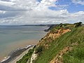
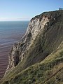
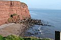
Category:Jurassic Coast
Jump to navigation
Jump to search
|
This place is a UNESCO World Heritage Site, listed as
Dorset and East Devon Coast.
|
World Heritage Site in England  | |||||
| Upload media | |||||
| Instance of | |||||
|---|---|---|---|---|---|
| Location | |||||
| Has part(s) |
| ||||
| Heritage designation |
| ||||
| official website | |||||
 | |||||
Subcategories
This category has the following 43 subcategories, out of 43 total.
A
B
- Beaches of Exmouth, Devon (171 F)
- Beer Beach, Devon (65 F)
C
- Chapman's Pool (72 F)
- Chesil Cove (18 F)
D
- Dancing Ledge (71 F)
E
- Egmont Bight (12 F)
G
H
- High Peak, Devon (21 F)
J
K
- King's Pier (8 F)
L
- Ladram Bay (107 F)
M
O
- Old Harry Rocks (1 P, 256 F)
- Otter Estuary (97 F)
P
- Pulpit Rock, Isle of Portland (65 F)
R
S
- Seaton Beach, Devon (47 F)
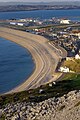
- Swanage Bay (66 F)
- Swyre Head, Chaldon Herring (21 F)
- Swyre Head, Isle of Purbeck (27 F)
T
- The Pinnacles (Old Harry Rocks) (43 F)
W
- Winspit (92 F)
Pages in category "Jurassic Coast"
The following 2 pages are in this category, out of 2 total.
Media in category "Jurassic Coast"
The following 200 files are in this category, out of 770 total.
(previous page) (next page)-
 'Weymouth Bay' by John Constable, Dayton Art Institute.JPG 3,000 × 1,908; 671 KB
-
 050402 058 dorset worbarrow-2.jpg 1,024 × 768; 660 KB
-
 050402 058 dorset worbarrow.jpg 1,024 × 768; 763 KB
-
 070329jad ukdor 01.jpg 1,024 × 509; 265 KB
-
 2008-04-19 swanage lighthouse.JPG 622 × 492; 93 KB
-
 2010-08-04-st albans head.jpg 2,048 × 1,536; 876 KB
-
 2010-10-06 Sandy Bay and Straight Point.jpg 1,530 × 1,114; 390 KB
-
 2010-10-07 peak hill sidmouth.jpg 2,048 × 1,536; 1.04 MB
-
 2010-10-07 sidmouth sea front view east.jpg 2,034 × 1,183; 539 KB
-
 2010-10-07 sidmouth sea front view west.jpg 1,924 × 1,047; 479 KB
-
 2012-07-24 Durlston Castle roof view.JPG 3,264 × 1,832; 1.65 MB
-
 A beach view at Seatown, Dorset - geograph.org.uk - 1499478.jpg 640 × 480; 64 KB
-
 A chance to rest after passing Beer - geograph.org.uk - 1444879.jpg 480 × 640; 71 KB
-
 A panoramic view of Seaton promenade - geograph.org.uk - 1042875.jpg 640 × 480; 55 KB
-

-
 A very low tide at Sidmouth beach. - geograph.org.uk - 1010018.jpg 640 × 480; 52 KB
-
 A windy day - West Bay - geograph.org.uk - 1195879.jpg 640 × 480; 36 KB
-
 Above Little Bindon - geograph.org.uk - 1355749.jpg 640 × 455; 67 KB
-
 Above Little Bindon - geograph.org.uk - 1521010.jpg 640 × 455; 73 KB
-
 Above Lyme Regis - geograph.org.uk - 1370499.jpg 640 × 455; 103 KB
-

-
-
 All aboard^ - geograph.org.uk - 1274190.jpg 468 × 640; 86 KB
-
 Allotments at Beer, Devon - geograph.org.uk - 886536.jpg 640 × 426; 91 KB
-
 Allotments with a view in Beer - geograph.org.uk - 1069661.jpg 640 × 480; 125 KB
-
 Allotments, Beer - geograph.org.uk - 952320.jpg 640 × 480; 168 KB
-
 Along the prom at Seaton - geograph.org.uk - 815684.jpg 640 × 427; 202 KB
-
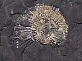
 Ammonoid Fossil of Jurassic Coast in England.jpg 3,648 × 2,736; 3.31 MB
-
 Approaching the mouth of the Axe - geograph.org.uk - 341303.jpg 640 × 480; 91 KB
-
 Approaching Wallsend Cove - geograph.org.uk - 1802355.jpg 640 × 480; 81 KB
-

-

-
 Ballard cliff.jpg 2,048 × 1,365; 581 KB
-
 Base of the Southwell Landslip - geograph.org.uk - 1029224.jpg 427 × 640; 98 KB
-
 Beach (3562059335).jpg 4,288 × 2,848; 6.6 MB
-
 Beach and dunes, Exmouth - geograph.org.uk - 1034645.jpg 640 × 480; 59 KB
-
 Beach at Maer Rocks Exmouth - geograph.org.uk - 1039483.jpg 640 × 428; 59 KB
-
 Beach at Sandy Bay - geograph.org.uk - 389103.jpg 640 × 480; 95 KB
-
 Beach at Seaton - geograph.org.uk - 932055.jpg 640 × 337; 46 KB
-
 Beach at Sidmouth Looking west - geograph.org.uk - 679517.jpg 640 × 412; 113 KB
-
 Beach at the Cobb in October - geograph.org.uk - 590871.jpg 640 × 378; 57 KB
-
 Beach by The Esplanade, Sidmouth - geograph.org.uk - 242839.jpg 640 × 480; 58 KB
-
 Beach front cafe - geograph.org.uk - 1738012.jpg 640 × 389; 82 KB
-
 Beach hut city on Portland Bill - geograph.org.uk - 469909.jpg 640 × 480; 88 KB
-
 Beach huts - geograph.org.uk - 1704942.jpg 1,600 × 1,071; 296 KB
-
 Beach huts, Seaton - geograph.org.uk - 952317.jpg 640 × 480; 63 KB
-
 Beach West of the Cobb, Lyme Regis - geograph.org.uk - 771477.jpg 640 × 480; 81 KB
-
 Beach, Exmouth - geograph.org.uk - 1400418.jpg 640 × 480; 106 KB
-
 Beer (Devon).jpg 1,024 × 768; 129 KB
-
 Beer Beach Boats.jpg 5,184 × 3,456; 6.23 MB
-
 Beer Cliffs from Seaton Seafront - geograph.org.uk - 308118.jpg 640 × 427; 70 KB
-
 Beer Head - geograph.org.uk - 1182788.jpg 480 × 640; 193 KB
-
 Beer Head - geograph.org.uk - 965857.jpg 640 × 480; 50 KB
-
 Beer Head and Under Hooken - geograph.org.uk - 1199849.jpg 640 × 480; 162 KB
-
 Beer Head Cliffs - geograph.org.uk - 965909.jpg 640 × 480; 72 KB
-
 Beer Head from Seaton Beach - geograph.org.uk - 1285399.jpg 640 × 480; 60 KB
-
 Beer Head from Windgate - geograph.org.uk - 1139205.jpg 640 × 428; 160 KB
-
 Beer, by Hooken Cliffs - geograph.org.uk - 344382.jpg 640 × 427; 195 KB
-

-
 Beer, The coast path climbing from Beer - geograph.org.uk - 1737008.jpg 535 × 800; 609 KB
-
 Beer, The End of the Road - geograph.org.uk - 1716622.jpg 800 × 533; 402 KB
-
 Beer, View towards Seaton Hole - geograph.org.uk - 1736972.jpg 800 × 535; 414 KB
-
 Bickwell Brook enters the sea - geograph.org.uk - 1580743.jpg 640 × 480; 110 KB
-
 Big Point Rock and Little Point Rock - geograph.org.uk - 879177.jpg 640 × 480; 85 KB
-
 Bindon hill from the east.jpg 1,400 × 1,050; 219 KB
-
 Bindon Hill from the west.jpg 1,975 × 988; 319 KB
-
 Black Ven - geograph.org.uk - 69627.jpg 640 × 480; 107 KB
-
 Black Ven.jpg 4,032 × 3,024; 5.42 MB
-
 Blue Pool, Furzebrook, Dorset - geograph.org.uk - 720161.jpg 640 × 416; 83 KB
-

-
 Boat off Exmouth beach.jpg 3,303 × 2,231; 2.82 MB
-
 Boats at Sidmouth - geograph.org.uk - 1347567.jpg 640 × 480; 88 KB
-
 Boats at Sidmouth - geograph.org.uk - 2737.jpg 640 × 480; 67 KB
-
 Boats at Sidmouth - geograph.org.uk - 717727.jpg 632 × 640; 132 KB
-
 Bottoms up^ - geograph.org.uk - 1274193.jpg 640 × 480; 123 KB
-
 Boulder ruckle climbers purbeck.jpg 1,877 × 2,816; 1.13 MB
-
 Bran point dorset.jpg 2,816 × 2,112; 1.08 MB
-
 Breakwater at Sidmouth - geograph.org.uk - 1139188.jpg 426 × 640; 197 KB
-

-
 BSbeach.jpg 640 × 479; 85 KB
-
 Budleigh Salterton , Treetops and Sea - geograph.org.uk - 1476767.jpg 640 × 480; 119 KB
-
 Budleigh Salterton cliffs - geograph.org.uk - 1140405.jpg 424 × 640; 203 KB
-

-
 Budleigh Salterton Promenade - geograph.org.uk - 1112610.jpg 640 × 430; 48 KB
-

-

-
 Butterstreet Cove, East Fleet - geograph.org.uk - 553946.jpg 640 × 480; 55 KB
-
 Buy your cruises here^ - geograph.org.uk - 1108955.jpg 640 × 430; 50 KB
-
 Caravan park and cliffs, Branscombe beach - geograph.org.uk - 952197.jpg 640 × 480; 173 KB
-
 Cave Hole - geograph.org.uk - 1098571.jpg 640 × 427; 81 KB
-
 Cave, Tom Tizzard's Hole, Beer - geograph.org.uk - 218527.jpg 640 × 480; 129 KB
-
 Caves in the chalk near Beer. - geograph.org.uk - 770935.jpg 640 × 480; 107 KB
-
 Chalk Cliffs West of Beer - geograph.org.uk - 1184480.jpg 640 × 480; 52 KB
-
 Chalk Cliffs, Beer - geograph.org.uk - 1184487.jpg 480 × 640; 83 KB
-
 Chalk cliffs, Beer - geograph.org.uk - 7260.jpg 640 × 480; 133 KB
-
 Chapman's Rocks and red-stained sea - geograph.org.uk - 1200436.jpg 640 × 480; 107 KB
-
 Charmouth at sunrise - geograph.org.uk - 725948.jpg 640 × 480; 38 KB
-
 Charmouth Heritage Coast Centre.jpg 640 × 384; 55 KB
-
 Chesil beach.2004-04-07.700px.jpg 700 × 391; 86 KB
-
 Chesil cove from west cliff portland dorset.jpg 1,877 × 2,816; 1.12 MB
-
 Chiselbury Bay - geograph.org.uk - 879193.jpg 640 × 480; 82 KB
-
 Chislebury Bay - geograph.org.uk - 1138787.jpg 428 × 640; 169 KB
-
 Chit Rocks - geograph.org.uk - 1183203.jpg 640 × 480; 201 KB
-
 Chit Rocks, Sidmouth - geograph.org.uk - 1010007.jpg 640 × 480; 106 KB
-
 Chit Rocks, Sidmouth - geograph.org.uk - 35066.jpg 640 × 480; 163 KB
-
 Christmas day swim, Exmouth - geograph.org.uk - 1090769.jpg 640 × 480; 76 KB
-
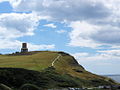 Clavell Tower 1.jpg 1,000 × 750; 202 KB
-
 Clavell Tower 2.jpg 1,000 × 750; 221 KB
-
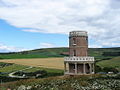
 Clavell Tower re-erected february 2008.jpg 1,950 × 2,600; 1.3 MB
-
 Cliff above Chit Rocks - geograph.org.uk - 1139196.jpg 426 × 640; 168 KB
-
-
 Cliff Erosion - geograph.org.uk - 677112.jpg 427 × 640; 93 KB
-
 Cliff face at Budleigh Salterton. - geograph.org.uk - 198414.jpg 640 × 480; 113 KB
-
 Cliff path at Budleigh Salterton. - geograph.org.uk - 198417.jpg 640 × 480; 113 KB
-

-
 Cliff, Hooken landslip - geograph.org.uk - 242390.jpg 480 × 640; 101 KB
-
 Cliff-top path, above The Floors - geograph.org.uk - 1225380.jpg 640 × 480; 96 KB
-

-
 Cliffs above Beer Beach - geograph.org.uk - 771472.jpg 640 × 480; 95 KB
-
 Cliffs above Hooken Beach - geograph.org.uk - 871068.jpg 640 × 480; 116 KB
-
 Cliffs above Hooken landslip - geograph.org.uk - 242208.jpg 640 × 480; 107 KB
-
 Cliffs above Littleham Cove - geograph.org.uk - 1339643.jpg 640 × 480; 246 KB
-
 Cliffs above mutton cove portland dorset.jpg 1,877 × 2,816; 1.17 MB
-
 Cliffs above Otterton Ledge.jpg 4,128 × 2,800; 3.28 MB
-
 Cliffs above Sidmouth - geograph.org.uk - 1139131.jpg 640 × 426; 171 KB
-

-
 Cliffs at Littlecombe Shoot - geograph.org.uk - 871077.jpg 640 × 480; 87 KB
-
 Cliffs at Peak Hill, Sidmouth, Devon - geograph.org.uk - 715047.jpg 640 × 440; 66 KB
-
 Cliffs at Sidmouth - geograph.org.uk - 414004.jpg 640 × 481; 79 KB
-
 Cliffs at the end of Straight Point - geograph.org.uk - 1074745.jpg 640 × 480; 59 KB
-
 Cliffs at White Nothe - geograph.org.uk - 414743.jpg 640 × 480; 68 KB
-
-

-

-
 Cliffs by the mouth of the River Axe - geograph.org.uk - 1072559.jpg 480 × 640; 88 KB
-
 Cliffs east end of Branscombe beach - geograph.org.uk - 952208.jpg 640 × 480; 145 KB
-
 Cliffs East of Beer - geograph.org.uk - 341069.jpg 640 × 480; 86 KB
-
 Cliffs east of St Albans Head.jpg 2,048 × 1,536; 742 KB
-
 Cliffs near Beer - geograph.org.uk - 595778.jpg 640 × 480; 76 KB
-

-

-
 Cliffs west of Sidmouth - geograph.org.uk - 27179.jpg 640 × 480; 56 KB
-
 Cliffs west of West Bottom - geograph.org.uk - 135494.jpg 640 × 425; 86 KB
-
 Clifftop Path - geograph.org.uk - 1069867.jpg 640 × 480; 64 KB
-
 Clifftop, Dunscombe Cliff - geograph.org.uk - 1347466.jpg 640 × 480; 103 KB
-
 Climbers at hedbury quarry dorset.jpg 1,877 × 2,816; 1.15 MB
-
 Coast above Twopenny Loaf Rock - geograph.org.uk - 956319.jpg 640 × 480; 69 KB
-
 Coast and quarries, Longstone Ope - geograph.org.uk - 1029272.jpg 427 × 640; 105 KB
-
 Coast line at Sidmouth - geograph.org.uk - 1718639.jpg 640 × 450; 84 KB
-
 Coast Path east of Salcombe Mouth - geograph.org.uk - 871097.jpg 640 × 480; 88 KB
-
 Coast Path over Arratt's Hill - geograph.org.uk - 871066.jpg 640 × 480; 81 KB
-
-
 Coast viewed from Berry Camp - geograph.org.uk - 2893880.jpg 1,024 × 768; 225 KB
-
 Coastal defences at Lyme Regis - geograph.org.uk - 484056.jpg 640 × 480; 93 KB
-
 Coastal defences, Sidmouth - geograph.org.uk - 1010491.jpg 640 × 480; 60 KB
-
 Coastal Erosion near Portland Bill - geograph.org.uk - 1802437.jpg 640 × 480; 66 KB
-
 CoastalrockintheJurassi Coast DorsetEngland.jpg 1,280 × 704; 487 KB
-
 CoastalrockintheJurassi Coast DorsetEngland22263892945298045725812.jpg 1,194 × 672; 313 KB
-
 CoastalrockintheJurassi Coast DorsetEngland51514514041.jpg 1,226 × 604; 325 KB
-
 Coastline at Salcombe Mouth - geograph.org.uk - 871103.jpg 480 × 640; 78 KB
-

-
 Coastline at Weston Ebb - geograph.org.uk - 871087.jpg 640 × 480; 73 KB
-
 Collapsed sea-cave, Portland coast - geograph.org.uk - 1312297.jpg 640 × 480; 263 KB
-
 Cover Hole - geograph.org.uk - 135813.jpg 640 × 417; 85 KB
-
 Crowded beach - geograph.org.uk - 882652.jpg 640 × 453; 363 KB
-
-
 Crushed ammonite fossil chapmans pool dorset.jpg 2,816 × 2,112; 1.34 MB
-

-
 Custom House Quay - geograph.org.uk - 1184195.jpg 360 × 640; 59 KB
-
 Danger Cliff, Jurassic Coast.jpg 3,588 × 2,392; 5.39 MB
-
 Danger Point - geograph.org.uk - 1138729.jpg 640 × 427; 164 KB
-
 Danger Point - geograph.org.uk - 1298649.jpg 640 × 480; 115 KB
-
 Danger Point and Black Head - geograph.org.uk - 879208.jpg 640 × 480; 65 KB
-

-
 Dawlish Warren and Straight Point.jpg 3,944 × 2,800; 4.04 MB
-
 Descent into Sidmouth - geograph.org.uk - 1139142.jpg 640 × 426; 186 KB
-
 Distant Jurassic Coast.jpg 5,184 × 3,456; 8.58 MB
-
 Disused quarry - geograph.org.uk - 1030917.jpg 480 × 640; 107 KB
-
 Dorset coast W of St Aldhelm's Head.JPG 5,184 × 3,456; 5.47 MB
-
 Dunscombe Cliff - geograph.org.uk - 1347487.jpg 640 × 480; 130 KB
-
 Dunscombe Cliff - geograph.org.uk - 6856.jpg 640 × 480; 91 KB
-
 Dunscombe Cliff from Salcombe Hill - geograph.org.uk - 932749.jpg 640 × 480; 41 KB
-
 Dunscombe Cliff from Weston Combe - geograph.org.uk - 1153308.jpg 640 × 480; 71 KB
-
 Durdle Door , Coastal Scenery - geograph.org.uk - 1119689.jpg 640 × 480; 70 KB
-
 Durdle Door , Directions on a Rock - geograph.org.uk - 1119714.jpg 640 × 480; 65 KB
-
 Durdle Door, Lulworth.jpg 3,264 × 2,448; 5.59 MB
-
 Durdle Pier, Portland - geograph.org.uk - 719170.jpg 480 × 640; 84 KB
-
 Durlston bay from durlston castle.jpg 2,816 × 1,877; 1.05 MB
-
 East Cliff at West Bay - geograph.org.uk - 7256.jpg 480 × 640; 128 KB
-
 East Devon , Bushes, Cliff and Ocean - geograph.org.uk - 1476779.jpg 640 × 480; 102 KB
-

-

-

-

-

-
-
 East Devon , Coastal Scenery - geograph.org.uk - 1477353.jpg 640 × 480; 80 KB
-

-

-


.jpg)


.jpg)


