Category:White Nothe
Jump to navigation
Jump to search
Headland in Dorset, England  | |||||
| Upload media | |||||
| Instance of | |||||
|---|---|---|---|---|---|
| Location |
| ||||
| Owned by | |||||
| Operator | |||||
 | |||||
Media in category "White Nothe"
The following 96 files are in this category, out of 96 total.
-
 Beach Below White Nothe - geograph.org.uk - 4107522.jpg 640 × 480; 105 KB
-
 Beach, Ringstead Bay - geograph.org.uk - 1005272.jpg 640 × 480; 111 KB
-
 Beach, Ringstead Bay - geograph.org.uk - 1006575.jpg 427 × 640; 110 KB
-
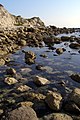
 Boulders on the shore, Ringstead Bay - geograph.org.uk - 1006589.jpg 427 × 640; 105 KB
-
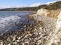
 Chalk beach west of White Nothe - geograph.org.uk - 1005303.jpg 427 × 640; 91 KB
-
 Chalk cliffs above Ringstead Bay - geograph.org.uk - 480719.jpg 640 × 628; 88 KB
-
 Choppy weather at Ringstead.jpg 4,608 × 3,456; 3.6 MB
-
 Cliffs at White Nothe - geograph.org.uk - 414711.jpg 640 × 480; 90 KB
-
 Cliffs at White Nothe - geograph.org.uk - 414743.jpg 640 × 480; 68 KB
-

-
 Cliffs west of White Nothe - geograph.org.uk - 222619.jpg 480 × 640; 161 KB
-
 Cliffs, Ringstead - geograph.org.uk - 848917.jpg 640 × 480; 141 KB
-

-
 Coast path above Ringstead Bay - geograph.org.uk - 2991351.jpg 1,024 × 768; 226 KB
-
 Coast path on the cliffs of Whitenothe - geograph.org.uk - 222119.jpg 640 × 480; 170 KB
-
 Coastal Path leading towards the White Nothe - geograph.org.uk - 2625453.jpg 1,200 × 795; 837 KB
-

-
 Coastal view east from White Nothe - geograph.org.uk - 266446.jpg 640 × 480; 90 KB
-
 Coastguard cottages at White Nothe - geograph.org.uk - 1949764.jpg 640 × 480; 226 KB
-
 Coastguard cottages on White Nothe, Dorset - DSC08895.jpg 4,896 × 3,672; 5.83 MB
-
 Coastguard cottages on White Nothe, Dorset - DSC08915.jpg 4,896 × 3,672; 6.69 MB
-

-
 Desperate cows at Whitenothe - geograph.org.uk - 222604.jpg 640 × 480; 156 KB
-
 Holworth, the path from Ringstead - geograph.org.uk - 1415639.jpg 640 × 480; 73 KB
-
 Houses above Ringstead Bay - geograph.org.uk - 89072.jpg 640 × 480; 144 KB
-
 Lazy days on the beach at Ringstead - geograph.org.uk - 868229.jpg 640 × 432; 80 KB
-
 Looking into the landslip - geograph.org.uk - 1949803.jpg 640 × 480; 291 KB
-
 Looking into the landslip - geograph.org.uk - 1949809.jpg 640 × 480; 289 KB
-
 National Trust White Nothe sign - DSC08925.jpg 3,672 × 4,896; 4.91 MB
-
 Ringstead Bay (looking west) - geograph.org.uk - 89073.jpg 640 × 480; 74 KB
-
 Ringstead Bay - geograph.org.uk - 161663.jpg 640 × 480; 73 KB
-
 Ringstead Bay - geograph.org.uk - 2991355.jpg 1,024 × 768; 184 KB
-
 Ringstead Bay - geograph.org.uk - 3048797.jpg 640 × 480; 74 KB
-
 Ringstead Bay - geograph.org.uk - 3048826.jpg 640 × 480; 80 KB
-
 Ringstead Bay - geograph.org.uk - 480711.jpg 640 × 591; 83 KB
-
 Ringstead Bay - geograph.org.uk - 521909.jpg 640 × 387; 87 KB
-

-
 Ringstead bay from the clifftop.jpg 1,877 × 2,816; 1.15 MB
-
 Ringstead Bay, Path to the Beach - geograph.org.uk - 1705193.jpg 640 × 480; 95 KB
-
 Ringstead beach - DSC08873.jpg 4,896 × 3,672; 5.84 MB
-
 Ringstead Beach - geograph.org.uk - 2642037.jpg 640 × 480; 107 KB
-
 Ringstead beach and reef with White Nothe in the distance - DSC08976.jpg 4,896 × 3,672; 5.05 MB
-
 Ringstead beach from the path to White Nothe - DSC08881.jpg 4,896 × 3,672; 5.78 MB
-
 Ringstead from White Nothe-5.jpg 2,800 × 1,864; 2.26 MB
-
 Ringstead village from the path to White Nothe - DSC08936.jpg 4,896 × 3,672; 5.02 MB
-
 Ringstead village from the path to White Nothe - DSC08937.jpg 4,896 × 3,672; 4.92 MB
-
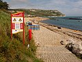 Ringstead, beach notices - geograph.org.uk - 1416605.jpg 640 × 480; 104 KB
-
 Ringstead, gliding above White Nothe - geograph.org.uk - 1415632.jpg 640 × 480; 40 KB
-

-
 Ringstead, the beach - geograph.org.uk - 3051506.jpg 640 × 480; 68 KB
-
 Ringstead, view towards White Nothe - geograph.org.uk - 1416602.jpg 640 × 480; 90 KB
-
-

-

-
 Rocky ringstead bay shore dorset.jpg 1,877 × 2,816; 1.05 MB
-
 Sea fishing on Ringstead Beach - geograph.org.uk - 266901.jpg 640 × 480; 115 KB
-

-
 Smugglers path white nothe dorset.jpg 1,877 × 2,816; 1.55 MB
-
 South Down, Dorset - geograph.org.uk - 1715700.jpg 640 × 379; 50 KB
-

-
 South West Coast Path on White Nothe, Dorset - DSC08926.jpg 3,672 × 4,896; 7.36 MB
-

-

-
 Stile above Ringstead Bay - geograph.org.uk - 414707.jpg 640 × 480; 99 KB
-
 The Beach near Ringstead - geograph.org.uk - 2534332.jpg 1,024 × 768; 272 KB
-
 The Burning Cliff - geograph.org.uk - 8527.jpg 480 × 640; 115 KB
-
 The Clifftop above Ringstead Bay - geograph.org.uk - 2534289.jpg 1,024 × 768; 197 KB
-
 The coast above Ringstead Bay - geograph.org.uk - 2991348.jpg 1,024 × 768; 206 KB
-
 The Coast Path above King Rock - geograph.org.uk - 2533242.jpg 1,024 × 768; 237 KB
-
-
 Top of the Smugglers Path at White Nothe - geograph.org.uk - 266751.jpg 640 × 480; 109 KB
-

-
 Upper chalk outcrop at White Nothe - geograph.org.uk - 266779.jpg 640 × 480; 104 KB
-
 View east from White Nothe - geograph.org.uk - 222585.jpg 640 × 480; 68 KB
-

-

-
 View from White Nothe east towards Bat's Head - DSC08910.jpg 4,896 × 3,672; 5.24 MB
-
 View from White Nothe east towards Bat's Head - DSC08911.jpg 3,672 × 4,896; 5.21 MB
-
 View from White Nothe east towards Bat's Head - DSC08912.jpg 4,896 × 3,672; 4.79 MB
-
 Viper's Bugloss - geograph.org.uk - 848915.jpg 640 × 480; 151 KB
-
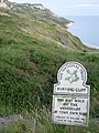
 Warning Sign at White Nothe - geograph.org.uk - 414739.jpg 640 × 480; 90 KB
-
 White Nothe and beyond!.jpg 4,608 × 3,456; 3.32 MB
-
 White Nothe and Ringstead path sign - DSC08878.jpg 4,896 × 3,672; 7.8 MB
-

-
 White Nothe from the South West Coast Path, Dorset - DSC09005.jpg 4,896 × 3,672; 4.76 MB
-
 White Nothe headland from the shore below the undercliff.jpg 2,816 × 2,112; 1.1 MB
-
 White nothe headland west side at sea level dorset.jpg 1,800 × 2,700; 1 MB
-
 White Nothe in the distance from the South West Coast Path, Dorset - DSC09008.jpg 4,896 × 3,672; 6.06 MB
-

-
 White nothe undercliff panorama.jpg 3,916 × 1,968; 1.45 MB
-
 White Nothe, Coast Path - geograph.org.uk - 1706314.jpg 800 × 533; 379 KB
-
 White Nothe, Westerly view from cliff edge - geograph.org.uk - 2625440.jpg 1,200 × 795; 895 KB
-
 Whitenothe Cottages - geograph.org.uk - 222599.jpg 640 × 480; 130 KB
-
 Whitenothe Cottages - geograph.org.uk - 266738.jpg 640 × 480; 93 KB
-
 Whitenothe national trust sign.jpg 1,333 × 2,000; 765 KB
-
 Written in stones on Ringstead Beach - geograph.org.uk - 266895.jpg 480 × 640; 149 KB


_-_geograph.org.uk_-_89073.jpg)


