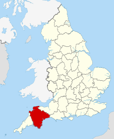
Category:Geology of Devon
Jump to navigation
Jump to search
Ceremonial counties of England: Bedfordshire · Berkshire · Buckinghamshire · Cambridgeshire · Cheshire · Cornwall · Cumbria · Derbyshire · Devon · Dorset · Durham · East Riding of Yorkshire · East Sussex · Essex · Gloucestershire · Greater Manchester · Hampshire · Herefordshire · Hertfordshire · Isle of Wight · Kent · Lancashire · Leicestershire · Lincolnshire · Merseyside · North Yorkshire · Northamptonshire · Northumberland · Nottinghamshire · Oxfordshire · Shropshire · Somerset · South Yorkshire · Staffordshire · Suffolk · Surrey · Warwickshire · West Midlands · West Sussex · West Yorkshire · Wiltshire · Worcestershire
City-counties:
Former historic counties: Yorkshire
Other former counties:
City-counties:
Former historic counties: Yorkshire
Other former counties:
ceremonial county of England | |||||
| Upload media | |||||
| Spoken text audio | |||||
|---|---|---|---|---|---|
| Instance of | |||||
| Location |
| ||||
| Capital | |||||
| Population |
| ||||
| Area |
| ||||
| Different from | |||||
| Said to be the same as | Devon (historic county of England, ceremonial county of England, 1844) | ||||
 | |||||
Subcategories
This category has the following 15 subcategories, out of 15 total.
A
C
F
- Fossils of Devon (6 F)
G
H
- High Peak, Devon (21 F)
J
L
- Ladram Bay (108 F)
M
P
- Plateau Gravels (1 F)
R
V
- Valley Gravel (Sidmouth) (2 F)
Media in category "Geology of Devon"
The following 23 files are in this category, out of 23 total.
-
Cross-bedded Permian Sandstone - geograph.org.uk - 71404.jpg 640 × 480; 102 KB
-
Croyde Bay - geograph.org.uk - 1038354.jpg 640 × 480; 116 KB
-
Devon Culm Subsoil - geograph.org.uk - 344702.jpg 640 × 640; 153 KB
-
Earthquake, Lundy - geograph.org.uk - 73871.jpg 640 × 480; 54 KB
-
FeldsparMegacryst Dartmoor IS.jpg 1,034 × 690; 506 KB
-
Folded rocks near Hilsea Point - geograph.org.uk - 326530.jpg 480 × 640; 147 KB
-
Hartland Quay chevron folds.jpg 4,032 × 3,024; 4.16 MB
-
Hartland Quay Cliff Face, Devon - geograph.org.uk - 364272.jpg 640 × 480; 131 KB
-
Holwell Quarry, Holwell Tor - geograph.org.uk - 1545046.jpg 640 × 480; 113 KB
-
LEE DEVON DETAIL OF BADLY BORED ROCKS.JPG 7,360 × 4,912; 24.29 MB
-
Natural arch, Stantaway Hill - geograph.org.uk - 725859.jpg 640 × 480; 160 KB
-
Natural arch, Stantaway Hill - geograph.org.uk - 725867.jpg 640 × 480; 135 KB
-
Pillow Lava SSSI Chipley Quarry - geograph.org.uk - 1187275.jpg 640 × 480; 112 KB
-
Pillow Lava SSSI Chipley Quarry closeup - geograph.org.uk - 1187277.jpg 640 × 480; 102 KB
-
Rocks at Hilsea Point - geograph.org.uk - 326254.jpg 640 × 494; 121 KB
-
Saltern Cove Paignton.jpg 800 × 600; 133 KB
-
Slate at Morte Point in Devon.jpg 5,472 × 3,648; 7.45 MB
-
SW England China Clay Pits.png 3,194 × 1,900; 2.23 MB
-
The Earthquake on West Lundy.jpg 4,116 × 2,728; 6.17 MB
-
Wave cut platform - geograph.org.uk - 222060.jpg 480 × 640; 94 KB
-
Welcombe Mouth - geograph.org.uk - 25072.jpg 640 × 476; 128 KB


