Category:Hiking trails in Ruhland
Jump to navigation
Jump to search
| Object location | | View all coordinates using: OpenStreetMap |
|---|
Wanderwege in Ruhland
[edit]Subcategories
This category has the following 11 subcategories, out of 11 total.
G
R
- Radweg Arnsdorf-Bärhaus (6 F)
- Radweg Arnsdorf-Guteborn (1 P, 40 F)
- Radweg Arnsdorf-Jannowitz (17 F)
- Radweg Arnsdorf-Kroppen (18 F)
- Radweg Arnsdorf-Schwarzbach (2 F)
- Radweg Bärhaus-Frauendorf (7 F)
- Radweg Ruhland-Arnsdorf (20 F)
- Radweg Ruhland-Bärhaus (2 F)
- Radweg Ruhland-Frauendorf (12 F)
- Radweg Ruhland-Tettau (9 F)
Media in category "Hiking trails in Ruhland"
The following 3 files are in this category, out of 3 total.
-
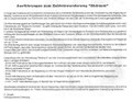 Ruhland, OSL-Gebietswanderweg Süd Amtsbl.11.1993 S.4.pdf 1,179 × 912; 2.16 MB
-
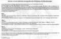
 Ruhland, Wanderwege Beschilderung Amtsbl.2.1994 S.11-13.pdf 1,158 × 500, 5 pages; 1.64 MB
-
 Ruhland. Wanderwege I-III Amtsbl.8.1993 S.3-4.pdf 1,172 × 752, 4 pages; 2.04 MB