Category:Radweg Bärhaus-Frauendorf
Jump to navigation
Jump to search
| Object location | | View all coordinates using: OpenStreetMap |
|---|
„Radweg Bärhaus-Frauendorf“
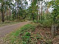
[edit]Deutsch: Diese Kategorie erfasst einen Radwanderweg von Bärhaus im Gebiet der Gemarkungen Lauchhammer und Frauendorf nach Frauendorf. Der Weg nutzt alte Ortsverbindungen, mündet in Bärhaus in die gleichnamige Straße und in Frauendorf in die Hauptstraße.
English: This category contains a cycling trail from Bärhaus in the area of Lauchhammert and Frauendorf to Frauendorf. Its using old local connections from Bärhaus to Hauptstraße (Frauendorf).
Media in category "Radweg Bärhaus-Frauendorf"
The following 7 files are in this category, out of 7 total.
-
 Radweg Bärhaus-Frauendorf nordwärts hinter Kreuzung mit Radweg Ruhland-Tettau, 01.jpg 4,000 × 3,000; 6.31 MB
-
 Radweg Bärhaus-Frauendorf nordwärts hinter Kreuzung mit Radweg Ruhland-Tettau, 02.jpg 3,000 × 4,000; 6.15 MB
-
 Radweg Ruhland-Tettau, alte Wegsäule an Kreuzung, 01.jpg 3,000 × 4,000; 7.46 MB
-
 Radweg Ruhland-Tettau, alte Wegsäule an Kreuzung, 02.jpg 3,000 × 4,000; 6.43 MB
-
 Radweg Ruhland-Tettau, alte Wegsäule an Kreuzung, 03.jpg 3,000 × 4,000; 6.03 MB
-
 Radweg Ruhland-Tettau, alte Wegsäule an Kreuzung, 04.jpg 4,000 × 3,000; 7.16 MB
-
 Radweg Ruhland-Tettau, alte Wegsäule an Kreuzung, 05.jpg 4,000 × 3,000; 7.52 MB


