Category:Radweg Arnsdorf-Guteborn
Jump to navigation
Jump to search
| Object location | | View all coordinates using: OpenStreetMap |
|---|
„Radweg Arnsdorf-Guteborn“
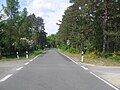
[edit]Deutsch: Diese Kategorie erfasst einen Radwanderweg von Arnsdorf im Gebiet der Gemarkungen Guteborn, Arnsdorf und Ruhland nach Guteborn. Der Weg ist eine alte Ortsverbindungsstraße, kreuzt bei der Wohnstelle Waldesruh die K 6603, mündet in Arnsdorf in die Guteborner Straße und in Guteborn in die Arnsdorfer Straße.
Pages in category "Radweg Arnsdorf-Guteborn"
This category contains only the following page.
Media in category "Radweg Arnsdorf-Guteborn"
The following 40 files are in this category, out of 40 total.
-
 Arnsdorf, Guteborner Straße bei Hausnr. 2, OSL-Knotenpunkt 24, 01.jpg 3,000 × 4,000; 3.79 MB
-
 Arnsdorf, Radweg nach Guteborn,OSL-Knotenpunkt 25, 01.jpg 2,302 × 3,407; 1.11 MB
-

-
 Guteborn, Arnsdorfer Str. nordwestwärts bei Hausnr. 4, 01.jpg 1,600 × 1,200; 1.03 MB
-
 Guteborn, Grenzstein am Radweg Arnsdorf-Guteborn, 02.jpg 2,272 × 1,704; 867 KB
-
 Guteborn, Grenzstein am Radweg Arnsdorf-Guteborn, 03.jpg 2,272 × 1,704; 708 KB
-
 Guteborn, Grenzstein am Radweg Arnsdorf-Guteborn, 04.jpg 2,272 × 1,704; 791 KB
-
 Guteborn, Grenzstein am Radweg Arnsdorf-Guteborn, 05.jpg 2,272 × 1,704; 791 KB
-
 Guteborn, Rastplatz Dürre Ziege, Ostansicht, 01.jpg 1,600 × 1,200; 1.3 MB
-
 Guteborn, Rastplatz Dürre Ziege, Ostansicht, 02.jpg 1,600 × 1,200; 1.23 MB
-
 Guteborn, Rastplatz Dürre Ziege, Ostansicht, 03.jpg 1,200 × 1,600; 1.52 MB
-
 Guteborn, Wegsäule am Rastplatz Dürre Ziege, Südansicht, 01.jpg 1,600 × 1,200; 1.35 MB
-
 Guteborn, Wegsäule am Rastplatz Dürre Ziege, Südansicht, 02.jpg 1,600 × 1,200; 1.3 MB
-

-
 NSG „Sorgenteich“ in Guteborn, Informationstafel NSG am Radweg Arnsdorf-Guteborn, 01.jpg 4,000 × 3,000; 3.45 MB
-
 NSG „Sorgenteich“ in Guteborn, Informationstafel NSG am Radweg Arnsdorf-Guteborn, 02.jpg 4,000 × 3,000; 3.68 MB
-

-

-

-
 Radweg Arnsdorf-Guteborn ostwärts bei Rastplatz Waldesruh, Spätfrühling, 01.jpg 2,272 × 1,704; 532 KB
-
 Radweg Arnsdorf-Guteborn ostwärts bei Rastplatz Waldesruh, Spätfrühling, 02.jpg 2,272 × 1,704; 617 KB
-
 Radweg Arnsdorf-Guteborn ostwärts bei Waldesruh, Spätfrühling, 01.jpg 2,272 × 1,704; 683 KB
-
 Radweg Arnsdorf-Guteborn ostwärts bei Waldesruh, Spätfrühling, 02.jpg 2,272 × 1,704; 594 KB
-
 Radweg Arnsdorf-Guteborn westwärts bei Rastplatz Waldesruh, Spätfrühling, 01.jpg 2,272 × 1,704; 555 KB
-
 Radweg Arnsdorf-Guteborn westwärts bei Rastplatz Waldesruh, Spätfrühling, 02.jpg 2,272 × 1,704; 510 KB
-
 Radweg Arnsdorf-Guteborn westwärts bei Waldesruh, Spätfrühling, 01.jpg 2,272 × 1,704; 617 KB
-

-

-
 Radweg Arnsdorf-Guteborn, Stieleiche am Dorfgraben an der Feldecke, Frühling, 01.jpg 2,448 × 3,264; 1.43 MB
-
 Ruhland, Dorfaue (OT Arnsdorf) Höhe Hausnr. 4, Informationstafel Amt Ruhland, 01.jpg 4,000 × 3,000; 2.47 MB
-

-
 Ruhland, Dorfaue (OT Arnsdorf) Höhe Hausnr. 4, OSL-Knotenpunkt 24, 01.jpg 3,000 × 4,000; 4.63 MB
-
 Ruhland, Dorfaue (OT Arnsdorf) nordwärts bei Hausnr. 5, Herbst, 01.jpg 4,000 × 3,000; 4.86 MB
-

-
-

-
 Wanderweg-Info-Tafel mit Karte am OSL-Knotenpunkt 11, 01.jpg 4,000 × 3,000; 3.46 MB
-
 Wanderweg-Info-Tafel mit Karte am OSL-Knotenpunkt 23, 01.jpg 4,000 × 3,000; 3.22 MB
-
 Wanderweg-Info-Tafel mit Karte am OSL-Knotenpunkt 24, 01.jpg 3,000 × 4,000; 3.18 MB
-
 Wanderweg-Info-Tafel mit Karte am OSL-Knotenpunkt 25, 01.jpg 2,851 × 2,705; 898 KB


_H%C3%B6he_Hausnr._4,_Informationstafel_Amt_Ruhland,_01.jpg)
_H%C3%B6he_Hausnr._4,_Informationstafel_Radwegenetz_OSL_S%C3%BCdteil,_01.jpg)
_H%C3%B6he_Hausnr._4,_OSL-Knotenpunkt_24,_01.jpg)
_nordw%C3%A4rts_bei_Hausnr._5,_Herbst,_01.jpg)


