Category:Hiking trails in Connecticut
Jump to navigation
Jump to search
States of the United States: Alaska · Arizona · California · Colorado · Connecticut · Delaware · Florida · Georgia · Hawaii · Idaho · Illinois · Indiana · Iowa · Kansas · Kentucky · Maine · Maryland · Massachusetts · Michigan · Minnesota · Mississippi · Missouri · Montana · Nebraska · Nevada · New Hampshire · New Jersey · New Mexico · New York · North Carolina · North Dakota · Ohio · Oregon · Pennsylvania · Rhode Island · South Carolina · Tennessee · Texas · Utah · Vermont · Virginia · Washington · West Virginia · Wisconsin · Wyoming
English: Hiking trails in the U.S. state of Connecticut.
Deutsch: Wanderwege im US-Bundesstaat Connecticut
Wikimedia category | |||||
| Upload media | |||||
| Instance of | |||||
|---|---|---|---|---|---|
| Category combines topics | |||||
| Connecticut | |||||
state of the United States of America      .svg)  | |||||
| Pronunciation audio | |||||
| Instance of | |||||
| Part of | |||||
| Named after | |||||
| Location |
| ||||
| Located in or next to body of water | |||||
| Capital | |||||
| Legislative body | |||||
| Executive body | |||||
| Highest judicial authority | |||||
| Anthem |
| ||||
| Head of government |
| ||||
| Inception |
| ||||
| Highest point | |||||
| Population |
| ||||
| Area |
| ||||
| Elevation above sea level |
| ||||
| Replaces | |||||
| Different from | |||||
| Maximum temperature record |
| ||||
| Minimum temperature record |
| ||||
| official website | |||||
 | |||||
Subcategories
This category has the following 19 subcategories, out of 19 total.
A
- Appalachian Trail in Connecticut (16 F)
H
- Hancock Brook Trail (16 F)
- Housatonic Range Trail (15 F)
J
- Jericho Trail (5 F)
L
- Lillinonah Trail (14 F)
M
- Menunkatuck Trail (3 F)
N
- Narragansett Trail (9 F)
- Natchaug Trail (14 F)
- Nehantic Trail (19 F)
P
- Pachaug Trail (16 F)
- Paugussett Trail (10 F)
S
T
- Tunxis Trail (9 F)
W
- Whitestone Cliffs Trail (12 F)
Media in category "Hiking trails in Connecticut"
The following 38 files are in this category, out of 38 total.
-
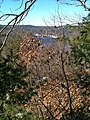
 Amity from Blue Blaze Tail, Hamden, CT (53309658801).jpg 4,192 × 1,987; 1.95 MB
-
 Amity from Blue Blaze Tail, Hamden, CT (53309658826).jpg 4,192 × 1,987; 2.32 MB
-
 Amity from Blue Blaze Tail, Hamden, CT (53310017509).jpg 4,032 × 1,908; 2.61 MB
-
 Amity from Blue Blaze Tail, Hamden, CT (53310134300).jpg 4,608 × 2,184; 2.88 MB
-
 Baldwin Drive, Hamden, Connecticut (53308793627).jpg 2,184 × 4,608; 8.43 MB
-
 BBHTKettletownMillerTrail.jpg 1,536 × 2,048; 2 MB
-
 BBHTZoarTrailPryddenFalls1.jpg 2,048 × 1,536; 1.87 MB
-
 BBHTZoarTrailPryddenFalls2.jpg 1,536 × 2,048; 1.98 MB
-
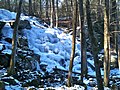
 BeaconCapGlacialErraticBoulder.JPG 2,048 × 1,536; 1.8 MB
-
-
 Edgewood Park, New Haven (53225120966).jpg 4,608 × 2,592; 9.92 MB
-
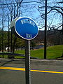
 Entrance to Ives Trail.jpg 2,448 × 3,264; 2.99 MB
-
 HousatonicRiverScenicViewSpurPaugussettTrail2.JPG 2,048 × 1,536; 1.87 MB
-
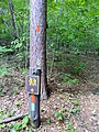
 Ives Trail Marker.JPG 3,264 × 2,448; 3.29 MB
-
 Ives Trail Spur Marker.jpg 2,448 × 3,264; 2.84 MB
-
 Ives Trail Spur Markers.jpg 2,448 × 3,264; 3.49 MB
-
 Lake Chamberlin Trails (53593081617).jpg 8,160 × 3,768; 12.33 MB
-
 Lake Watrous10-28-07.jpg 2,592 × 1,944; 389 KB
-
 NaugatuckTrailheadSign.jpg 1,536 × 2,048; 1.78 MB
-
 NaugatuckTrailNaugatuckStateForestBeaconFallsCT-CTRoute8Border.jpg 2,048 × 1,536; 1.93 MB
-
 Nehantic Trail and Pachaug Trail eastern fork split.jpg 1,936 × 2,592; 3.1 MB
-
 Nehantic Trail and Pachaug Trail western fork split.jpg 2,592 × 1,936; 2.68 MB
-
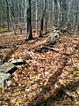
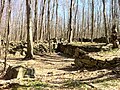 NipmuckTrailStoneFoundationRuins.jpg 2,592 × 1,936; 2.77 MB
-
 PaugussettTrailheadSign.jpg 1,539 × 980; 1,000 KB
-
 PowerLineCutWebbMountainPaugussettTrail.JPG 1,536 × 2,048; 1.63 MB
-
 RailroadTracksLakeZoarPaugussettTrail.JPG 2,048 × 1,536; 2.18 MB
-
 RoaringBrookFalls.jpg 5,184 × 3,456; 10.1 MB
-
 Rocky Top Preserve - Hamden, CT (53648253397).jpg 8,160 × 3,768; 15.54 MB
-
 RoundHillBrookWebbMountainPaugussettTrail.JPG 2,048 × 1,536; 2.02 MB
-
 StileInFieldOnJohnnycakeMtn.JPG 1,660 × 1,055; 327 KB
-
 Still River Greenway.jpg 3,729 × 2,098; 2.46 MB
-
 TunxisCompounceCascadeTrailCussgutterBrook.JPG 2,048 × 1,536; 1.27 MB
-
 West Rock (53225135341).jpg 2,592 × 4,608; 9.74 MB
-
 West Rock (53225446268).jpg 2,268 × 4,032; 9.39 MB
-
 WhittemoreSideTrailNaugatuckStateForestBethanyCT-MtLaurelPath.jpg 1,536 × 2,048; 2.13 MB
-
 WhittemoreSideTrailNaugatuckStateForestBethanyCT-StoneFence.jpg 1,536 × 2,048; 2.25 MB
-
 WhittemoreTrailheadSign.jpg 1,536 × 2,048; 1.62 MB
-
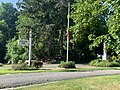 Williams Park Entrance.jpg 4,032 × 3,024; 3.39 MB
.jpg)
.jpg)
.jpg)
.jpg)
.jpg)


.jpg)


.jpg)


.jpg)


.jpg)
.jpg)


