Category:Hiking trails in Colorado
Jump to navigation
Jump to search
States of the United States: Alaska · Arizona · California · Colorado · Connecticut · Delaware · Florida · Georgia · Hawaii · Idaho · Illinois · Indiana · Iowa · Kansas · Kentucky · Maine · Maryland · Massachusetts · Michigan · Minnesota · Mississippi · Missouri · Montana · Nebraska · Nevada · New Hampshire · New Jersey · New Mexico · New York · North Carolina · North Dakota · Ohio · Oregon · Pennsylvania · Rhode Island · South Carolina · Tennessee · Texas · Utah · Vermont · Virginia · Washington · West Virginia · Wisconsin · Wyoming
Wikimedia category | |||||
| Upload media | |||||
| Instance of | |||||
|---|---|---|---|---|---|
| Category combines topics | |||||
| Colorado | |||||
state of the United States of America   .jpg)    | |||||
| Pronunciation audio | |||||
| Instance of | |||||
| Part of |
| ||||
| Named after | |||||
| Location |
| ||||
| Located in or next to body of water | |||||
| Capital | |||||
| Legislative body | |||||
| Executive body | |||||
| Highest judicial authority | |||||
| Official language | |||||
| Anthem |
| ||||
| Head of government |
| ||||
| Inception |
| ||||
| Highest point | |||||
| Population |
| ||||
| Area |
| ||||
| Elevation above sea level |
| ||||
| Replaces | |||||
| Different from | |||||
| Maximum temperature record |
| ||||
| Minimum temperature record |
| ||||
| official website | |||||
 | |||||
Subcategories
This category has the following 29 subcategories, out of 29 total.
A
- American Basin Trail (8 F)
- Apex Trail (Colorado) (2 F)
C
- Canyon Rim Trail (15 F)
D
- Dodgeton Trail 1302 (1 F)
E
- East Inlet Trail (4 F)
- East Longs Peak Trail (2 F)
F
- Fern Lake Trail (5 F)
- Flattop Mountain Trail (17 F)
G
- Grays Peak Trail (10 F)
H
- Hike to Arapaho Glacier (8 F)
I
- Indian Trail No. 1300 (2 F)
L
- Lake Haiyaha Trail (1 F)
- Lower Dadd Gulch Trail (17 F)
M
- Manitou Incline (6 F)
- Mount McConnell Trail (10 F)
P
- Pikes Peak Greenway (12 F)
S
- Serpents Trail (5 F)
T
W
- Wahatoya Trail (4 F)
Media in category "Hiking trails in Colorado"
The following 95 files are in this category, out of 95 total.
-
 Bison Peak GPS Track.jpg 2,000 × 2,000; 1.27 MB
-
 CrossCr101410sm1.jpg 1,024 × 685; 571 KB
-
 Cub Lake Trail.JPG 2,048 × 1,536; 439 KB
-
 Cub Lake Trail2.JPG 2,048 × 1,536; 204 KB
-
 Cub Lake Trail3.JPG 2,048 × 1,536; 291 KB
-
 Cub Lake Trail4.JPG 2,048 × 1,536; 474 KB
-
 Cub Lake Trail5.JPG 1,536 × 2,048; 456 KB
-
 Cuerno Verde Trail.JPG 3,164 × 2,215; 4.35 MB
-
 Dike Trail no. 1389.JPG 4,720 × 3,297; 15.72 MB
-
 Dog hiking in Manitou Springs.jpg 3,264 × 2,448; 1.45 MB
-
 Dream Lake Trail (9449409513).jpg 3,648 × 2,736; 2.22 MB
-
 Fall colors, Poudre Canyon.jpg 3,264 × 2,448; 3.41 MB
-
 First Look Trail at Fishers Peak State Park.JPG 5,150 × 3,837; 14.09 MB
-
 Fishers Peak State Park trail.JPG 6,000 × 4,000; 9.97 MB
-
 Flat Tops trail.jpg 1,600 × 1,200; 994 KB
-
 Flattop Mountain and trail.jpg 2,816 × 2,112; 2.53 MB
-
 Georgetown Lake (Colorado).JPG 5,840 × 3,720; 17.28 MB
-
 Grays and Torreys GPS Track.jpg 2,000 × 2,000; 1.68 MB
-
 Greenland Trail, north trailhead.JPG 5,737 × 2,988; 13.01 MB
-
 Handies Peak WSA (9464712075).jpg 5,616 × 3,744; 20.38 MB
-
 Handies Peak WSA (9467472864).jpg 5,616 × 3,744; 17.27 MB
-
 Handies Peak WSA (9467479288).jpg 5,454 × 3,636; 18.44 MB
-
 Handies Peak WSA (9467518106).jpg 5,616 × 3,744; 19.18 MB
-
 Handies Peak WSA (9467554118).jpg 5,616 × 3,744; 17.99 MB
-
 Handies Peak WSA (9467591186).jpg 5,616 × 3,744; 22.04 MB
-
 Handies Peak WSA (9467649390).jpg 5,552 × 3,701; 16.26 MB
-
 Hiking at Sky Ranch 1.jpg 2,592 × 1,944; 3.31 MB
-
 Hiking at Sky Ranch 2.jpg 2,592 × 1,944; 2.51 MB
-
 Hiking trail at Clinton Gulch Dam Reservoir.JPG 5,317 × 3,158; 11.38 MB
-
 Hiking trail in the Ice Lake Basin.jpg 3,872 × 2,592; 5.88 MB
-
 Hiking trail up Mt. Bierstadt.jpg 1,024 × 768; 1.01 MB
-
 Historic Gilpin Tramway trail.JPG 5,720 × 3,268; 18.83 MB
-
 Horsetooth mtn4.jpg 2,160 × 3,840; 3.35 MB
-
 Horsetooth mtn5.jpg 3,024 × 4,032; 4.49 MB
-
 Horsetooth mtn6.jpg 3,679 × 2,812; 2.59 MB
-
 Keyhole.jpg 1,169 × 787; 221 KB
-
 Leadville National Fish Hatchery (4857054851).jpg 4,416 × 3,312; 3.17 MB
-
 Leadville National Fish Hatchery (4857056917).jpg 4,416 × 3,312; 2.81 MB
-
 Leadville National Fish Hatchery (4857081567).jpg 4,416 × 3,312; 3.86 MB
-
 Leadville National Fish Hatchery (4857669086).jpg 4,416 × 3,312; 3.45 MB
-
 Leadville National Fish Hatchery (4857671452).jpg 4,416 × 3,312; 3.44 MB
-
 Leadville National Fish Hatchery (4857686660).jpg 4,416 × 3,312; 2.98 MB
-
 Leadville National Fish Hatchery (4857693440).jpg 4,416 × 3,312; 3.58 MB
-
 Manitou Lake Picnic Area.JPG 5,274 × 2,725; 10.15 MB
-
 Missouri Mountain GPS Track.jpg 2,000 × 2,000; 1.61 MB
-
 Montgomery Pass Trail (6149079590).jpg 5,184 × 3,456; 4.94 MB
-
 Mosca Pass.JPG 3,889 × 2,748; 8.29 MB
-
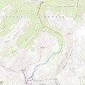
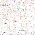 Mt Democrat GPS Track.jpg 2,000 × 2,000; 762 KB
-
 Mt Huron and La Plata Peak GPS Track.jpg 2,000 × 2,000; 1.47 MB
-
 Mt Sherman GPS Track.jpg 2,000 × 2,000; 865 KB
-
 Mt. Antero GPS Track.jpg 2,000 × 2,000; 1.58 MB
-
 Mushroom rocks at RMNP IMG 5268.JPG 4,000 × 3,000; 2.24 MB
-
 Nolan072607-34.jpg 1,024 × 685; 518 KB
-
 Overlook trail in Rito Seco Park 2.JPG 4,925 × 4,000; 19.2 MB
-
 Overlook trail in Rito Seco Park.JPG 4,531 × 2,782; 12.24 MB
-
 Overlook Trail trailhead area.JPG 5,103 × 2,771; 12.36 MB
-
 Penitente Canyon Recreation Area trail.JPG 5,634 × 3,880; 15.35 MB
-
 Poudre Canyon, Greyrock trail.jpg 3,264 × 2,448; 2.17 MB
-
 Quandry Peak GPS Track.jpg 2,000 × 777; 526 KB
-
 Red Cloud Peak WSA (9470367663).jpg 3,744 × 5,616; 21.02 MB
-
 Red Cloud Peak WSA (9470419585).jpg 5,616 × 3,744; 19.75 MB
-
 Red Cloud Peak WSA (9473378954).jpg 5,616 × 3,744; 22.97 MB
-
 Reservoir Trail trailhead.JPG 5,458 × 3,577; 16.51 MB
-
 Rito Seco Park hiking trail bridge.JPG 4,000 × 5,237; 17.76 MB
-
 Rocky Mount N.P., Lake Irene 8-28-12 (8087110517).jpg 1,215 × 1,600; 704 KB
-
 San Juan Skyway - Path at Leopard Creek - NARA - 7721490.jpg 1,167 × 766; 914 KB
-
 Sanjuan14ers-8.jpg 6,000 × 4,000; 27.13 MB
-
 Sawtooth GPS Track.jpg 2,000 × 901; 677 KB
-
 Secret Trail (10997936296).jpg 1,200 × 1,600; 1.75 MB
-
 Snow-Covered Trails (15425871931).jpg 4,288 × 2,848; 5.56 MB
-
 South Boulder Peak and Bear Peak GPS Track.jpg 2,000 × 1,388; 858 KB
-
 Spanish Peaks Wilderness.JPG 3,663 × 3,544; 7.07 MB
-
 Spring Creek Trailhead sign.JPG 2,695 × 3,240; 1.27 MB
-
 St. Vrain State Park.JPG 5,666 × 3,394; 15.17 MB
-
 Storm King Mountain Memorial Trail.JPG 5,331 × 4,000; 13.48 MB
-
 The Shaft House of the Lost Park Reservoir Ruins in Lost Creek Wilderness Colorado.JPG 2,848 × 2,134; 1.04 MB
-
 Tom Bennhoff Lake Trail.JPG 5,857 × 3,342; 21.6 MB
-
 Trail at Rock Park, Castle Rock, CO IMG 5207.JPG 4,000 × 3,000; 4.87 MB
-
 Trail Marker (10998115656).jpg 1,944 × 2,592; 1.96 MB
-
 Trail on the way to Grizzly Peak.jpg 3,008 × 2,000; 3.09 MB
-
 Two Ponds Trail B&W (14844613392).jpg 1,536 × 2,048; 908 KB
-
 Wilder Gulch Trail (6128749643).jpg 5,184 × 3,456; 3.5 MB
-
 Wilder Gulch Trail (6128750607).jpg 2,509 × 3,452; 1.36 MB
-
 Wilder Gulch Trail (6128750865).jpg 3,787 × 2,525; 1.63 MB
-
 Wilder Gulch Trail (6128752477).jpg 3,456 × 5,184; 3.17 MB
-
 Wilder Gulch Trail (6128753813).jpg 3,456 × 5,184; 3.09 MB
-
 Wilder Gulch Trail (6128755105).jpg 5,184 × 3,456; 3.09 MB
-
 Wilder Gulch Trail (6129300474).jpg 5,184 × 3,456; 4.37 MB
-
 Wilder Gulch Trail (6129300694).jpg 3,299 × 2,200; 1.45 MB
-
 Wilder Gulch Trail (6129301520).jpg 3,456 × 5,184; 3.05 MB
-
 Wilder Gulch Trail (6129302324).jpg 2,854 × 4,280; 5.76 MB
-
 Wilder Gulch Trail (6129305128).jpg 3,456 × 5,184; 6.47 MB
-
 Wilder Gulch Trail (6129306140).jpg 5,184 × 3,456; 4.8 MB
-
 Wilder Gulch Trail (6129306722).jpg 5,184 × 3,456; 4.83 MB
-
 Wilson Trail Crossing sign.JPG 4,204 × 3,230; 10.92 MB


.jpg)


.JPG)


.jpg)
.jpg)
.jpg)
.jpg)
.jpg)
.jpg)
.jpg)


.jpg)
.jpg)
.jpg)
.jpg)
.jpg)
.jpg)
.jpg)


.jpg)


.jpg)
.jpg)
.jpg)


.jpg)


.jpg)
.jpg)


.jpg)

.jpg)
.jpg)
.jpg)
.jpg)
.jpg)
.jpg)
.jpg)
.jpg)
.jpg)
.jpg)
.jpg)
.jpg)
.jpg)
.jpg)
