Category:Healy Pass, County Cork
Jump to navigation
Jump to search
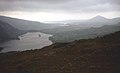
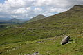
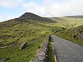
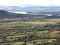
English: The R574 is an Irish regional road in the Beara peninsula which crosses the Caha Mountains via the (Tim) Healy Pass. It is a popular tourist route with the pass at an altitude of 300m giving panoramas towards Bantry Bay to the south-east and the Kenmare River to the north-west.
Media in category "Healy Pass, County Cork"
The following 52 files are in this category, out of 52 total.
-
 'CHRIST DIED FOR OUR SINS' - geograph.org.uk - 1722779.jpg 1,024 × 761; 89 KB
-
 Beara Peninsula Healy Pass 1996 08 14.jpg 3,044 × 2,048; 829 KB
-
 Beara Peninsula T-Junction L62 Road to Healy Pass 1987 08 17.jpg 3,340 × 2,160; 7.68 MB
-
 Bottom of the Healy Pass - geograph.org.uk - 1099464.jpg 632 × 409; 56 KB
-
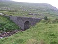 Bridge on the Tim Healy Pass - geograph.org.uk - 1380762.jpg 640 × 480; 88 KB
-
 Bridge on the Tim Healy Pass - geograph.org.uk - 1380791.jpg 640 × 480; 96 KB
-
 Clashduv - geograph.org.uk - 262658.jpg 640 × 480; 80 KB
-
 Clougherane - geograph.org.uk - 263398.jpg 640 × 480; 103 KB
-

-
 Coolcreen - geograph.org.uk - 286143.jpg 640 × 480; 76 KB
-

-
 Glanmore Lake - geograph.org.uk - 155097.jpg 640 × 480; 96 KB
-
 Glanmore Lake from Healy Pass - 1960 - geograph.org.uk - 1722796.jpg 1,024 × 761; 115 KB
-
 Glanmore Lake viewed from the Healy Pass - geograph.org.uk - 486289.jpg 640 × 426; 108 KB
-
 Hairpin on the Healy Pass - geograph.org.uk - 1404851.jpg 640 × 480; 229 KB
-
 Healy Pass - geograph.org.uk - 1404854.jpg 640 × 480; 232 KB
-
 Healy Pass - geograph.org.uk - 262660.jpg 640 × 480; 104 KB
-
 Healy Pass - geograph.org.uk - 263389.jpg 640 × 480; 110 KB
-
 Healy Pass - geograph.org.uk - 263391.jpg 640 × 480; 111 KB
-
 Healy Pass - geograph.org.uk - 263392.jpg 640 × 480; 89 KB
-
 Healy Pass - geograph.org.uk - 286136.jpg 640 × 480; 103 KB
-
 Healy Pass - geograph.org.uk - 3249.jpg 445 × 640; 36 KB
-
 Healy Pass and Glanmore Lake - geograph.org.uk - 1214622.jpg 640 × 392; 39 KB
-
 Healy Pass on Bere Peninsula - geograph.org.uk - 155081.jpg 640 × 480; 117 KB
-
 Healy Pass-12-Haus-1989-gje.jpg 2,672 × 1,767; 2 MB
-
 Healy Pass-14-Landschaft-1989-gje.jpg 2,717 × 1,763; 2.06 MB
-
 Healy Pass-16-Landschaft-Binsen-1989-gje.jpg 2,717 × 1,803; 2.29 MB
-
 Healy Pass-18-Schaf-1989-gje.jpg 2,679 × 1,617; 1.96 MB
-
 Healy Pass-20-Glanmore-See-1989-gje.jpg 2,595 × 1,655; 1.93 MB
-
 Healy Pass-22-Glanmore-See-1989-gje.jpg 2,569 × 1,691; 1.72 MB
-
 Healy's Pass - 1960 - geograph.org.uk - 1722369.jpg 1,024 × 761; 132 KB
-
 Healy's Pass, looking back to Adrigole - geograph.org.uk - 1722389.jpg 1,024 × 761; 112 KB
-
 Healy's Pass, looking towards Adrigole - geograph.org.uk - 1722378.jpg 1,024 × 761; 115 KB
-
 Hillside below the Healy Pass (2) - geograph.org.uk - 1403269.jpg 640 × 480; 163 KB
-
 Hillside below the Healy Pass - geograph.org.uk - 263393.jpg 640 × 480; 87 KB
-
 IERLAND SCHOTLAND 2004 115 (5977495852).jpg 3,264 × 2,176; 1,000 KB
-
 IERLAND SCHOTLAND 2004 116 (5977258313).jpg 3,264 × 2,176; 3.38 MB
-
 Knockastumpa - geograph.org.uk - 263399.jpg 640 × 480; 125 KB
-
 Looking north from Healy Pass - 1960 - geograph.org.uk - 1722786.jpg 1,024 × 761; 127 KB
-
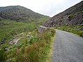
 Road descending from the Healy Pass - geograph.org.uk - 486301.jpg 640 × 426; 120 KB
-
 S-bend on the Healy Pass - geograph.org.uk - 486262.jpg 640 × 426; 108 KB
-
 Shrine at top of Healy Pass - geograph.org.uk - 1404840.jpg 480 × 640; 194 KB
-
 Shrine on the Healy Pass - geograph.org.uk - 486225.jpg 426 × 640; 94 KB
-
-
 The Healy Pass - geograph.org.uk - 486244.jpg 640 × 426; 129 KB
-
 The Healy Pass - geograph.org.uk - 486253.jpg 640 × 426; 113 KB
-
 The Healy Pass - geograph.org.uk - 499050.jpg 640 × 480; 141 KB
-
 The Healy Pass Summit - geograph.org.uk - 499041.jpg 640 × 480; 172 KB
-
-
-
 View north from the Healy Pass - geograph.org.uk - 486283.jpg 640 × 426; 103 KB
-
 View of Glanmore Lake from Healy Pass - geograph.org.uk - 499060.jpg 640 × 480; 142 KB


_-_geograph.org.uk_-_1403269.jpg)

.jpg)
.jpg)


