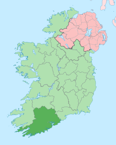
Category:Roads in County Cork
Jump to navigation
Jump to search
Counties of the Republic of Ireland: Carlow · Cavan · Clare · Cork(1) · Donegal · Galway(3) · Kerry · Kildare · Kilkenny · Laois · Leitrim · Louth · Mayo · Meath · Monaghan · Roscommon · Sligo · Tipperary(4) · Westmeath · Wicklow – Separate cities: Cork(1) · Dublin(2) · Galway(3) – Former counties: Former counties of Northern Ireland: Antrim · Armagh ·
Wikimedia category | |||||
| Upload media | |||||
| Instance of | |||||
|---|---|---|---|---|---|
| Category combines topics | |||||
| County Cork | |||||
county in Ireland | |||||
| Instance of | |||||
| Location | Munster, Ireland | ||||
| Capital | |||||
| Legislative body |
| ||||
| Executive body |
| ||||
| Official language | |||||
| Population |
| ||||
| Area |
| ||||
| official website | |||||
 | |||||
Subcategories
This category has the following 11 subcategories, out of 11 total.
D
H
- Healy Pass, County Cork (52 F)
J
- Jack Lynch Tunnel (5 F)
N
- N20 road (Ireland) (10 F)
- N22 road (Ireland) (6 F)
R
- R512 road (Ireland) (3 F)
- R513 road (Ireland) (2 F)
- R601 road (Ireland) (2 F)
- R624 road (Ireland) (14 F)
T
Media in category "Roads in County Cork"
The following 200 files are in this category, out of 393 total.
(previous page) (next page)-
A fine hedge - geograph.org.uk - 2113693.jpg 640 × 480; 131 KB
-
A narrow lane, Glengarriff - geograph.org.uk - 263367.jpg 640 × 480; 95 KB
-
A plaque by the road - geograph.org.uk - 2112428.jpg 640 × 480; 141 KB
-
A rural crossroads - geograph.org.uk - 2915474.jpg 1,024 × 768; 197 KB
-
A straight(ish) road - geograph.org.uk - 2116890.jpg 640 × 480; 127 KB
-
A very narrow road - geograph.org.uk - 3551808.jpg 800 × 600; 213 KB
-
A very wide junction - geograph.org.uk - 3551727.jpg 800 × 600; 155 KB
-
Almost a crossroads - geograph.org.uk - 2917817.jpg 1,024 × 768; 179 KB
-
Almost a traffic island - geograph.org.uk - 3551875.jpg 800 × 600; 189 KB
-
Along the R586 - geograph.org.uk - 2917769.jpg 1,024 × 768; 256 KB
-
Along the road - geograph.org.uk - 3549376.jpg 800 × 600; 203 KB
-
An interested cow - geograph.org.uk - 2116931.jpg 640 × 480; 195 KB
-
An Irish crossroads - geograph.org.uk - 3550800.jpg 800 × 600; 140 KB
-
An L-road - geograph.org.uk - 3549427.jpg 800 × 600; 202 KB
-
An odd arrangement of roads - geograph.org.uk - 2913550.jpg 640 × 480; 98 KB
-
Another Irish minor road through farmland - geograph.org.uk - 2917902.jpg 1,024 × 768; 284 KB
-
Another junction on the N71 - geograph.org.uk - 2917639.jpg 1,024 × 768; 248 KB
-
Another silly speed limit - geograph.org.uk - 2917788.jpg 1,024 × 768; 301 KB
-
Approaching Airport Road Roundabout - geograph.org.uk - 666916.jpg 640 × 480; 64 KB
-
Back to the R637 - geograph.org.uk - 2917703.jpg 1,024 × 768; 261 KB
-
Ballincolla, Co. Cork, Ireland - panoramio.jpg 3,072 × 2,304; 3.16 MB
-
Ballincollig Technology Park - geograph.org.uk - 989509.jpg 640 × 480; 72 KB
-
Ballyhooly, County Cork - geograph.org.uk - 1796444.jpg 3,579 × 1,938; 4.04 MB
-
Beara Way - geograph.org.uk - 263659.jpg 640 × 480; 99 KB
-
Beara Way - geograph.org.uk - 263663.jpg 640 × 480; 119 KB
-
Between the hedges - geograph.org.uk - 2112385.jpg 640 × 480; 120 KB
-
Bofickil, Minor road to Eyeries - geograph.org.uk - 267052.jpg 640 × 480; 88 KB
-
Bosky road - geograph.org.uk - 2917864.jpg 1,024 × 768; 344 KB
-
Bridge pilaster on disused road bridge - geograph.org.uk - 1396051.jpg 480 × 640; 311 KB
-
Broomfield Lane - geograph.org.uk - 4910468.jpg 640 × 480; 175 KB
-
Broomfield Lane north of Midleton - geograph.org.uk - 4910502.jpg 640 × 480; 171 KB
-
Broomfield Lane, Midleton - geograph.org.uk - 4910476.jpg 640 × 480; 195 KB
-
Broomfield Lane, North of Midleton - geograph.org.uk - 4910504.jpg 640 × 480; 182 KB
-
Bus Turning Area, Donnybrook - geograph.org.uk - 757616.jpg 640 × 480; 60 KB
-
Bus Éireann bus stop.jpg 3,456 × 4,608; 6.5 MB
-
By The Road To Ardgroom - geograph.org.uk - 456827.jpg 640 × 473; 122 KB
-
Cahergal Junction - geograph.org.uk - 1843863.jpg 3,448 × 2,292; 1.7 MB
-
Cahoo Cross Roads - geograph.org.uk - 2112394.jpg 640 × 480; 135 KB
-
Canalmore - geograph.org.uk - 263729.jpg 640 × 480; 91 KB
-
Carbery Oils - geograph.org.uk - 3551625.jpg 800 × 600; 185 KB
-
Carrigaline Road - geograph.org.uk - 757678.jpg 640 × 480; 104 KB
-
Casey's Bar - geograph.org.uk - 1564868.jpg 640 × 427; 65 KB
-
Church Road - geograph.org.uk - 4656952.jpg 3,876 × 2,472; 4.99 MB
-
Cleanderry - geograph.org.uk - 267961.jpg 640 × 480; 114 KB
-
Clear run - geograph.org.uk - 2116580.jpg 640 × 480; 155 KB
-
Clonakilty Harbour - geograph.org.uk - 2112411.jpg 640 × 480; 128 KB
-
Coastal road on Bearra Peninsula - geograph.org.uk - 1403107.jpg 640 × 480; 169 KB
-
Cork South Ring Flyover 2.JPG 2,560 × 1,920; 1.06 MB
-
Cottage - Glennageare East Townland - geograph.org.uk - 1898211.jpg 640 × 480; 88 KB
-
Cottage at Tooreennasillane - geograph.org.uk - 2917682.jpg 1,024 × 768; 216 KB
-
Country road - geograph.org.uk - 2833429.jpg 640 × 480; 55 KB
-
Country road in County Cork - geograph.org.uk - 2773538.jpg 640 × 480; 100 KB
-
Country road in West Co. Cork - geograph.org.uk - 2832878.jpg 640 × 480; 103 KB
-
Country road junction - geograph.org.uk - 2857997.jpg 640 × 480; 47 KB
-
Country road leaving Knockburden - geograph.org.uk - 4862990.jpg 1,600 × 1,200; 410 KB
-
Country road near Balinlining - geograph.org.uk - 4890920.jpg 1,600 × 1,200; 450 KB
-
Country road near Ballinacurra - geograph.org.uk - 4867357.jpg 1,600 × 1,200; 254 KB
-
Country road near Ballinhassig - geograph.org.uk - 3117784.jpg 1,024 × 768; 162 KB
-
Country road near Cork Airport - geograph.org.uk - 3117939.jpg 1,024 × 768; 196 KB
-
Country road near Cross Barry - geograph.org.uk - 4860557.jpg 1,600 × 1,200; 367 KB
-
Country road near Kilnagnangy - geograph.org.uk - 4867364.jpg 1,600 × 1,200; 458 KB
-
Country road near Knockgorm - geograph.org.uk - 4533873.jpg 1,200 × 742; 154 KB
-
Country road near Raheens Heast - geograph.org.uk - 4917893.jpg 800 × 447; 89 KB
-
Country road near Tisaxon, west of Kinsale - geograph.org.uk - 4533750.jpg 1,200 × 741; 201 KB
-
Country road not far from Ballinhassig - geograph.org.uk - 2871169.jpg 640 × 480; 124 KB
-
Country road south of the Airport - geograph.org.uk - 4001345.jpg 1,024 × 576; 230 KB
-
County Cork, the road (342193590).jpg 1,200 × 798; 593 KB
-
Cow Sign at the Top of Scairt Hill - geograph.org.uk - 757573.jpg 640 × 480; 67 KB
-
Cows in the distance - geograph.org.uk - 2116605.jpg 640 × 480; 118 KB
-
Cross roads, overlooking Ballygarvan - geograph.org.uk - 2871262.jpg 640 × 480; 60 KB
-
Crossroads at Memorial Cross - geograph.org.uk - 4862930.jpg 1,600 × 1,200; 532 KB
-
Crossroads just north of Carrigaline - geograph.org.uk - 4868722.jpg 1,600 × 989; 287 KB
-
Crossroads near Gortnaclogh - geograph.org.uk - 4857303.jpg 1,024 × 768; 203 KB
-
Cullen Cross Roads - geograph.org.uk - 2773514.jpg 640 × 480; 48 KB
-
Disused farmhouse near Coolea - geograph.org.uk - 1379503.jpg 640 × 480; 88 KB
-
Don't people care^ - geograph.org.uk - 2917783.jpg 1,024 × 768; 321 KB
-
Donnybrook Commercial Centre - geograph.org.uk - 757646.jpg 640 × 480; 75 KB
-
Douglas Road, Cork - geograph.org.uk - 594250.jpg 640 × 521; 106 KB
-
Down Cooney's Road - geograph.org.uk - 757693.jpg 480 × 640; 116 KB
-
Drainage ditch - geograph.org.uk - 2917809.jpg 1,024 × 768; 235 KB
-
Driving - geograph.org.uk - 235851.jpg 640 × 480; 76 KB
-
Dursey road - geograph.org.uk - 283427.jpg 640 × 480; 86 KB
-
E-30 euroroute IE.png 270 × 150; 5 KB
-
Eastbound N25 near Gortroe Cross - geograph.org.uk - 6053522.jpg 800 × 533; 591 KB
-
Eastbound N25 near to Churchtown - geograph.org.uk - 6052852.jpg 800 × 533; 482 KB
-
Eccles Hotel - geograph.org.uk - 1752838.jpg 3,456 × 2,304; 1.53 MB
-
Facilities on the roundabout - geograph.org.uk - 2111491.jpg 640 × 480; 122 KB
-
Farm access road near Ballinvarosig - geograph.org.uk - 4890940.jpg 1,600 × 1,200; 564 KB
-
Farm access track - geograph.org.uk - 4861887.jpg 1,600 × 1,200; 549 KB
-
Farm buildings as seen from a rural road - geograph.org.uk - 4860700.jpg 1,600 × 989; 224 KB
-
Farm driveway in Ballynidon - geograph.org.uk - 4533766.jpg 1,200 × 744; 217 KB
-
Farm entrance near Carrigaline - geograph.org.uk - 5042728.jpg 1,024 × 768; 277 KB
-
Farm on the Cod's Head - geograph.org.uk - 1403090.jpg 640 × 480; 217 KB
-
Farm track - geograph.org.uk - 3556652.jpg 640 × 361; 85 KB
-
Farm track at Doonavanig - geograph.org.uk - 5431236.jpg 1,024 × 768; 177 KB
-
Farm track at Rag Bridge - geograph.org.uk - 5811378.jpg 1,024 × 768; 139 KB
-
Farm track below Musheramore - geograph.org.uk - 5814356.jpg 1,024 × 768; 294 KB
-
Farm track east of Clondulane - geograph.org.uk - 4085377.jpg 2,592 × 1,944; 1.66 MB
-
Farm track near Ballywilliam - geograph.org.uk - 5432627.jpg 1,024 × 768; 222 KB
-
Farm track near Bridgetown Priory - geograph.org.uk - 6277350.jpg 1,024 × 768; 172 KB
-
Farm track near Carrigaline - geograph.org.uk - 5002834.jpg 1,024 × 768; 219 KB
-
Farm track near Cloyne - geograph.org.uk - 5432775.jpg 1,024 × 768; 347 KB
-
Farm track near Knocknalurgan - geograph.org.uk - 4890935.jpg 1,600 × 1,200; 553 KB
-
Farm track near Poulanargid - geograph.org.uk - 5436612.jpg 1,024 × 768; 222 KB
-
Farm track near Shronebeha - geograph.org.uk - 6274622.jpg 1,024 × 768; 212 KB
-
Farm track north west of minor road - geograph.org.uk - 5132398.jpg 2,000 × 1,333; 1,018 KB
-
Farm track south east of minor road - geograph.org.uk - 5132408.jpg 2,000 × 1,333; 993 KB
-
Farm track, Annahala West - geograph.org.uk - 5814225.jpg 1,024 × 768; 367 KB
-
Farm Track, Old Head of Kinsale - geograph.org.uk - 5146072.jpg 2,000 × 1,333; 1.48 MB
-
Farms on the Coolea road - geograph.org.uk - 1379553.jpg 640 × 480; 84 KB
-
Fermoy Bypass 1 March 2008.JPG 4,000 × 3,000; 2.85 MB
-
Fermoy Bypass junction 16.jpg 1,024 × 768; 159 KB
-
FermoyBypass.JPG 3,888 × 2,592; 5.82 MB
-
Fly the flag - geograph.org.uk - 2116667.jpg 640 × 480; 146 KB
-
Foildarrig - geograph.org.uk - 264315.jpg 640 × 480; 125 KB
-
Footpath at the Gearagh - geograph.org.uk - 483698.jpg 640 × 426; 153 KB
-
Forest trackway - geograph.org.uk - 2922832.jpg 1,024 × 768; 384 KB
-
Forest trackway - geograph.org.uk - 2922850.jpg 1,024 × 768; 265 KB
-
Forest trackway, looking north - geograph.org.uk - 2922855.jpg 1,024 × 768; 169 KB
-
Fork in Road - geograph.org.uk - 760119.jpg 640 × 480; 83 KB
-
Fork in the road - geograph.org.uk - 3549419.jpg 800 × 600; 188 KB
-
Garranefeen Strand - geograph.org.uk - 5146043.jpg 2,000 × 1,333; 1,012 KB
-
Garranefeen Strand - geograph.org.uk - 5158081.jpg 2,000 × 1,333; 1.42 MB
-
Glanalin Road - geograph.org.uk - 1843029.jpg 3,456 × 2,304; 1.53 MB
-
Glanmire north.JPG 4,000 × 3,000; 2.8 MB
-
Glen Road - geograph.org.uk - 1427245.jpg 640 × 360; 70 KB
-
Glenbeg - geograph.org.uk - 263782.jpg 640 × 480; 93 KB
-
Gortgarriff - geograph.org.uk - 268104.jpg 640 × 480; 117 KB
-
Grange Road - geograph.org.uk - 760164.jpg 640 × 480; 70 KB
-
Heading North to Ballincollig - geograph.org.uk - 994336.jpg 480 × 640; 115 KB
-
Hedged Road - geograph.org.uk - 1844015.jpg 3,396 × 2,210; 1.62 MB
-
Hikers at junction - geograph.org.uk - 816965.jpg 640 × 426; 88 KB
-
House beyond the crossroads - geograph.org.uk - 3550815.jpg 800 × 600; 173 KB
-
House by a crossroads - geograph.org.uk - 2919158.jpg 1,024 × 768; 254 KB
-
Houses in the distance - geograph.org.uk - 3551645.jpg 800 × 600; 212 KB
-
IMG R639Fermoy5656w.jpg 2,359 × 1,659; 1.41 MB
-
Into the distance - geograph.org.uk - 2116962.jpg 640 × 480; 158 KB
-
Irish country lane - geograph.org.uk - 3551619.jpg 800 × 600; 182 KB
-
Irish country road - geograph.org.uk - 5518652.jpg 1,600 × 1,200; 550 KB
-
Junction in Churchtown - geograph.org.uk - 2821560.jpg 640 × 480; 57 KB
-
Junction on Road to Togher - geograph.org.uk - 667531.jpg 640 × 480; 73 KB
-
Kilcatherine, Beara Way Cycle Route - geograph.org.uk - 268074.jpg 640 × 480; 105 KB
-
Kilcatherine, Beara Way Cycle Route - geograph.org.uk - 268078.jpg 640 × 480; 97 KB
-
Kilcatherine, Beara Way Cycle Route - geograph.org.uk - 268080.jpg 640 × 480; 112 KB
-
Kildorrery N73 road. - geograph.org.uk - 1562384.jpg 640 × 425; 72 KB
-
Kildorrery3.JPG 3,888 × 2,592; 1.67 MB
-
Kroz Irsku 5. kolovoza 2024.jpg 3,060 × 4,080; 3.5 MB
-
Kroz Irsku 5.8.2024.jpg 3,060 × 4,080; 3.76 MB
-
Laharan - geograph.org.uk - 270898.jpg 640 × 480; 91 KB
-
Land behind Barley Cove - geograph.org.uk - 3566302.jpg 640 × 427; 203 KB
-
Lane at Barnageehy - geograph.org.uk - 3556186.jpg 640 × 427; 239 KB
-
Lane at Dromasta Bridge - geograph.org.uk - 3559120.jpg 640 × 427; 194 KB
-
Lane in parallel - geograph.org.uk - 3549355.jpg 800 × 600; 183 KB
-
Lane off the N71 - geograph.org.uk - 2913529.jpg 640 × 480; 107 KB
-
Lane off the R637 - geograph.org.uk - 3551697.jpg 800 × 600; 219 KB
-
Lane through forestry - geograph.org.uk - 3755271.jpg 800 × 451; 205 KB
-
Lane through misty moorland - geograph.org.uk - 3767575.jpg 800 × 451; 164 KB
-
Lane to a farm - geograph.org.uk - 3549391.jpg 800 × 600; 239 KB
-
Lane, Shantullig - geograph.org.uk - 244443.jpg 640 × 480; 82 KB
-
Lisfihill Cross Roads - geograph.org.uk - 2116888.jpg 640 × 480; 142 KB
-
Lone Road (31571487).jpeg 2,048 × 3,059; 930 KB
-
M8 M-F scheme, August 2008.jpg 1,024 × 1,280; 264 KB
-
M8FermoyBypass.JPG 3,627 × 1,886; 3.51 MB
-
Main road to Clonakilty - geograph.org.uk - 2111489.jpg 640 × 480; 112 KB
-
Minor junction - geograph.org.uk - 2112478.jpg 640 × 480; 101 KB
-
Minor junction - geograph.org.uk - 3552783.jpg 800 × 600; 179 KB
-
Minor road (dead end) - geograph.org.uk - 3767616.jpg 800 × 451; 204 KB
-
Minor road - Ardagh Townland - geograph.org.uk - 2440209.jpg 640 × 480; 86 KB
-
Minor road - Ballyvoge More Townland - geograph.org.uk - 3743967.jpg 640 × 427; 69 KB
-
Minor road - geograph.org.uk - 3665727.jpg 640 × 480; 107 KB
-
Minor Road - geograph.org.uk - 594356.jpg 640 × 494; 99 KB
-
Minor road - Highfield Townland - geograph.org.uk - 3744143.jpg 480 × 640; 139 KB
-
Minor road - Tooreen Townland - geograph.org.uk - 3742594.jpg 640 × 427; 73 KB
-
Minor road at Clashduff - geograph.org.uk - 3553735.jpg 640 × 427; 252 KB
-
Minor Road Junction - geograph.org.uk - 596597.jpg 640 × 480; 138 KB
-
Minor road on the north of Great Island - geograph.org.uk - 594388.jpg 640 × 480; 112 KB
-
ModelVillageDripsey.JPG 3,157 × 2,097; 5.37 MB
-
Mountain Barrack - geograph.org.uk - 1337922.jpg 600 × 450; 223 KB
-
Mountain road - geograph.org.uk - 3543785.jpg 640 × 427; 236 KB


