Category:Valleys of Ireland
Appearance
Wikimedia category | |||||
| Upload media | |||||
| Instance of | |||||
|---|---|---|---|---|---|
| Category combines topics | |||||
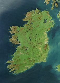
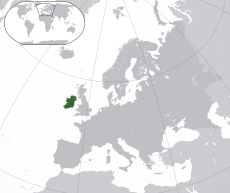
| Ireland | |||||
island in the North Atlantic Ocean | |||||
| Pronunciation audio | |||||
| Instance of | |||||
| Part of | |||||
| Location | British Isles, Europe, Northern Hemisphere | ||||
| Located in or next to body of water | |||||
| Width |
| ||||
| Length |
| ||||
| Highest point |
| ||||
| Population |
| ||||
| Area |
| ||||
| Different from | |||||
 | |||||
Subcategories
This category has the following 13 subcategories, out of 13 total.
*
- Cirques in Ireland (45 F)
B
- Bullaba River Valley (5 F)
C
- Camcor River valley (6 F)
G
- Glen of Imaal (301 F)
H
- Healy Pass, County Cork (52 F)
N
R
Media in category "Valleys of Ireland"
The following 108 files are in this category, out of 108 total.
-
Arigna valley - geograph.org.uk - 1587963.jpg 640 × 480; 102 KB
-
Bogland near Sradoon - geograph.org.uk - 1638542.jpg 640 × 480; 49 KB
-
Boyne valley looking north-west - geograph.org.uk - 455555.jpg 640 × 480; 111 KB
-
Cahermacun View of Rathborney River Valley 2015 09 04.jpg 3,504 × 2,094; 6.12 MB
-
Cahermacun View of Upper Rathborney River Valley 2015 09 04.jpg 3,504 × 2,336; 6.98 MB
-
Coolcreen - geograph.org.uk - 286143.jpg 640 × 480; 76 KB
-
Cooleenlemane - geograph.org.uk - 249984.jpg 640 × 480; 114 KB
-
Cooleenlemane River - geograph.org.uk - 249971.jpg 640 × 480; 94 KB
-
Coumtay Gulley - geograph.org.uk - 526483.jpg 409 × 640; 59 KB
-
Crinnagh River valley - geograph.org.uk - 776947.jpg 637 × 425; 99 KB
-
Cummeenaloughaun valley and outlet stream - geograph.org.uk - 466854.jpg 640 × 427; 143 KB
-
Dodder Valley Burnt-out Cars - geograph.org.uk - 466682.jpg 640 × 480; 119 KB
-
Donegal. "A View Of Glenveagh" - geograph.org.uk - 1063635.jpg 640 × 480; 70 KB
-
End of the Gearhanagour Stream valley - geograph.org.uk - 451015.jpg 640 × 427; 130 KB
-
Eskamuckny Glen - geograph.org.uk - 776904.jpg 637 × 425; 112 KB
-
Eskamuckny Glen - geograph.org.uk - 776908.jpg 425 × 637; 100 KB
-
Fields of Breanlee - geograph.org.uk - 724757.jpg 421 × 640; 106 KB
-
Fraughan Rock Glen - geograph.org.uk - 290239.jpg 2,288 × 1,712; 655 KB
-
Gearhanagour Stream - geograph.org.uk - 451035.jpg 640 × 427; 135 KB
-
Gearhanagour Stream valley - geograph.org.uk - 450984.jpg 640 × 427; 135 KB
-
Glaninchiquin valley, view south west - geograph.org.uk - 467152.jpg 640 × 415; 156 KB
-
Gleann Cholm Cille - geograph.org.uk - 69004.jpg 640 × 417; 71 KB
-
Glencolumbkille in early summer - geograph.org.uk - 65574.jpg 640 × 422; 107 KB
-
Glencolumbkille in winter - geograph.org.uk - 65572.jpg 640 × 427; 78 KB
-
Glengesh in the mist - geograph.org.uk - 557244.jpg 640 × 425; 33 KB
-
Glenmacnass - geograph.org.uk - 627290.jpg 640 × 480; 92 KB
-
Glenmacnass Valley - geograph.org.uk - 64541.jpg 640 × 391; 117 KB
-
Glentaunemon - geograph.org.uk - 235669.jpg 640 × 480; 76 KB
-
Gorge on the Owengin - geograph.org.uk - 200426.jpg 640 × 488; 157 KB
-
In the Black Valley - geograph.org.uk - 781253.jpg 637 × 425; 105 KB
-
Kings River Valley - geograph.org.uk - 932708.jpg 640 × 480; 52 KB
-
Kings River Valley and Beyond - geograph.org.uk - 932685.jpg 640 × 480; 61 KB
-
Knocknasallagh - geograph.org.uk - 289929.jpg 640 × 480; 83 KB
-
Miner's Way and Arigna valley - geograph.org.uk - 797925.jpg 640 × 480; 82 KB
-
Minte Seisce general view - geograph.org.uk - 390844.jpg 640 × 480; 88 KB
-
Mourne Mountains (6838097636).jpg 2,592 × 1,552; 882 KB
-
Near Windy Gap - geograph.org.uk - 778372.jpg 637 × 425; 71 KB
-
On the Kerry Way - geograph.org.uk - 781181.jpg 637 × 425; 115 KB
-
Oughtmama and Bell Harbour - geograph.org.uk - 65479.jpg 640 × 424; 102 KB
-
Owencashla River valley - geograph.org.uk - 273905.jpg 640 × 480; 85 KB
-
Owencashla River valley - geograph.org.uk - 273947.jpg 640 × 480; 111 KB
-
Owennalacken Valley - geograph.org.uk - 456635.jpg 640 × 427; 123 KB
-
River Suir from Mount Congreve Gardens - geograph.org.uk - 216232.jpg 640 × 480; 104 KB
-
Summer evening in Bunowen valley - geograph.org.uk - 201295.jpg 640 × 452; 158 KB
-
The head of Cummeenduff Glen - geograph.org.uk - 36580.jpg 640 × 480; 57 KB
-
The Miners Way in the Arigna valley - geograph.org.uk - 1630978.jpg 640 × 480; 109 KB
-
The valley of Gleninagh about Feenagh - geograph.org.uk - 67318.jpg 640 × 427; 101 KB
-
The Vee - geograph.org.uk - 216229.jpg 640 × 480; 101 KB
-
Tirhoran Townland - geograph.org.uk - 1390786.jpg 640 × 479; 56 KB
-
Tirhoran Townland - geograph.org.uk - 1390788.jpg 640 × 479; 63 KB
-
Track to the Poisoned Glen - geograph.org.uk - 396344.jpg 640 × 480; 94 KB
-
Upper Glen Beagh - geograph.org.uk - 399562.jpg 640 × 480; 94 KB
-
Valley at Glenaddragh - geograph.org.uk - 1352888.jpg 640 × 427; 86 KB
-
Valley east of Glenties - geograph.org.uk - 1365016.jpg 640 × 427; 84 KB
-
Valley of Eglish River - geograph.org.uk - 872769.jpg 480 × 640; 89 KB
-
Valley of the Bonet River - geograph.org.uk - 1618927.jpg 640 × 480; 108 KB
-
View down Barra valley - geograph.org.uk - 305496.jpg 640 × 422; 43 KB
-
View down Glenbeagh - geograph.org.uk - 395118.jpg 640 × 480; 217 KB
-
Aughils River - geograph.org.uk - 276366.jpg 640 × 480; 133 KB
-
Bredagh Glen, Moville, Co Donegal - geograph.org.uk - 83434.jpg 640 × 480; 75 KB
-
Colourful sheep - geograph.org.uk - 220072.jpg 600 × 450; 87 KB
-
Coumshingaun Lake - geograph.org.uk - 517027.jpg 640 × 480; 139 KB
-
Crinnagh River valley - geograph.org.uk - 776940.jpg 637 × 425; 75 KB
-
Cro Nimhe - geograph.org.uk - 397842.jpg 640 × 480; 59 KB
-
Crossterry - geograph.org.uk - 263348.jpg 640 × 480; 87 KB
-
Dunquin - geograph.org.uk - 259524.jpg 640 × 480; 93 KB
-
Farranacarriga - geograph.org.uk - 256300.jpg 640 × 480; 114 KB
-
Farranacarriga - geograph.org.uk - 256303.jpg 640 × 480; 104 KB
-
Glacial landscaping - geograph.org.uk - 201104.jpg 640 × 480; 150 KB
-
Glaninchquin - geograph.org.uk - 287803.jpg 640 × 480; 116 KB
-
Glenduff - geograph.org.uk - 223314.jpg 640 × 480; 133 KB
-
Glenmoylan - geograph.org.uk - 234254.jpg 640 × 480; 73 KB
-
Gullamore - geograph.org.uk - 268083.jpg 640 × 480; 109 KB
-
Gully in the cliffs above Old Head Beach - geograph.org.uk - 1404022.jpg 640 × 480; 108 KB
-
Inny Valley and Caunoge. - geograph.org.uk - 65482.jpg 640 × 424; 69 KB
-
Long Glen, Inishowen, Co Donegal - geograph.org.uk - 83437.jpg 640 × 480; 89 KB
-
Moraine on the valley sides - geograph.org.uk - 220080.jpg 600 × 450; 81 KB
-
The Ballynahow River valley - geograph.org.uk - 579261.jpg 640 × 480; 120 KB
-
The Borlin Valley from the Kilgarvan Road - geograph.org.uk - 499028.jpg 640 × 480; 192 KB
-
The Corabber River valley - geograph.org.uk - 179723.jpg 640 × 480; 147 KB
-
The Devil's Glen - geograph.org.uk - 290241.jpg 2,288 × 1,712; 707 KB
-
The Finn valley - geograph.org.uk - 612183.jpg 640 × 480; 83 KB
-
The Glenmacnass Valley - geograph.org.uk - 627298.jpg 640 × 480; 99 KB
-
The Poisoned Glen - geograph.org.uk - 395203.jpg 640 × 480; 71 KB
-
Top of Glen Gesh - geograph.org.uk - 305463.jpg 640 × 420; 80 KB
-
Undulating farmland in Ennistymon - geograph.org.uk - 250556.jpg 640 × 480; 49 KB
-
Valley - geograph.org.uk - 219217.jpg 600 × 450; 51 KB
-
Valley beside Derryfanga - geograph.org.uk - 450525.jpg 640 × 417; 125 KB
-
Valley where two rivers meet - geograph.org.uk - 17819.jpg 640 × 416; 341 KB
-
View up Sruell Gap - geograph.org.uk - 304709.jpg 640 × 413; 74 KB
-
View up the Barra Valley - geograph.org.uk - 396416.jpg 640 × 480; 198 KB
-
Wooded valley near Aghameen - geograph.org.uk - 446754.jpg 640 × 480; 89 KB


