Category:Green River (Colorado River) in Utah
Jump to navigation
Jump to search
Subcategories
This category has the following 24 subcategories, out of 24 total.
A
D
- Dellenbaugh Butte (1 F)
E
F
- Flaming Gorge Dam (19 F)
G
- Green River State Park (1 F)
J
- Jensen Bridge (21 F)
L
- Labyrinth Canyon (Green River) (34 F)
N
O
- Ouray National Wildlife Refuge (16 F)
- Ouray, Utah (2 F)
P
S
- Stillwater Canyon (10 F)
T
W
Media in category "Green River (Colorado River) in Utah"
The following 200 files are in this category, out of 268 total.
(previous page) (next page)-
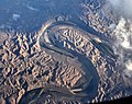
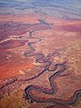
 2010-Aerial photograph of Green River, Utah.jpg 2,500 × 1,875; 4.87 MB
-

-

-

-
 A BLM employee navigates the Green River in Utah's Desolation Canyon Area.jpg 2,438 × 2,500; 1.32 MB
-
 A BLM employee navigating Utah's Desolation Canyon Area.jpg 2,500 × 1,772; 1.28 MB
-
 A BLM park ranger aboard his raft in the Green River.jpg 2,500 × 2,313; 1.9 MB
-

-

-
-

-

-
 A breathtaking view from the the Green River in Utah's Desolation Canyon Area.jpg 2,500 × 1,666; 1.13 MB
-
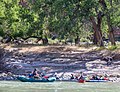
 A campsite in Utah's Desolation Canyon Area.jpg 2,500 × 1,667; 1.64 MB
-
 A group floats down the Green River within Utah's Desolation Canyon Area.jpg 2,500 × 1,574; 1.53 MB
-
 A group stops to take in the view of Utah's Desolation Canyon Area.jpg 2,500 × 1,667; 1.78 MB
-

-
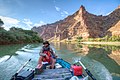
 A group taking rafts down the Green River in Utah's Desolation Canyon Area.jpg 2,500 × 1,667; 782 KB
-
 A park ranger stops to take in the beauty of Utah's Desolation Canyon Area.jpg 2,500 × 1,663; 2.27 MB
-

-
-
 A park ranger surveying Utah's Desolation Canyon Area by raft in the Green River.jpg 2,500 × 1,667; 1.26 MB
-
 A park ranger surveys Utah's Desolation Canyon Area - 49059877597.jpg 2,500 × 1,667; 897 KB
-

-

-
 A park ranger surveys Utah's Desolation Canyon Area by raft in the Green River.jpg 1,909 × 2,500; 1.78 MB
-
 A park ranger surveys Utah's Desolation Canyon Area.jpg 2,500 × 1,667; 1.24 MB
-
 A park ranger white water rafts down the Green River of Utah's Desolation Canyon Area.jpg 2,500 × 1,918; 1.37 MB
-

-

-

-
 A park ranger whitewater rafting in the Green River of Utah's Desolation Canyon Area.jpg 2,500 × 2,204; 2.06 MB
-
 A shallow point of the Green River within Utah's Desolation Canyon Area - 49059140903.jpg 2,500 × 1,662; 2.06 MB
-
 A shallow point of the Green River within Utah's Desolation Canyon Area - 49059141408.jpg 1,667 × 2,500; 2.39 MB
-
 A shallow point of the Green River within Utah's Desolation Canyon Area.jpg 1,664 × 2,500; 1.88 MB
-
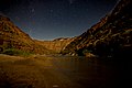 A starry night in Utah's Desolation Canyon Area.jpg 2,500 × 1,667; 1.14 MB
-
-
 A076, Canyonlands National Park, Utah, USA, Green River, 2002.jpg 500 × 333; 126 KB
-

-
 Adventurers go kayaking in the Green River of Utah's Desolation Canyon Area.jpg 2,500 × 1,759; 2.04 MB
-
 Adventurers greeting one another in Utah's Desolation Canyon Area.jpg 2,500 × 1,845; 1.66 MB
-
 Adventurers pausing along the Green River to talk - 49065003721.jpg 1,664 × 2,500; 1.92 MB
-
 Adventurers pausing along the Green River to talk.jpg 2,500 × 1,908; 2.38 MB
-

-
 An explorer navigates the Green River within Utah's Desolation Canyon Area.jpg 2,500 × 1,666; 1.31 MB
-
 An explorer paddle boarding down the Green River in Utah's Desolation Canyon Area.jpg 2,500 × 1,963; 1.74 MB
-
 An explorer rafts down the Green River for a survey of Utah's Desolation Canyon Area.jpg 2,500 × 1,307; 1.29 MB
-
 Beauty can be found all over as stars rest above Utah's Desolation Canyon Area.jpg 1,667 × 2,500; 1.19 MB
-
 BLM employees survey the Green River in Utah's Desolation Canyon Area.jpg 2,500 × 1,667; 1.7 MB
-
 BLM park rangers survey Utah's Desolation Canyon Area by rafts in the Green River.jpg 2,500 × 1,667; 1.35 MB
-
 BLM park rangers survey Utah's Desolation Canyon Area.jpg 1,957 × 2,021; 1.57 MB
-
 BLM park rangers white water raft down the Green River in Utah's Desolation Canyon Area.jpg 2,500 × 2,117; 1.63 MB
-
 Bluffs of the Green River-LCCN2008678214.jpg 7,360 × 5,545; 7.33 MB
-
 Bonito Bend between Labyrinth and Stillwater Canyons LCCN96510195.jpg 1,536 × 1,145; 161 KB
-
 Bowknot Bend of the Green River in Utah 2015.jpg 16,100 × 2,613; 1.32 MB
-
 Bowknot Bend on the Green River UT.jpg 4,368 × 2,912; 10.68 MB
-

-
-
 Buttes of the Cross, Green River.jpg 4,901 × 2,448; 3.27 MB
-

-
 Canoes parked on the shore of the Green Rivier in Utah's Desolation Canyon Area.jpg 2,500 × 1,667; 1.81 MB
-
 Canyonlands 8-14 (15297487517).jpg 5,760 × 3,840; 5.29 MB
-
 Canyonlands Dead Horse Point.jpg 1,280 × 853; 1.82 MB
-
 Canyonlands National Park CANY4406.jpg 3,072 × 2,048; 3.76 MB
-
 Canyonlands NP-Utah-USA.jpg 6,935 × 2,974; 5.58 MB
-
 Canyonlands-Confluence Overlook.jpg 759 × 484; 166 KB
-
 Center of Horse Shoe Canyon. Green River. Old nos. 286, 417 - NARA - 517836.jpg 3,000 × 1,923; 4.8 MB
-
 Center of Horse Shoe Canyon. Green River. Old nos. 286, 417, 1871 - 1878 - NARA - 517836.jpg 3,000 × 1,923; 2.31 MB
-
-
 Confluence of Green and Colorado Rivers.jpg 3,072 × 2,304; 2.71 MB
-
 Crystal Geyser - panoramio.jpg 1,500 × 1,000; 432 KB
-
 Dellenbaugh Butte.jpg 1,072 × 670; 252 KB
-
 Detroit Photographic Company (0811).jpg 1,536 × 1,156; 299 KB
-

-

-
 Dinosaur National Monument 2017 4.jpg 11,923 × 2,613; 21.19 MB
-
 Dinosaur National Monument Monarch Survey (48765169438).jpg 3,240 × 5,144; 3.36 MB
-
 Dinosaur National Monument Monarch Survey (48765169853).jpg 5,759 × 2,968; 2.35 MB
-
 Dinosaur National Monument Monarch Survey (48765501806).jpg 5,236 × 2,875; 2 MB
-
 Dinosaur National Monument Monarch Survey (48765697042).jpg 5,552 × 2,880; 2.01 MB
-
 Dinosaur National Monument Monarch Survey (48765697257).jpg 5,392 × 3,384; 2.01 MB
-
 Dinosaur NM 20.jpg 5,760 × 3,840; 7.81 MB
-
 Dinosaur NM, Green River - panoramio.jpg 858 × 643; 621 KB
-
 Dinosaur NM-Campground.jpg 677 × 545; 64 KB
-

-
 Encounter over Utah. Bowknot bend, Green river below (5572321661).jpg 1,024 × 768; 309 KB
-
 Eremogone sp. in the flatlands west of the Green River, UT, USA.jpg 3,468 × 4,624; 3.78 MB
-
 Explorers before white water rafting in the Green River in Utah's Desolation Canyon Area.jpg 2,500 × 1,667; 1.47 MB
-
 Explorers coast down the Green River of Utah's Desolation Canyon Area in a raft.jpg 2,500 × 1,667; 1.07 MB
-
 Explorers enjoy a meal along the shore of the Green River.jpg 2,500 × 1,666; 1.41 MB
-

-

-
 Explorers excitedly raft down the Green River of Utah's Desolation Canyon Area in a raft.jpg 2,500 × 2,441; 2.04 MB
-

-
 Explorers whitewater rafting down the Green River of Utah's Desolation Canyon Area in a raft.jpg 2,500 × 1,667; 1,008 KB
-
 Felony Tower and Woodrruff Bottom (7257582874).jpg 1,600 × 1,067; 741 KB
-
-

-

-

-

-

-
 Green River & Upheaval Dome, UT.jpg 3,544 × 1,992; 6.75 MB
-
 Green River (6356569739).jpg 4,320 × 3,240; 9.87 MB
-
 Green River (Dinosaur National Monument, Utah, USA) 1 (30079536491).jpg 3,996 × 2,596; 7.5 MB
-
 Green River (Dinosaur National Monument, Utah, USA) 2 (30163871705).jpg 4,286 × 2,666; 5.11 MB
-
 Green River (Dinosaur National Monument, Utah, USA) 3 (30163874365).jpg 3,942 × 2,499; 3.62 MB
-
 Green River (Dinosaur National Monument, Utah, USA) 4 (48685822811).jpg 4,000 × 2,454; 7.01 MB
-
 Green River (town of Green River, Utah, USA) (19680221689).jpg 3,008 × 1,763; 2.98 MB
-
 Green River aerial.jpg 3,868 × 2,904; 8.6 MB
-
 Green River and Bighorn Mesa (7257559916).jpg 1,600 × 1,067; 540 KB
-
 Green River and Buttes of the Cross.jpg 3,548 × 2,432; 1.78 MB
-
 Green River and Ekker Butte (7257548156).jpg 1,067 × 1,600; 502 KB
-
 Green River and Ekker Butte (crop).jpg 953 × 901; 349 KB
-
 Green River and Hardscrabble B Campsite (7257573766).jpg 1,600 × 1,067; 643 KB
-
 Green River at Brown's Hole. Daggett County, Utah - NARA - 516941.jpg 3,000 × 2,205; 2 MB
-
 Green River at Ouray Utah.jpg 2,688 × 1,512; 936 KB
-
 Green River at Split Mountain.jpg 11,204 × 4,687; 32.1 MB
-
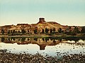 Green River Butte, Utah, 1898.jpg 7,160 × 5,382; 11.76 MB
-
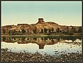 Green River Butte-LCCN2008678213.jpg 7,387 × 5,621; 6.79 MB
-
 Green River Canyon. Summit Valley, Uintas Mountains - NARA - 519480.jpg 3,000 × 2,491; 1.54 MB
-
 Green river canyon.jpg 2,168 × 1,446; 853 KB
-
 Green River from I-70 17 37 21 223000.jpeg 4,032 × 3,024; 2.7 MB
-
 Green River from I-70.jpeg 4,032 × 3,024; 2.73 MB
-
 Green River meanders.jpg 843 × 666; 155 KB
-
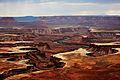
 Green River Overlook Canyonlands August 2016.jpg 2,258 × 1,274; 869 KB
-
 Green River UT 2005-10-13 2259.jpg 2,400 × 1,800; 1.12 MB
-
 Green River UT 2005-10-13 2338.jpg 2,400 × 1,800; 1.2 MB
-
 Green River UT 2005-10-13 2339.jpg 2,400 × 1,800; 938 KB
-
 Green River UT 2005-10-14 0002.jpg 3,200 × 1,368; 1.02 MB
-
 Green River UT 2005-10-14 0003.jpg 2,400 × 1,800; 1.2 MB
-
 Green River UT 2005-10-14 1855.jpg 1,024 × 768; 376 KB
-
 Green River UT 2005-10-14 2059.jpg 1,800 × 2,493; 1.76 MB
-
 Green River UT 2005-10-14 2101.jpg 3,072 × 1,728; 1.87 MB
-
 Green River UT 2005-10-14.jpg 1,024 × 768; 508 KB
-
 Green River Utah aerial.jpg 3,048 × 2,624; 4.55 MB
-
 Green river utah from sky.jpg 1,200 × 1,600; 495 KB
-
 Green River Utah.jpg 2,736 × 3,648; 4.12 MB
-
 Green River, eastern Utah.jpg 1,024 × 576; 139 KB
-

-

-

-
 Green River, in Brown's Hole. Daggett County, Utah - NARA - 517404.jpg 3,000 × 1,880; 1.18 MB
-

-

-
 Green River, UT 8-25-12 (8003108603).jpg 1,550 × 1,151; 450 KB
-
 Green River, UT 8-25-12 (8003110668).jpg 1,550 × 1,163; 627 KB
-
 Green River, UT 8-25-12 (8003110974).jpg 1,399 × 1,550; 383 KB
-
 Green River, UT Bridge 8-25-12 (7972232154).jpg 1,550 × 1,163; 550 KB
-
 Green River,Utah,USA. - panoramio - Roman Eugeniusz (1).jpg 2,288 × 1,712; 2.43 MB
-
 Green River,Utah,USA. - panoramio - Roman Eugeniusz (2).jpg 2,288 × 1,712; 2.39 MB
-
 Green River,Utah,USA. - panoramio - Roman Eugeniusz.jpg 2,288 × 1,712; 2.31 MB
-
 Green River,Utah,USA. - panoramio.jpg 2,288 × 1,712; 2 MB
-
 Green River-Cub Creek Valley UT 2005-10-14 2100.jpg 3,072 × 1,728; 1.86 MB
-
 Green River-Utah-Aerial-Photo-2018.jpg 3,648 × 5,472; 18.99 MB
-

-

-

-

-

-
-

-
-
-

-

-

-
 Green River. Split Mountain Canyon. Old nos. 364, 345, 441, 740. - NARA - 517939.jpg 3,000 × 1,896; 4.25 MB
-

-

-
-

-
-
 Green River. Stillwater Canyon. Old nos. 321, 379, 814 - NARA - 517971.jpg 3,000 × 1,869; 3.9 MB
-
 Green River. Stillwater Canyon. Old nos. 322, 380, 871 - NARA - 517992.jpg 3,000 × 1,862; 3.59 MB
-
 Green River.jpg 3,024 × 3,779; 3.05 MB
-
 Green-River-Utah-Aerial-2018.jpg 5,425 × 3,617; 17.33 MB
-
 Hiking to Fort Bottom (7257568890).jpg 1,600 × 1,067; 785 KB
-
 ISS-055-E-031251 (Bowknot Bend).jpg 720 × 1,080; 1.02 MB
-
 ISS-57 Green River, Utah.jpg 5,568 × 3,712; 3.16 MB
-
 Looking South from Hardscrabble Hill (7257565436).jpg 1,600 × 1,067; 632 KB
-
 Mineral-Bottom.jpg 1,536 × 1,024; 357 KB
-
 My Public Lands Magazine, Summer 2014 (13973363934).jpg 6,000 × 4,000; 9.98 MB
-
 Narrow Path on Fort Bottom Trail (7257572278).jpg 1,600 × 1,067; 704 KB
-
 NPS canyonlands-interior-map.jpg 6,000 × 4,268; 9.7 MB
-

-

-

-
 Park Rangers point out the features Utah's Desolation Canyon Area.jpg 2,500 × 1,667; 980 KB
-
 Plant wildlife of Utah's Desolation Canyon Area.jpg 1,772 × 2,500; 2.04 MB
-
 PSM V07 D405 Northern slope of the uinta mountains.jpg 2,356 × 1,099; 801 KB
-
 Rafters prepare to hit the water in Utah's Desolation Canyon Area.jpg 2,500 × 1,667; 1.59 MB
-
 Rafters take a break on the shore of the Green River.jpg 2,500 × 1,516; 1.41 MB
-
 Rafting through the Green River within Utah's Desolation Canyon Area in style.jpg 2,500 × 1,532; 1.68 MB
-

-
 Rafts await adventure along the shore of the Green River.jpg 2,500 × 1,667; 1.05 MB
-
-

-
 Ripple waves in the Green River of Utah's Desolation Canyon Area.jpg 1,667 × 2,500; 847 KB
-
 Road next to the Green River (7257581010).jpg 1,600 × 1,136; 612 KB


.jpg)


_lrg.jpg)


.jpg)


_1_(48811268151).jpg)


.jpg)


.jpg)
.jpg)
.jpg)
.jpg)
.jpg)


.jpg)


.jpg)


_(48795758707).jpg)

.jpg)
_1_(30079536491).jpg)
_2_(30163871705).jpg)
_3_(30163874365).jpg)
_4_(48685822811).jpg)
_(19680221689).jpg)

.jpg)

.jpg)
.jpg)
.jpg)


,_422.,_1871_-_1878_-_NARA_-_517813.jpg)


_and_down_(right)_the_river._6..._-_NARA_-_517823.jpg)
_and_down_-_NARA_-_517823.jpg)
.jpg)
.jpg)
.jpg)
.jpg)
.jpg)
.jpg)


_feet_at_entrance,_looking_downstream._Old_-_NARA_-_517934.jpg)
_feet_at_entrance,_looking_downstream._Old_nos._342,_361,_727._-_NARA_-_517934.jpg)


.jpg)
.jpg)

.jpg)

.jpg)
.jpg)


_(14759291342).jpg)

.jpg)
_in_Utah&filefrom=Ruins+Atop+Fort+Bottom+-+panoramio.jpg#mw-category-media)
_Green_River,_Utah.jpeg)
Categories:
- Rivers of Utah
- Green River (Colorado River) by state
- Tributaries of the Colorado River in Utah
- Bodies of water in Emery County, Utah
- Bodies of water in Grand County, Utah
- Bodies of water in Uintah County, Utah
- Bodies of water in Daggett County, Utah
- Rivers of Canyonlands National Park
- Colorado Plateau region of Utah
- Gunnison Valley (Emery and Grand counties, Utah)
- Book Cliffs
- Locations along Interstate 70 in Emery County, Utah
- Locations along Interstate 70 in Grand County, Utah
- Locations along U.S. Route 6 in Emery County, Utah
- Locations along U.S. Route 6 in Grand County, Utah
- Locations along U.S. Route 40 in Uintah County, Utah
- Locations along U.S. Route 191 in Grand County, Utah
- Locations along Utah State Route 4 (1962-1977) in Emery County, Utah
- Locations along Utah State Route 4 (1962-1977) in Grand County, Utah
- Locations along Utah State Route 6 (1910-1977) in Duchesne County, Utah
- Locations along Utah State Route 27 (1927-1977) in Emery County, Utah
- Locations along Utah State Route 19
- Locations along Utah State Route 88