Category:Colorado Plateau region of Utah
Jump to navigation
Jump to search
English: The portion of the Colorado Plateau Physiographic Province that is located in eastern Utah.
- The political boundary defined Utah (state) Colorado Plateau sub-region has four scientifically defined Physiographic Sections:
- the Uintah Basin Section — in northeastern Utah.
- the High Plateaus Section — physiographic defined boundaries completely within Utah).
- the northern portion of the Grand Canyon Section.
- the northern portion of the Canyon Lands Section.
Subcategories
This category has the following 15 subcategories, out of 15 total.
Pages in category "Colorado Plateau region of Utah"
The following 7 pages are in this category, out of 7 total.
Media in category "Colorado Plateau region of Utah"
The following 34 files are in this category, out of 34 total.
-
ArchCanyonUT.jpg 958 × 600; 136 KB
-
Bonanza, Utah Power Plant.jpg 3,648 × 2,736; 1 MB
-
Bryce Canyon hoodoos.jpg 3,689 × 4,919; 15.05 MB
-
Cedar Breaks Utah 1.jpg 3,798 × 5,064; 16.13 MB
-
Cedar Breaks Utah 2.jpg 3,812 × 5,082; 15.9 MB
-
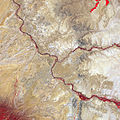
Dark Canyon Complex UT.jpg 720 × 480; 502 KB
-
Four Corners, Southwestern U.S.jpg 2,200 × 2,200; 2.73 MB
-
Glen Canyon in southeastern and south central Utah.jpg 3,008 × 2,000; 7.11 MB
-
Grand Staircase Diagram.jpg 6,503 × 1,985; 3.48 MB
-
Grand Staircase.jpg 484 × 113; 26 KB
-
Holmes 1877 Kanab Desert dut0035b.jpg 1,400 × 1,010; 1.96 MB
-
Iss069e001017 lrg.jpg 5,568 × 3,712; 5.36 MB
-
Karte der Navajo Volcanic Fields.jpg 1,280 × 1,467; 565 KB
-
Kodachrome Basin Utah.jpg 5,184 × 2,916; 9.32 MB
-
LaSal&Slickrock Utah USA.JPG 2,448 × 1,632; 872 KB
-
Map of the Navajo Volcanic Fields.jpg 1,280 × 1,467; 568 KB
-
Navajo Mountain (DSC06292).jpg 1,280 × 960; 560 KB
-
NavajoMtnAerial.jpg 982 × 482; 983 KB
-
Plateau laccoliths NASA.jpg 900 × 1,124; 324 KB
-
Saltwash Tidwell.JPG 2,048 × 1,536; 2.64 MB
-
SanRafealReef2.jpg 3,009 × 819; 668 KB
-
Southern Utah Three Kings DSC 0011.JPG 4,288 × 2,848; 6.42 MB
-
Thousand lake mountain.jpg 1,024 × 768; 142 KB
-
Mount Timpanogos 7 June 2011.jpg 4,179 × 682; 365 KB
-
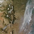
Wallow fire satphoto, June 7, 2011.jpg 720 × 720; 222 KB
-
Wea03031 - Flickr - NOAA Photo Library.jpg 1,788 × 1,160; 1.24 MB
-
Wea03034 - Flickr - NOAA Photo Library.jpg 1,788 × 1,152; 1.42 MB
-
Wea03037 - Flickr - NOAA Photo Library.jpg 1,788 × 1,152; 1.42 MB
-
Wea03038 - Flickr - NOAA Photo Library.jpg 1,788 × 1,172; 1.57 MB
-
Wea03039 - Flickr - NOAA Photo Library.jpg 1,788 × 1,060; 1.1 MB
-
Zion National Park Utah 1.jpg 5,184 × 2,916; 10.96 MB
-
Zion sandstone Utah 1.jpg 5,184 × 3,888; 19.03 MB
-
Zion sandstone Utah 2.jpg 3,888 × 5,184; 17.9 MB
-
Zion sandstone Utah 3.jpg 3,888 × 5,184; 18.69 MB


